


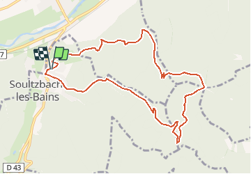
Parking cimetière Soultzbach-Ruines Schaenzle-Abri du StauffenCol de Marbach-Soultzbach par rond rouge

patrickbeyrath
User

Length
9.8 km

Max alt
800 m

Uphill gradient
564 m
Km-Effort
17.4 km

Min alt
336 m

Downhill gradient
569 m
Boucle
Yes
Creation date :
2018-10-13 05:51:53.816
Updated on :
2018-10-13 05:51:53.824
3h37
Difficulty : Medium

FREE GPS app for hiking
 SityTrail
IGN / Geographical institutes
SityTrail Plus
The world is yours!
About
Trail Walking of 9.8 km to be discovered at Grand Est, Haut-Rhin, Soultzbach-les-Bains. This trail is proposed by patrickbeyrath.
Positioning
Country:
France
Region :
Grand Est
Department/Province :
Haut-Rhin
Municipality :
Soultzbach-les-Bains
Location:
Unknown
Start:(Dec)
Start:(UTM)
366184 ; 5322221 (32U) N.
Comments