Trail Walking Grez-en-Bouère - Grez en Bouère - Photo
© OpenStreetMap contributors
Length
Length
12.8 km
Max alt
Max alt
111 m
Uphill gradient
Uphill gradient
154 m
Km-Effort
Km-Effort  
14.8 km
Min alt
Min alt
57 m
Downhill gradient
Downhill gradient
153 m
Boucle
Boucle
Yes
Creation date :
2018-04-17 16:59:21.999
Updated on :
2018-04-17 16:59:21.999

(0 Reviews)

Walking
Walking
3h20
Difficulty : Medium

Scan this QR Code to open this trail in the SityTrail application

FREE GPS app for hiking

Logo SityTrail SityTrail

IGN / Geographical institutes

Download SityTrail from the App Store Download SityTrail from Google Play

Logo SityTrail SityTrail World

The world is yours!

Download SityTrail from the App Store Download SityTrail from Google Play Download SityTrail on Huawei AppGallery

About

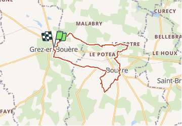
Trail Walking of 12.8 km to be discovered at Pays de la Loire, Mayenne, Grez-en-Bouère. This trail is proposed by neoroll44.

Description

La vallée de la Taude et du Fondrieux, par Bouère (plan d'eau).

Elevation profile

Positioning

Country:
France
Region :
Pays de la Loire
Department/Province :
Mayenne
Municipality :
Grez-en-Bouère
Location:
Unknown
Start:(UTM)
685270 ; 5305292 (30T) N.

Trails nearby

Trail Walking Bouère - Bouère. Circuit N4 - Photo
Walking
mamyzine

Walking

Easy
(1)
Bouère, Pays de la Loire, Mayenne, France
4.5 km | 5.4 km-effort
1h 38min
Yes
Trail Walking Bouère - De Bouère à St-Brice - Photo
Walking
neoroll44

Walking

Medium
Bouère, Pays de la Loire, Mayenne, France
13 km | 14.9 km-effort
3h 15min
Yes
Trail Walking Bouère - de Bouère à Grez - Photo
Walking
Michelraimbault

Walking

Very easy
Bouère, Pays de la Loire, Mayenne, France
14.4 km | 16.6 km-effort
3h 55min
Yes
Trail Walking Bouère - Bouère. autour du village  - Photo
Walking
mamyzine

Walking

Medium
Bouère, Pays de la Loire, Mayenne, France
11.4 km | 13.1 km-effort
3h 5min
Yes


Close
My subscriptions