Trail Mountain bike Châteauneuf-d'Oze - VTT04 - Les balcons de Ceuze - Photo

Les Hautes Alpes à découvrir ! GUIDE+

© OpenStreetMap contributors
Length
Length
24 km
Max alt
Max alt
1697 m
Uphill gradient
Uphill gradient
1021 m
Km-Effort
Km-Effort  
37 km
Min alt
Min alt
1232 m
Downhill gradient
Downhill gradient
1021 m
Boucle
Boucle
Yes
Creation date :
2018-03-23 05:40:46.294
Updated on :
2018-10-17 07:16:20.611

(0 Reviews)

Mountain bike
Mountain bike
2h15
Difficulty : Medium

Scan this QR Code to open this trail in the SityTrail application

FREE GPS app for hiking

Logo SityTrail SityTrail

IGN / Geographical institutes

Download SityTrail from the App Store Download SityTrail from Google Play

Logo SityTrail SityTrail World

The world is yours!

Download SityTrail from the App Store Download SityTrail from Google Play Download SityTrail on Huawei AppGallery

About

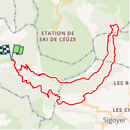
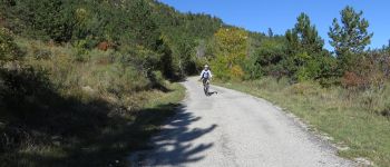
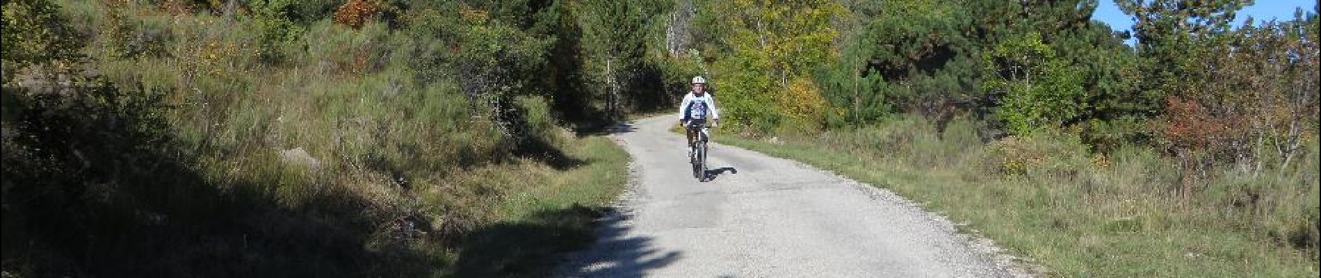
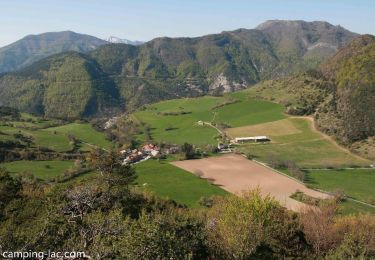
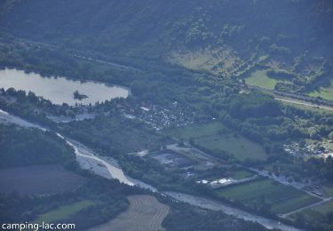
Trail Mountain bike of 24 km to be discovered at Provence-Alpes-Côte d'Azur, Hautes-Alpes, Châteauneuf-d'Oze. This trail is proposed by Camping Les Rives du Lac.

Description

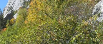
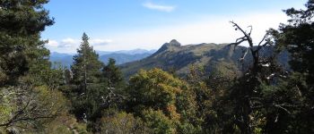
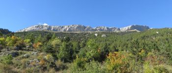
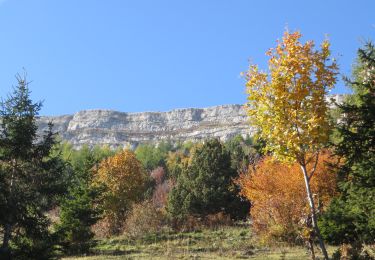
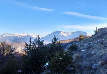
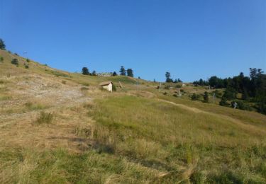
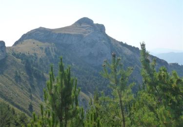
A circuit without any difficulty. The tour of Céüze by the South offers a breathtaking view! Do not be fooled by the small climb on a single track at the beginning of the route, because then you join a beautiful trail.
The trip is just under the cliffs, the return on a forest track through the Col des Guérins.

The tour can be done from the campsite (30 minutes drive then 45 minutes climb).

Elevation profile

Photos

Points of interest

Point of interest Châteauneuf-d'Oze - Single vers le sud - Photo
CampingLesRivesduLac
CHÂTEAUNEUF-D'OZE 
Point of interest Châteauneuf-d'Oze - Single de montée - Photo
CampingLesRivesduLac
CHÂTEAUNEUF-D'OZE 
Point of interest Sigoyer - Single de descente - Photo
CampingLesRivesduLac
Point of interest Sigoyer - Route forestière - Photo
CampingLesRivesduLac

Positioning

Country:
France
Region :
Provence-Alpes-Côte d'Azur
Department/Province :
Hautes-Alpes
Municipality :
Châteauneuf-d'Oze
Location:
Unknown
Start:(UTM)
730977 ; 4932163 (31T) N.

Trails nearby

Trail Walking Manteyer - R14   Pic de Ceuze - Photo
Walking
GUIDE+

Walking

Medium
(5)
Manteyer, Provence-Alpes-Côte d'Azur, Hautes-Alpes, France
9.6 km | 15.6 km-effort
4h 30min
Yes
Trail Mountain bike Manteyer - VTT32   aspremont - Photo
Mountain bike
GUIDE+

Mountain bike

Medium
(2)
Manteyer, Provence-Alpes-Côte d'Azur, Hautes-Alpes, France
21 km | 28 km-effort
2h 8min
No
Trail Mountain bike Châteauneuf-d'Oze - ceuse9 avril 2012 - Photo
Mountain bike
GUIDE
harydh

Mountain bike

Medium
(2)
Châteauneuf-d'Oze, Provence-Alpes-Côte d'Azur, Hautes-Alpes, France
18.1 km | 26 km-effort
Unknown
Yes
Trail Running Manteyer - Trail 09 - Céüze par le Pas du Loup - Photo
Running
GUIDE+

Running

Difficult
Manteyer, Provence-Alpes-Côte d'Azur, Hautes-Alpes, France
13.5 km | 28 km-effort
2h 30min
Yes
Trail Running Saint-Auban-d'Oze - Trail 01 - Le Cirque de Villauret - Photo
Running
GUIDE+

Running

Difficult
Saint-Auban-d'Oze, Provence-Alpes-Côte d'Azur, Hautes-Alpes, France
9.6 km | 19.9 km-effort
2h 0min
Yes
Trail Mountain bike Manteyer - VTT25 - Ceuse - Photo
Mountain bike
GUIDE+

Mountain bike

Medium
Manteyer, Provence-Alpes-Côte d'Azur, Hautes-Alpes, France
13.7 km | 23 km-effort
1h 27min
Yes
Trail Mountain bike Manteyer - VTT05 - Ceuze et Ceuzette - Photo
Mountain bike
GUIDE+

Mountain bike

Difficult
(1)
Manteyer, Provence-Alpes-Côte d'Azur, Hautes-Alpes, France
33 km | 47 km-effort
3h 20min
No
Trail Walking Furmeyer - R04  Le sentier botanique de Furmeyer - Photo
Walking
GUIDE+

Walking

Easy
(2)
Furmeyer, Provence-Alpes-Côte d'Azur, Hautes-Alpes, France
4 km | 6.9 km-effort
1h 34min
Yes
Trail Walking Saint-Auban-d'Oze - R02 oule depuis saint auban - Photo
Walking
GUIDE+

Walking

Medium
(1)
Saint-Auban-d'Oze, Provence-Alpes-Côte d'Azur, Hautes-Alpes, France
5.9 km | 13.9 km-effort
2h 44min
Yes


Close
My subscriptions