


025 Jas du Mas Col de Béal

MERMOZ33
User
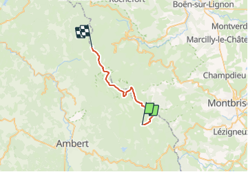

Length
23 km

Max alt
1609 m

Uphill gradient
602 m
Km-Effort
30 km

Min alt
1238 m

Downhill gradient
452 m
Boucle
No
Creation date :
2018-04-17 17:05:13.377
Updated on :
2018-04-17 17:05:13.377
6h29
Difficulty : Medium

FREE GPS app for hiking
 SityTrail
IGN / Geographical institutes
SityTrail Plus
The world is yours!
About
Trail Walking of 23 km to be discovered at Auvergne-Rhône-Alpes, Puy-de-Dôme, Saint-Anthème. This trail is proposed by MERMOZ33.
Positioning
Country:
France
Region :
Auvergne-Rhône-Alpes
Department/Province :
Puy-de-Dôme
Municipality :
Saint-Anthème
Location:
Unknown
Start:(Dec)
Start:(UTM)
568934 ; 5047403 (31T) N.
Comments