


passirac

bert16
User

Length
7.5 km

Max alt
180 m

Uphill gradient
131 m
Km-Effort
9.3 km

Min alt
99 m

Downhill gradient
131 m
Boucle
Yes
Creation date :
2018-04-17 18:00:12.194
Updated on :
2018-04-17 18:00:12.194
1h54
Difficulty : Easy

FREE GPS app for hiking
 SityTrail
IGN / Geographical institutes
SityTrail Plus
The world is yours!
About
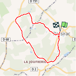
Trail Walking of 7.5 km to be discovered at New Aquitaine, Charente, Passirac. This trail is proposed by bert16.
Description
12 randonneurs 06 fev 2018
Positioning
Country:
France
Region :
New Aquitaine
Department/Province :
Charente
Municipality :
Passirac
Location:
Unknown
Start:(Dec)
Start:(UTM)
730004 ; 5025608 (30T) N.
Comments