Trail Cycle Pont-Sainte-Maxence - 
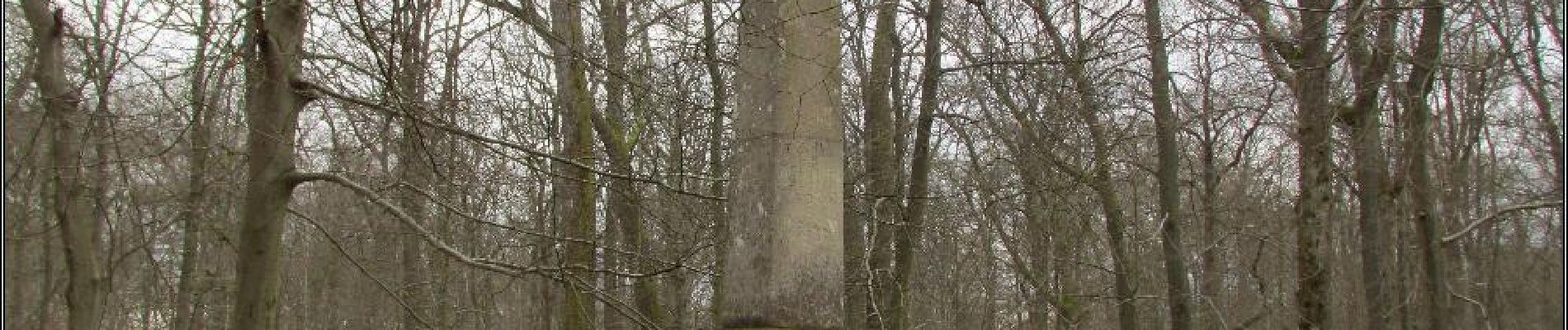
balade foret halatte - Photo
© OpenStreetMap contributors
Length
Length
10.4 km
Max alt
Max alt
150 m
Uphill gradient
Uphill gradient
133 m
Km-Effort
Km-Effort  
12.2 km
Min alt
Min alt
95 m
Downhill gradient
Downhill gradient
133 m
Boucle
Boucle
Yes
Creation date :
2018-04-17 21:02:21.094
Updated on :
2018-04-17 21:02:21.094

(0 Reviews)

Cycle
Cycle
1h55
Difficulty : Easy

Scan this QR Code to open this trail in the SityTrail application

FREE GPS app for hiking

Logo SityTrail SityTrail

IGN / Geographical institutes

Download SityTrail from the App Store Download SityTrail from Google Play

Logo SityTrail SityTrail Plus

The world is yours!

Download SityTrail from the App Store Download SityTrail from Google Play Download SityTrail on Huawei AppGallery

About

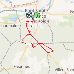
Trail Cycle of 10.4 km to be discovered at Hauts-de-France, Oise, Pont-Sainte-Maxence. This trail is proposed by gilbertdu60.

Description

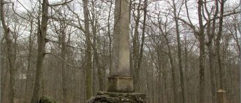
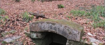
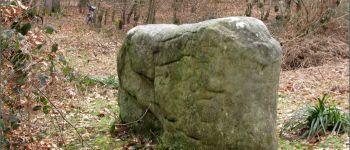
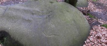
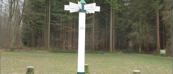
départ piscine des terriers, ( traversée de la RD1017) vers l'obélisque du roi de Rome et la fontaine des Lys, passage par le poteau du grand maitre, vers le chemin du cheval blanc arrêt au dolme de Chancy, vers le rocher au sanglier

Elevation profile

Photos

Points of interest

Point of interest Fleurines - obélisque du roi de Rome - Photo
gilbertdu60
Point of interest Fleurines - la fontaine des Lys - Photo
gilbertdu60
Point of interest Villers-Saint-Frambourg-Ognon - le dolmen de Chancy - Photo
gilbertdu60
VILLERS-SAINT-FRAMBOURG-OGNON 
Point of interest Villers-Saint-Frambourg-Ognon - le rocher au Sanglier - Photo
gilbertdu60
VILLERS-SAINT-FRAMBOURG-OGNON 
Point of interest Pont-Sainte-Maxence - poteau du grand maitre - Photo
gilbertdu60
PONT-SAINTE-MAXENCE 

Positioning

Country:
France
Region :
Hauts-de-France
Department/Province :
Oise
Municipality :
Pont-Sainte-Maxence
Location:
Unknown
Start:(UTM)
470907 ; 5460256 (31U) N.


Close
My subscriptions