


Pralognan - Refuge de la Pêche

jpduc
User
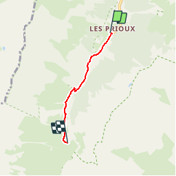

Length
2.7 km

Max alt
1919 m

Uphill gradient
201 m
Km-Effort
4.7 km

Min alt
1714 m

Downhill gradient
0 m
Boucle
No
Creation date :
2018-06-26 13:39:58.899
Updated on :
2018-06-26 13:39:58.899
1h04
Difficulty : Very easy

FREE GPS app for hiking
 SityTrail
IGN / Geographical institutes
SityTrail Plus
The world is yours!
About
Trail Walking of 2.7 km to be discovered at Auvergne-Rhône-Alpes, Savoy, Pralognan-la-Vanoise. This trail is proposed by jpduc.
Description
Sur chemin (GR55)
Positioning
Country:
France
Region :
Auvergne-Rhône-Alpes
Department/Province :
Savoy
Municipality :
Pralognan-la-Vanoise
Location:
Unknown
Start:(Dec)
Start:(UTM)
319931 ; 5024060 (32T) N.
Comments