


la Sinne / puits d'Auzon tracé bleu

amiral13
User GUIDE
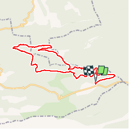

Length
17.5 km

Max alt
657 m

Uphill gradient
313 m
Km-Effort
22 km

Min alt
529 m

Downhill gradient
315 m
Boucle
Yes
Creation date :
2018-06-26 13:40:50.705
Updated on :
2018-06-26 13:40:50.705
2h53
Difficulty : Easy

FREE GPS app for hiking
 SityTrail
IGN / Geographical institutes
SityTrail Plus
The world is yours!
About
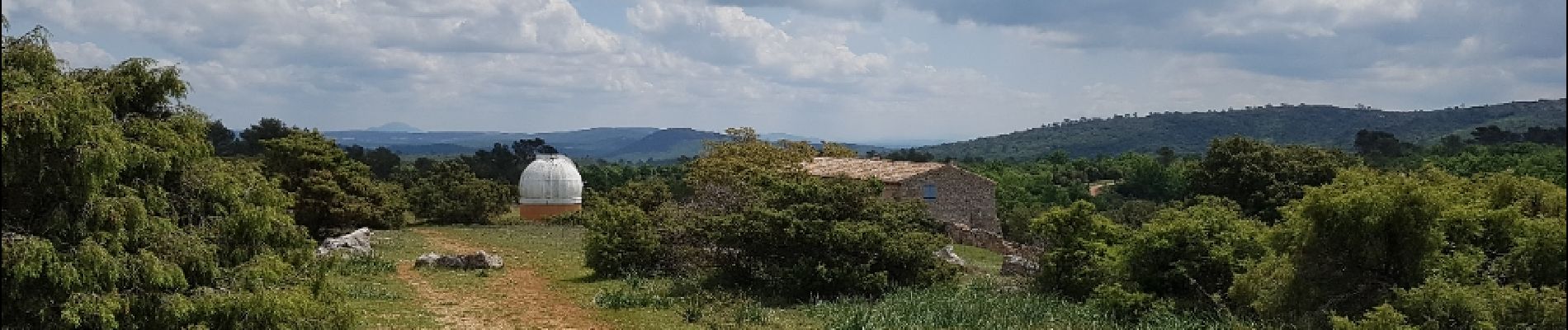
Trail Mountain bike of 17.5 km to be discovered at Provence-Alpes-Côte d'Azur, Bouches-du-Rhône, Vauvenargues. This trail is proposed by amiral13.
Photos


Positioning
Country:
France
Region :
Provence-Alpes-Côte d'Azur
Department/Province :
Bouches-du-Rhône
Municipality :
Vauvenargues
Location:
Unknown
Start:(Dec)
Start:(UTM)
717104 ; 4826107 (31T) N.
Comments