20 km | 30 km-effort
Bouillon-plateau 1
guydenis
User
Length
5.7 km
Max alt
418 m
Uphill gradient
117 m
Km-Effort
7.3 km
Min alt
344 m
Downhill gradient
117 m
Boucle
Yes
Creation date :
2014-12-10 00:00:00.0
Updated on :
2014-12-10 00:00:00.0
--
Difficulty : Very easy
FREE GPS app for hiking
About
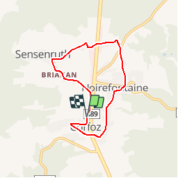
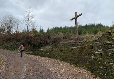
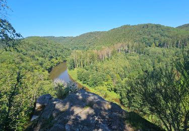
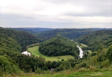
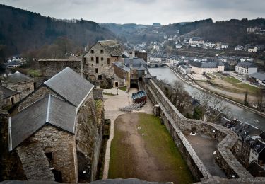
Trail Walking of 5.7 km to be discovered at Wallonia, Luxembourg, Bouillon. This trail is proposed by guydenis.
Description
TOUT SUR CHEMIN ASPHALTE - Curfoz - Briahan - Sensenruth - Les Minières - Noirefontaine - Curfoz
Positioning
Country:
Belgium
Region :
Wallonia
Department/Province :
Luxembourg
Municipality :
Bouillon
Location:
Sensenruth
Start:(Dec)
Start:(UTM)
649994 ; 5520185 (31U) N.
Comments
Trails nearby
RB-LUX-13 - Les belvédères bouillonnais
Walking
Medium
(7)
Bouillon,
Wallonia,
Luxembourg,
Belgium
5h 55min
Yes
RB-LUX-13 - Raccourci - Les belvédères bouillonnais
Walking
Medium
(4)
Bouillon,
Wallonia,
Luxembourg,
Belgium
16.7 km | 25 km-effort
4h 54min
Yes
Promenade vers la Passerelle de l’épine
Walking
Medium
(6)
Bouillon,
Wallonia,
Luxembourg,
Belgium
7.3 km | 11.2 km-effort
2h 33min
Yes
Noordelijke bossen Bouillon 15 km
Walking
Very difficult
(1)
Bouillon,
Wallonia,
Luxembourg,
Belgium
16.2 km | 24 km-effort
3h 43min
Yes
De Bouillon vers Corbion par le Tombeau du Geant
Walking
Difficult
(5)
Bouillon,
Wallonia,
Luxembourg,
Belgium
20 km | 30 km-effort
5h 0min
Yes
Le Sentier des Points de Vues - Bouillon
Walking
Difficult
Bouillon,
Wallonia,
Luxembourg,
Belgium
8.5 km | 12.2 km-effort
2h 47min
Yes
Promenade du Moulin du Rivage. (3,5km)
Walking
Easy
(2)
Bouillon,
Wallonia,
Luxembourg,
Belgium
3.3 km | 5.3 km-effort
1h 12min
Yes
Promenade de la Roche percée 47
On foot
Easy
(1)
Bouillon,
Wallonia,
Luxembourg,
Belgium
6.3 km | 8.7 km-effort
1h 58min
Yes
Promenade de la Ramonette et arboretum 8
On foot
Easy
(1)
Bouillon,
Wallonia,
Luxembourg,
Belgium
3.9 km | 6.1 km-effort
1h 23min
Yes