Trail Walking Bussières - BUSSIERES 22.1 KM - Photo
© OpenStreetMap contributors
Length
Length
22 km
Max alt
Max alt
207 m
Uphill gradient
Uphill gradient
216 m
Km-Effort
Km-Effort  
25 km
Min alt
Min alt
122 m
Downhill gradient
Downhill gradient
215 m
Boucle
Boucle
Yes
Creation date :
2018-06-26 16:07:43.478
Updated on :
2018-06-26 16:07:43.478

(0 Reviews)

Walking
Walking
5h30
Difficulty : Difficult

Scan this QR Code to open this trail in the SityTrail application

FREE GPS app for hiking

Logo SityTrail SityTrail

IGN / Geographical institutes

Download SityTrail from the App Store Download SityTrail from Google Play

Logo SityTrail SityTrail World

The world is yours!

Download SityTrail from the App Store Download SityTrail from Google Play Download SityTrail on Huawei AppGallery

About

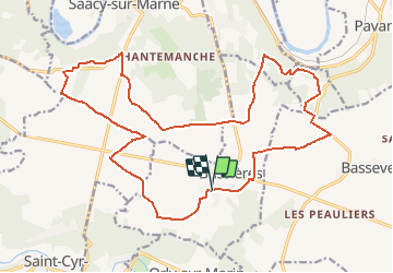
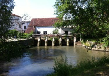
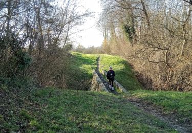
Trail Walking of 22 km to be discovered at Ile-de-France, Seine-et-Marne, Bussières. This trail is proposed by GOELERANDO2.

Description

BUSSIERES (77) 22.1 KM
Parking et départ Eglise

Elevation profile

Positioning

Country:
France
Region :
Ile-de-France
Department/Province :
Seine-et-Marne
Municipality :
Bussières
Location:
Unknown
Start:(UTM)
517259 ; 5418845 (31U) N.

Trails nearby

Trail Walking Saint-Cyr-sur-Morin - godillot - Photo
Walking
bernard.bonafous@free.fr

Walking

Very easy
(1)
Saint-Cyr-sur-Morin, Ile-de-France, Seine-et-Marne, France
21 km | 26 km-effort
5h 55min
Yes
Trail Walking Saint-Ouen-sur-Morin - Les tocards de BOITRON.2 - Photo
Walking
pikibangi

Walking

Difficult
Saint-Ouen-sur-Morin, Ile-de-France, Seine-et-Marne, France
24 km | 30 km-effort
6h 24min
Yes
Trail Walking Pavant - La tour aux pigeons - Photo
Walking

Walking

Very easy
Pavant, Hauts-de-France, Aisne, France
6.4 km | 8.5 km-effort
Unknown
Yes
Trail Walking Pavant - La tour aux pigeons - Photo
Walking
tracegps

Walking

Medium
Pavant, Hauts-de-France, Aisne, France
6.4 km | 8.5 km-effort
2h 0min
Yes
Trail Mountain bike Saâcy-sur-Marne - Les Bords de Marne en VTT - de Saâcy sur Marne à Chézy sur Marne - Photo
Mountain bike
tracegps

Mountain bike

Easy
Saâcy-sur-Marne, Ile-de-France, Seine-et-Marne, France
19.2 km | 21 km-effort
1h 40min
No
Trail Moto cross Boitron - Stéphane - Photo
Moto cross
daniel77750

Moto cross

Boitron, Ile-de-France, Seine-et-Marne, France
96 km | 116 km-effort
6h 14min
Yes
Trail Moto cross Boitron - Trail - Photo
Moto cross
daniel77750

Moto cross

Easy
Boitron, Ile-de-France, Seine-et-Marne, France
94 km | 116 km-effort
4h 13min
Yes
Trail Walking Pavant - Pavant du 21-02-2023 - Photo
Walking
VANDERPUTTENMi

Walking

Medium
Pavant, Hauts-de-France, Aisne, France
8.9 km | 11.2 km-effort
2h 10min
Yes
Trail Walking Pavant - Pavant du 06/02/2023 - Photo
Walking
VANDERPUTTENMi

Walking

Difficult
Pavant, Hauts-de-France, Aisne, France
9.6 km | 12.4 km-effort
2h 15min
Yes


Close
My subscriptions