


caujac fait

pidjam
User
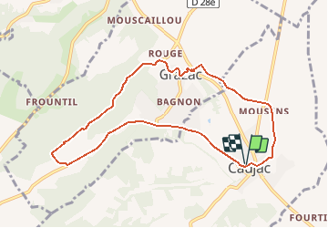

Length
9.5 km

Max alt
321 m

Uphill gradient
170 m
Km-Effort
11.8 km

Min alt
199 m

Downhill gradient
169 m
Boucle
Yes
Creation date :
2018-06-26 16:43:28.223
Updated on :
2018-06-26 16:43:28.223
2h35
Difficulty : Easy

FREE GPS app for hiking
 SityTrail
IGN / Geographical institutes
SityTrail Plus
The world is yours!
About
Trail Walking of 9.5 km to be discovered at Occitania, Haute-Garonne, Caujac. This trail is proposed by pidjam.
Description
circuit fait en juin 2018; beaucoup d'herbes folles et des ronces sur les passages que j'ai enlevé par rapport à l'autre circuit proposé ici.Pas de chemin sous les lignes au km 5.3.
Positioning
Country:
France
Region :
Occitania
Department/Province :
Haute-Garonne
Municipality :
Caujac
Location:
Unknown
Start:(Dec)
Start:(UTM)
375762 ; 4795177 (31T) N.
Comments
bien
rando accessible aux débutants peu sportif. ceci dit une ou deux côtes à pas piquer des vers