


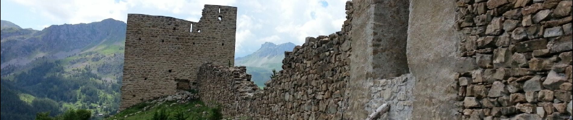
Embrunais - Réallon Le Fort - 3.2km 200m 1h10 - 2018 06 28 - public

Orcal37
User GUIDE
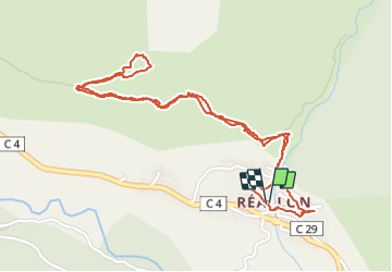

Length
3.1 km

Max alt
1600 m

Uphill gradient
192 m
Km-Effort
5.7 km

Min alt
1386 m

Downhill gradient
199 m
Boucle
Yes
Creation date :
2019-01-15 12:34:17.83
Updated on :
2021-09-20 18:07:33.738
1h20
Difficulty : Very easy

FREE GPS app for hiking
 SityTrail
IGN / Geographical institutes
SityTrail Plus
The world is yours!
About
Trail Walking of 3.1 km to be discovered at Provence-Alpes-Côte d'Azur, Hautes-Alpes, Réallon. This trail is proposed by Orcal37.
Description
Embrunais - Réallon Le Fort - 3.2km 200m 1h10 - 2018 06 28 - public
Photos


Positioning
Country:
France
Region :
Provence-Alpes-Côte d'Azur
Department/Province :
Hautes-Alpes
Municipality :
Réallon
Location:
Unknown
Start:(Dec)
Start:(UTM)
290791 ; 4941421 (32T) N.
Comments