


19,6 km | 25 km-effort
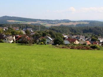
Westerwaldkreis: Descubra las mejores excursiones: 38 a pie y 1 en bici o bici de montaña. Todos estos circuitos, recorridos, itinerarios y actividades al aire libre están disponibles en nuestras aplicaciones SityTrail para smartphone y tablet.
A pie


• Trail created by VVV Frickhofen, Dorndorf + Thalheim.
A pie
• Symbol: KP2
A pie
• Symbol: KP1
A pie
• Symbol: KP3
A pie
• Symbol: grünes geschwungenes W auf weißem Grund
A pie
• Symbol: grünes geschwungenes W auf weißem Grund
A pie
• Symbol: grünes geschwungenes W auf weißem Grund
A pie
• Symbol: Elch
A pie
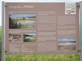
• Trail created by Ortsgemeinde Boden.
A pie
• Trail created by Ortsgemeinde Boden.
A pie
• Symbol: Teilweise gelber/weißer Text R4 auf schwarzem Grund
A pie
• Symbol: Elch
A pie
• Symbol: H3
A pie
A pie
A pie
A pie
A pie
A pie
A pie
20 excursiones mostradas en 40
Aplicación GPS de excursión GRATIS
 SityTrail
IGN / Institutos geográficos
SityTrail World
El mundo es suyo