Excursión Senderismo La Houssaye - Circuit des Moulins - La Houssaye - Photo

Circuit des Moulins - La Houssaye

 tracegps
tracegps

Usuario

© OpenStreetMap contributors
Longitud
Longitud
12,3 km
Altitud máxima
Altitud máxima
163 m
Desnivel positivo
Desnivel positivo
160 m
Km-Effort
Km-Effort  
14,4 km
Altitud mínima
Altitud mínima
103 m
Desnivel negativo
Desnivel negativo
160 m
Boucle
Boucle
Fecha de creación :
2014-12-10 00:00:00.0
Última modificación :
2014-12-10 00:00:00.0

(2 Opinión)

Senderismo
Senderismo
3h04
Dificultad : Difícil

Escanee este código QR para abrir la excursión en la aplicación SityTrail

Aplicación GPS de excursión GRATIS

Logo SityTrail SityTrail

IGN / Institutos geográficos

Descargar SityTrail en App Store Descargar SityTrail en Google Play

Logo SityTrail SityTrail World

El mundo es suyo

Descargar SityTrail en App Store Descargar SityTrail en Google Play Descargar SityTrail en Huawei AppGallery

A propósito

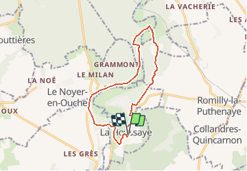
Ruta Senderismo de 12,3 km a descubrir en Normandía, Eure, La Houssaye. Esta ruta ha sido propuesta por tracegps.

Descripción

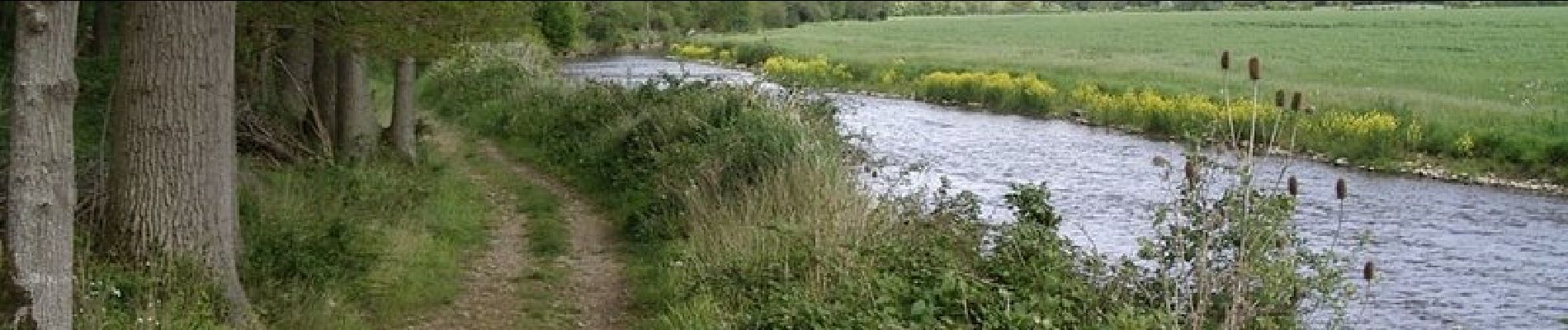
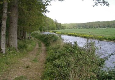
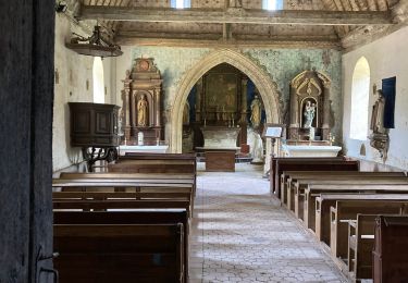
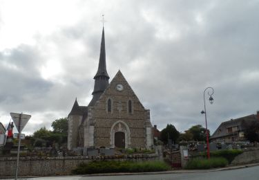
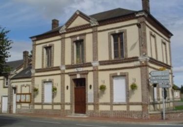
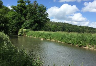
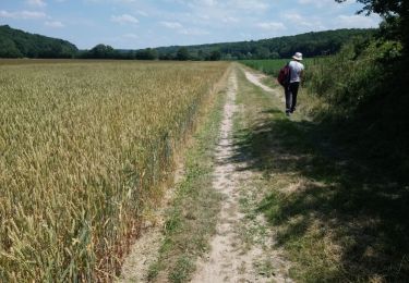
Circuit proposé par l’Office de Tourisme de Beaumont-le-Roger. Départ de la place de la mairie de La Houssaye. A voir sur le chemin : Maison de style Normand (Le Chainé), Moulin de Bougy, Eglise St Aignan (XIe, XIIe, XVIe) de La Houssaye, la Croix de Lorraine dans le cimetière. A proximité : La Ferme du Val Gallerand de style vieux normand. Très beaux parcours en vallée de la Risle. Le dépliant reprenant l’ensemble des circuits est à votre disposition à l’office du Tourisme.

Perfil altimétrico

Fotos

Localización

País:
France
Región :
Normandía
Departamento/provincia :
Eure
Municipio :
La Houssaye
Localidad:
Unknown
Salida:(Dec)
Salida:(UTM)
339202 ; 5428930 (31U) N.

Comentarios

Por favor conéctese para dejar un comentario o una evaluación


Je suis en apprentissage......


Excursiones cerca

Excursión Senderismo Le Noyer-en-Ouche - Circuit de Chatel La Lune - Le Noyer en Ouche - Photo
Senderismo
tracegps

Senderismo

Medio
(1)
Le Noyer-en-Ouche, Normandía, Eure, France
10,3 km | 11,9 km-effort
2h 30min
Excursión Senderismo Le Noyer-en-Ouche - Le noyer en ouche - Mancelles - Photo
Senderismo
serleb

Senderismo

Fácil
Le Noyer-en-Ouche, Normandía, Eure, France
10,3 km | 11,8 km-effort
2h 45min
Excursión Senderismo La Vieille-Lyre - 20220608-Champignoles - Photo
Senderismo
doudet

Senderismo

Medio
La Vieille-Lyre, Normandía, Eure, France
18,5 km | 21 km-effort
5h 3min
Excursión Senderismo Romilly-la-Puthenaye - Circuit des Clochers - Romilly la Puthenaye - Photo
Senderismo
tracegps

Senderismo

Difícil
Romilly-la-Puthenaye, Normandía, Eure, France
13,6 km | 15,2 km-effort
3h 25min
Excursión Senderismo La Ferrière-sur-Risle - Ajou - Photo
Senderismo
serleb

Senderismo

La Ferrière-sur-Risle, Normandía, Eure, France
9,4 km | 10,7 km-effort
2h 34min
Excursión Senderismo Mesnil-en-Ouche - Ajou - Photo
Senderismo
werth

Senderismo

Fácil
Mesnil-en-Ouche, Normandía, Eure, France
14,3 km | 16,9 km-effort
5h 1min
Excursión Senderismo La Ferrière-sur-Risle - Ferrieres entre risle et colombages - Photo
Senderismo
ymarvin27

Senderismo

Fácil
(1)
La Ferrière-sur-Risle, Normandía, Eure, France
7,7 km | 9,1 km-effort
1h 47min
Excursión Senderismo Mesnil-en-Ouche - gouttière  - Photo
Senderismo
werth

Senderismo

Fácil
Mesnil-en-Ouche, Normandía, Eure, France
8,5 km | 10,1 km-effort
2h 17min
Excursión Senderismo La Ferrière-sur-Risle - ajou  la ferriere 31 mars 2017 - Photo
Senderismo
dominiquelaudou

Senderismo

Fácil
La Ferrière-sur-Risle, Normandía, Eure, France
8,7 km | 10,1 km-effort
2h 14min


Cerrar
Mis suscripciones