Excursión Carrera The Municipal District of Cahir — Cashel - Ballinacourty Loop - Photo
 mlmoroneybb
mlmoroneybb

Usuario

© OpenStreetMap contributors
Longitud
Longitud
8,2 km
Altitud máxima
Altitud máxima
249 m
Desnivel positivo
Desnivel positivo
198 m
Km-Effort
Km-Effort  
10,9 km
Altitud mínima
Altitud mínima
111 m
Desnivel negativo
Desnivel negativo
199 m
Boucle
Boucle
Fecha de creación :
2014-12-10 00:00:00.0
Última modificación :
2014-12-10 00:00:00.0

(0 Opinión)

Carrera
Carrera
2h00
Dificultad : Medio

Escanee este código QR para abrir la excursión en la aplicación SityTrail

Aplicación GPS de excursión GRATIS

Logo SityTrail SityTrail

IGN / Institutos geográficos

Descargar SityTrail en App Store Descargar SityTrail en Google Play

Logo SityTrail SityTrail World

El mundo es suyo

Descargar SityTrail en App Store Descargar SityTrail en Google Play Descargar SityTrail en Huawei AppGallery

A propósito

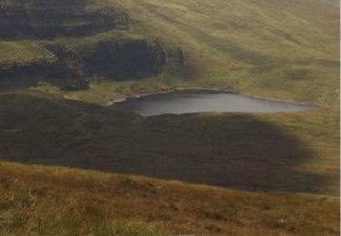
Ruta Carrera de 8,2 km a descubrir en Desconocido, County Tipperary, The Municipal District of Cahir — Cashel. Esta ruta ha sido propuesta por mlmoroneybb.

Descripción

A-B. From the mapboard in the green area at Christ the King statue follow downhill to enter the Nature Park. This loop is marked with purple arrows – but overlaps with two other loops (green and light blue arrows) and the long-distance Ballyhoura Way which is marked with the familiar yellow walking man and arrows. Descend wooden steps and over a footbridge and shortly afterwards you reach a Y-junction. Veer left here and follow the woodland trail for approximately 1km to reach a wooden stile. Exiting the stile the green loop turns right – you turn left.

Perfil altimétrico

Localización

País:
Ireland
Región :
Desconocido
Departamento/provincia :
County Tipperary
Municipio :
The Municipal District of Cahir — Cashel
Localidad:
Clonbeg
Salida:(UTM)
556475 ; 5809160 (29U) N.

Excursiones cerca

Excursión Senderismo The Municipal District of Cahir — Cashel - l diheen - Photo
Senderismo
mlmoroneybb

Senderismo

Difícil
The Municipal District of Cahir — Cashel, Desconocido, County Tipperary, Ireland
16,3 km | 32 km-effort
5h 46min
Excursión Senderismo The Municipal District of Cahir — Cashel - Galtees - Lake Muskry Circuit - Photo
Senderismo
johnkeating

Senderismo

Muy fácil
The Municipal District of Cahir — Cashel, Desconocido, County Tipperary, Ireland
10,1 km | 18,2 km-effort
3h 10min
No
Excursión Carrera The Municipal District of Cahir — Cashel - Bianconi Loop - Photo
Carrera
mlmoroneybb

Carrera

Fácil
The Municipal District of Cahir — Cashel, Desconocido, County Tipperary, Ireland
3,8 km | 5,3 km-effort
2h 0min
Excursión Carrera The Municipal District of Cahir — Cashel - The Millenium Stone Loop - Photo
Carrera
mlmoroneybb

Carrera

Medio
The Municipal District of Cahir — Cashel, Desconocido, County Tipperary, Ireland
9,4 km | 12,4 km-effort
2h 0min
Excursión Senderismo The Municipal District of Cahir — Cashel - Slievenamuck Walking Marathon Sunday March 24th 2013 - Photo
Senderismo
mlmoroneybb

Senderismo

Difícil
The Municipal District of Cahir — Cashel, Desconocido, County Tipperary, Ireland
42 km | 56 km-effort
11h 36min
No
Excursión Senderismo The Municipal District of Cahir — Cashel - Galtee Walking Club Marathon - Photo
Senderismo
mlmoroneybb

Senderismo

Difícil
The Municipal District of Cahir — Cashel, Desconocido, County Tipperary, Ireland
41 km | 54 km-effort
11h 22min
Excursión Senderismo The Municipal District of Cahir — Cashel - lisvarrinane new - Photo
Senderismo
mlmoroneybb

Senderismo

Fácil
The Municipal District of Cahir — Cashel, Desconocido, County Tipperary, Ireland
4,6 km | 6 km-effort
1h 17min
Excursión Senderismo The Municipal District of Cahir — Cashel - Winter B 2012 - Photo
Senderismo
mlmoroneybb

Senderismo

Medio
The Municipal District of Cahir — Cashel, Desconocido, County Tipperary, Ireland
12,7 km | 17,3 km-effort
Desconocido
Excursión Senderismo The Municipal District of Cahir — Cashel - Rock an Torabh Walk - Photo
Senderismo
mlmoroneybb

Senderismo

Medio
The Municipal District of Cahir — Cashel, Desconocido, County Tipperary, Ireland
8,1 km | 10,7 km-effort
2h 18min


Cerrar
Mis suscripciones