![](/images/other/stat-length.png)
![Excursión Senderismo Cadenet - Cadenet -Lourmarin - Photo](https://media.geolcdn.com/t/1900/400/ext.pjpeg?maxdim=2&url=https%3A%2F%2Fmedia.geolcdn.com%2Ff%2Ff0fee848-9372-4ead-90a1-4f47846561d2.jpg)
Cadenet -Lourmarin
Randonnées en Provence
Séjours montagne été / hiver (raquettes)
![Longitud](/images/other/stat-length.png)
Longitud
12,1 km
![Altitud máxima](https://static1.geolcdn.com/siteimages/upload/files/1508320355ic_sort_altitude_max_24dp.png)
Altitud máxima
289 m
![Desnivel positivo](https://static1.geolcdn.com/siteimages/upload/files/1508320355ic_sort_den_pos_24dp.png)
Desnivel positivo
236 m
![Km-Effort](/images/other/stat-length.png)
Km-Effort
15,3 km
![Altitud mínima](https://static1.geolcdn.com/siteimages/upload/files/1508320355ic_sort_altitude_min_24dp.png)
Altitud mínima
186 m
![Desnivel negativo](https://static1.geolcdn.com/siteimages/upload/files/1508320355ic_sort_den_neg_24dp.png)
Desnivel negativo
237 m
![Boucle](https://static1.geolcdn.com/siteimages/upload/files/16400158638029165_repeat_loop_refresh_sync_direction_icon.png)
Boucle
Sí
Fecha de creación :
2019-04-19 07:47:09.906
Última modificación :
2019-04-23 16:04:16.391
![Senderismo](https://static1.geolcdn.com/sitytour/trail-icons/101.png)
5h43
Dificultad : Muy fácil
![Escanee este código QR para abrir la excursión en la aplicación SityTrail](https://capi.geolives.com/qq0zvz2zws4bq2lad0pu/sitytour/trails/2063967/qr.png?size=200)
Aplicación GPS de excursión GRATIS
A propósito
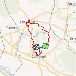
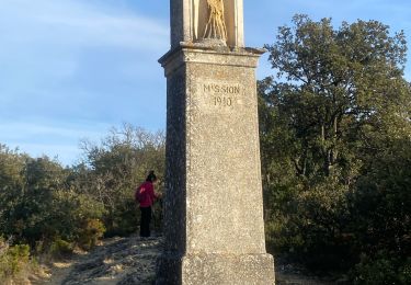
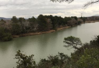
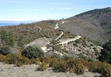
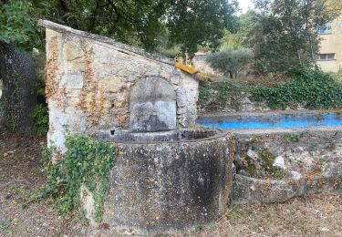
Ruta Senderismo de 12,1 km a descubrir en Provenza-Alpes-Costa Azul, Vaucluse, Cadenet. Esta ruta ha sido propuesta por Randonnées en Provence.
Descripción
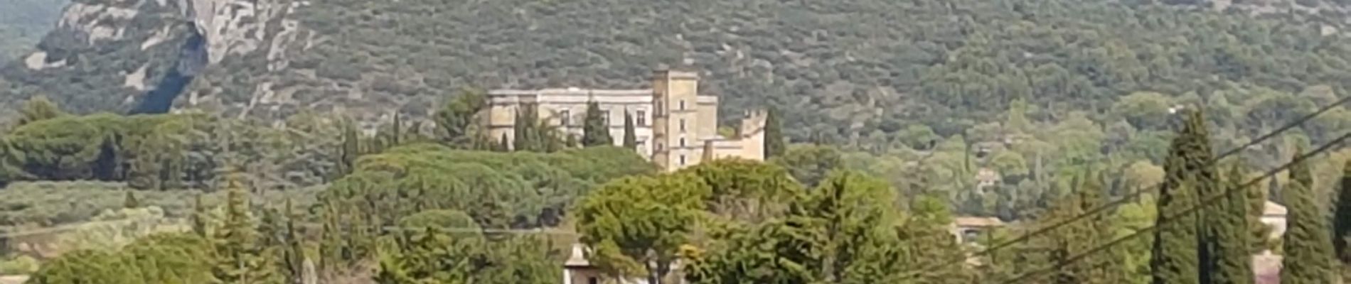
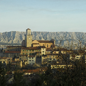
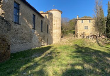
Cadenet et Lourmarin : visite des villages et des chateaux
Localización
País:
France
Región :
Provenza-Alpes-Costa Azul
Departamento/provincia :
Vaucluse
Municipio :
Cadenet
Localidad:
Unknown
Salida:(Dec)
Salida:(UTM)
691393 ; 4845467 (31T) N.
Comentarios
Excursiones cerca
![Excursión Bici de montaña Cucuron - Le Coteau des Gamates - Photo](https://media.geolcdn.com/t/375/260/ext.jpg?maxdim=2&url=https%3A%2F%2Fservices.sitytrail.com%2FGeolivesWS%2FDownloadMedia.ashx%3FTrailID%3D108569%26Media%3D1477_1.jpg)
![Bici de montaña Bici de montaña](https://static1.geolcdn.com/sitytour/trail-icons/202.png)
Le Coteau des Gamates
Bici de montaña
Muy difícil
(1)
Cucuron,
Provenza-Alpes-Costa Azul,
Vaucluse,
France
![](/images/other/stat-length.png)
25 km | 40 km-effort
3h 10min
![](https://static1.geolcdn.com/siteimages/upload/files/16400158638029165_repeat_loop_refresh_sync_direction_icon.png)
Sí
![Excursión Senderismo La Roque-d'Anthéron - Gambadous - La Roque d'Antheron - Photo](https://media.geolcdn.com/t/375/260/ext.jpg?maxdim=2&url=https%3A%2F%2Fstatic1.geolcdn.com%2Fsiteimages%2Fupload%2Ffiles%2F1553511878bg_sport_marche.png)
![Senderismo Senderismo](https://static1.geolcdn.com/sitytour/trail-icons/101.png)
Gambadous - La Roque d'Antheron
Senderismo
Fácil
(2)
La Roque-d'Anthéron,
Provenza-Alpes-Costa Azul,
Bocas del Ródano,
France
![](/images/other/stat-length.png)
7,3 km | 10 km-effort
2h 30min
![](https://static1.geolcdn.com/siteimages/upload/files/16400158638029165_repeat_loop_refresh_sync_direction_icon.png)
Sí
![Excursión Bici de montaña Villelaure - Rando à Villelaure - Photo](https://media.geolcdn.com/t/375/260/ext.jpg?maxdim=2&url=https%3A%2F%2Fservices.sitytrail.com%2FGeolivesWS%2FDownloadMedia.ashx%3FTrailID%3D100952%26Media%3D451_1.jpg)
![Bici de montaña Bici de montaña](https://static1.geolcdn.com/sitytour/trail-icons/202.png)
Rando à Villelaure
Bici de montaña
Difícil
(1)
Villelaure,
Provenza-Alpes-Costa Azul,
Vaucluse,
France
![](/images/other/stat-length.png)
29 km | 39 km-effort
2h 0min
![](https://static1.geolcdn.com/siteimages/upload/files/16400158638029165_repeat_loop_refresh_sync_direction_icon.png)
Sí
![Excursión Senderismo Vaugines - Vaugines - roque rousse. - Vaugines - Photo](https://media.geolcdn.com/t/375/260/ext.jpg?maxdim=2&url=https%3A%2F%2Fmedia.geolcdn.com%2Ff%2F6177de4a-3309-4104-9e1d-30cfd59fb2bd.jpg)
![Senderismo Senderismo](https://static1.geolcdn.com/sitytour/trail-icons/101.png)
Vaugines - roque rousse. - Vaugines
Senderismo
Medio
Vaugines,
Provenza-Alpes-Costa Azul,
Vaucluse,
France
![](/images/other/stat-length.png)
6 km | 9 km-effort
2h 3min
![](https://static1.geolcdn.com/siteimages/upload/files/16400158638029165_repeat_loop_refresh_sync_direction_icon.png)
Sí
![Excursión Senderismo Cucuron - Cucuron. Vaugine. Cucuron - Photo](https://media.geolcdn.com/t/375/260/ext.jpg?maxdim=2&url=https%3A%2F%2Fmedia.geolcdn.com%2Ff%2F5f7ad201-3654-4768-83c6-f7d23646c099.jpg)
![Senderismo Senderismo](https://static1.geolcdn.com/sitytour/trail-icons/101.png)
Cucuron. Vaugine. Cucuron
Senderismo
Medio
Cucuron,
Provenza-Alpes-Costa Azul,
Vaucluse,
France
![](/images/other/stat-length.png)
5,3 km | 6,5 km-effort
2h 8min
![](https://static1.geolcdn.com/siteimages/upload/files/16400158638029165_repeat_loop_refresh_sync_direction_icon.png)
Sí
![Excursión Senderismo La Roque-d'Anthéron - GB DURANCE+ CHÂTEAU DE JANSON - Photo](https://media.geolcdn.com/t/375/260/ext.jpg?maxdim=2&url=https%3A%2F%2Fmedia.geolcdn.com%2Ff%2Fe459b870-44d9-4218-9eb9-ffb1a47bd648.jpg)
![Senderismo Senderismo](https://static1.geolcdn.com/sitytour/trail-icons/101.png)
GB DURANCE+ CHÂTEAU DE JANSON
Senderismo
Medio
La Roque-d'Anthéron,
Provenza-Alpes-Costa Azul,
Bocas del Ródano,
France
![](/images/other/stat-length.png)
5,5 km | 6 km-effort
1h 22min
![](https://static1.geolcdn.com/siteimages/upload/files/16400158638029165_repeat_loop_refresh_sync_direction_icon.png)
Sí
![Excursión Senderismo Vaugines - SityTrail - PF-Vaugines - Le Mourre Nègre à partir de Vaugines - Var - Photo](https://media.geolcdn.com/t/375/260/ext.jpg?maxdim=2&url=https%3A%2F%2Fmedia.geolcdn.com%2Ff%2Fb13e0996-37e3-436e-a340-7f737ac7ab81.JPG)
![Senderismo Senderismo](https://static1.geolcdn.com/sitytour/trail-icons/101.png)
SityTrail - PF-Vaugines - Le Mourre Nègre à partir de Vaugines - Var
Senderismo
Muy difícil
(1)
Vaugines,
Provenza-Alpes-Costa Azul,
Vaucluse,
France
![](/images/other/stat-length.png)
20 km | 32 km-effort
7h 14min
![](https://static1.geolcdn.com/siteimages/upload/files/16400158638029165_repeat_loop_refresh_sync_direction_icon.png)
Sí
![Excursión Senderismo Villelaure - Villelaure château de la reine Laure Villelaure - Photo](https://media.geolcdn.com/t/375/260/ext.jpg?maxdim=2&url=https%3A%2F%2Fmedia.geolcdn.com%2Ff%2Fb7e64666-8f15-413e-93ea-08f0067c9ed6.jpg)
![Senderismo Senderismo](https://static1.geolcdn.com/sitytour/trail-icons/101.png)
Villelaure château de la reine Laure Villelaure
Senderismo
Medio
Villelaure,
Provenza-Alpes-Costa Azul,
Vaucluse,
France
![](/images/other/stat-length.png)
7,8 km | 10,7 km-effort
2h 22min
![](https://static1.geolcdn.com/siteimages/upload/files/16400158638029165_repeat_loop_refresh_sync_direction_icon.png)
Sí
![Excursión A pie Lourmarin - Lourmarin - Cadenet - Lourmarin - Photo](https://media.geolcdn.com/t/375/260/ext.jpg?maxdim=2&url=https%3A%2F%2Fmedia.geolcdn.com%2Ff%2F2d53adfc-3504-4117-a8f3-d2bec3eead0d.jpg)
![A pie A pie](https://static1.geolcdn.com/sitytour/trail-icons/100.png)
Lourmarin - Cadenet - Lourmarin
A pie
Fácil
Lourmarin,
Provenza-Alpes-Costa Azul,
Vaucluse,
France
![](/images/other/stat-length.png)
11,5 km | 14,6 km-effort
3h 19min
![](https://static1.geolcdn.com/siteimages/upload/files/16400158638029165_repeat_loop_refresh_sync_direction_icon.png)
Sí