Excursión Senderismo Glandage - Glandage - col de la Péyère - Photo

Glandage - col de la Péyère

 luccho
luccho

Usuario

© OpenStreetMap contributors
Longitud
Longitud
14,4 km
Altitud máxima
Altitud máxima
1322 m
Desnivel positivo
Desnivel positivo
629 m
Km-Effort
Km-Effort  
23 km
Altitud mínima
Altitud mínima
895 m
Desnivel negativo
Desnivel negativo
624 m
Boucle
Boucle
Fecha de creación :
2020-03-07 08:36:16.0
Última modificación :
2020-03-09 08:14:16.807

(0 Opinión)

Senderismo
Senderismo
5h29
Dificultad : Medio

Escanee este código QR para abrir la excursión en la aplicación SityTrail

Aplicación GPS de excursión GRATIS

Logo SityTrail SityTrail

IGN / Institutos geográficos

Descargar SityTrail en App Store Descargar SityTrail en Google Play

Logo SityTrail SityTrail World

El mundo es suyo

Descargar SityTrail en App Store Descargar SityTrail en Google Play Descargar SityTrail en Huawei AppGallery

A propósito

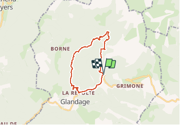
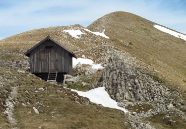
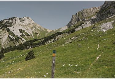
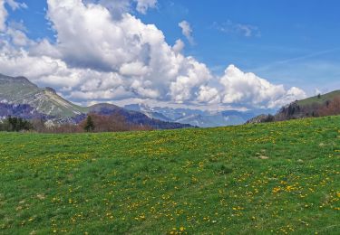
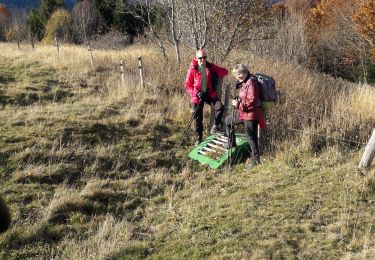
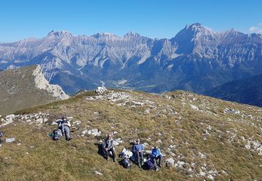
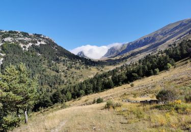
Ruta Senderismo de 14,4 km a descubrir en Auvergne-Rhône-Alpes, Drôme, Glandage. Esta ruta ha sido propuesta por luccho.

Descripción

Boucle glandage - les sucettes de borne - col de la pléyère - Glandage

Perfil altimétrico

Localización

País:
France
Región :
Auvergne-Rhône-Alpes
Departamento/provincia :
Drôme
Municipio :
Glandage
Localidad:
Unknown
Salida:(Dec)
Salida:(UTM)
707403 ; 4953146 (31T) N.

Excursiones cerca

Excursión Senderismo Glandage - Grimone-Le Jocou 12km - Photo
Senderismo
GUIDE
thonyc

Senderismo

Difícil
Glandage, Auvergne-Rhône-Alpes, Drôme, France
12 km | 24 km-effort
6h 0min
Excursión Senderismo Glandage - Le Jocou 2 - Photo
Senderismo
Marco05

Senderismo

Difícil
Glandage, Auvergne-Rhône-Alpes, Drôme, France
8,5 km | 18,1 km-effort
4h 0min
Excursión Senderismo Châtillon-en-Diois - Circuit des Baumes - Pont de vachères-Soubreroche - Boulc - Photo
Senderismo
Philindy26

Senderismo

Medio
Châtillon-en-Diois, Auvergne-Rhône-Alpes, Drôme, France
11,4 km | 18,5 km-effort
4h 20min
Excursión Senderismo Glandage - 2022-09-05_12h23m25_Le Jocou-col de Seysse 12km.gpx (2).xml - Photo
Senderismo
chancha

Senderismo

Muy difícil
Glandage, Auvergne-Rhône-Alpes, Drôme, France
11,6 km | 24 km-effort
5h 27min
Excursión Senderismo Glandage - 2022-06-24_19h10m37_Le Jocou par crêtes des  Amousières 10km.gpx.xml - Photo
Senderismo
chancha

Senderismo

Muy difícil
Glandage, Auvergne-Rhône-Alpes, Drôme, France
9,6 km | 22 km-effort
5h 9min
Excursión Senderismo Lalley - Serre Motaire et Lazare - Photo
Senderismo
PapouBertrand

Senderismo

Muy difícil
Lalley, Auvergne-Rhône-Alpes, Isère, France
14,6 km | 24 km-effort
23h 45min
Excursión Senderismo Lalley - le Rognon depuis le col de Lus - Photo
Senderismo
cmarit

Senderismo

Medio
(1)
Lalley, Auvergne-Rhône-Alpes, Isère, France
14,6 km | 24 km-effort
6h 53min
Excursión Senderismo Lalley - Rognon - Bouturet - Col des Selles - Photo
Senderismo
patjobou

Senderismo

Medio
Lalley, Auvergne-Rhône-Alpes, Isère, France
15 km | 25 km-effort
6h 18min
Excursión Senderismo Glandage - Col de la Péyère (Grimone) - Photo
Senderismo
Philindy26

Senderismo

Difícil
Glandage, Auvergne-Rhône-Alpes, Drôme, France
12,2 km | 20 km-effort
4h 0min


Cerrar
Mis suscripciones