![](/images/other/stat-length.png)
![Excursión Senderismo La Salette-Fallavaux - Valgaudemar J5 Les Crêtesde la Salette IBP 159 - Photo](https://media.geolcdn.com/t/1900/400/ext.pjpeg?maxdim=2&url=https%3A%2F%2Fstatic1.geolcdn.com%2Fsiteimages%2Fupload%2Ffiles%2F1553511878bg_sport_marche.png)
Valgaudemar J5 Les Crêtesde la Salette IBP 159
jouans
Usuario
![Longitud](/images/other/stat-length.png)
Longitud
17,1 km
![Altitud máxima](https://static1.geolcdn.com/siteimages/upload/files/1508320355ic_sort_altitude_max_24dp.png)
Altitud máxima
1976 m
![Desnivel positivo](https://static1.geolcdn.com/siteimages/upload/files/1508320355ic_sort_den_pos_24dp.png)
Desnivel positivo
1239 m
![Km-Effort](/images/other/stat-length.png)
Km-Effort
34 km
![Altitud mínima](https://static1.geolcdn.com/siteimages/upload/files/1508320355ic_sort_altitude_min_24dp.png)
Altitud mínima
1132 m
![Desnivel negativo](https://static1.geolcdn.com/siteimages/upload/files/1508320355ic_sort_den_neg_24dp.png)
Desnivel negativo
1239 m
![Boucle](https://static1.geolcdn.com/siteimages/upload/files/16400158638029165_repeat_loop_refresh_sync_direction_icon.png)
Boucle
Sí
Fecha de creación :
2020-11-25 16:42:25.486
Última modificación :
2021-06-24 15:58:02.671
![Senderismo](https://static1.geolcdn.com/sitytour/trail-icons/101.png)
6h42
Dificultad : Muy difícil
![Escanee este código QR para abrir la excursión en la aplicación SityTrail](https://capi.geolives.com/qq0zvz2zws4bq2lad0pu/sitytour/trails/2606854/qr.png?size=200)
Aplicación GPS de excursión GRATIS
A propósito
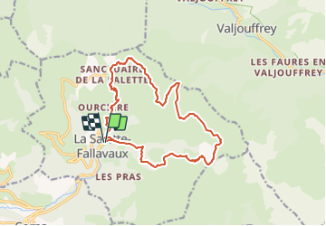
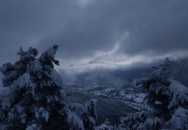
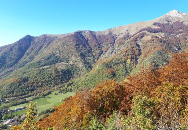
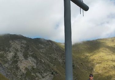
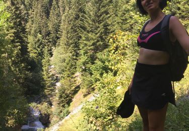
Ruta Senderismo de 17,1 km a descubrir en Auvergne-Rhône-Alpes, Isère, La Salette-Fallavaux. Esta ruta ha sido propuesta por jouans.
Descripción
Randonnée autour du sanctuaire de la salette Fallavaux La salette col des Clos Col des Vachers
Localización
País:
France
Región :
Auvergne-Rhône-Alpes
Departamento/provincia :
Isère
Municipio :
La Salette-Fallavaux
Localidad:
Unknown
Salida:(Dec)
Salida:(UTM)
735235 ; 4969577 (31T) N.
Comentarios
Excursiones cerca
![Excursión Senderismo La Salette-Fallavaux - Croix de Rougny via ND de la Salette - Photo](https://media.geolcdn.com/t/375/260/ext.jpg?maxdim=2&url=https%3A%2F%2Fmedia.geolcdn.com%2Ff%2F2c02e1cb-779c-4473-995c-4136efa43ee7.jpg)
![Senderismo Senderismo](https://static1.geolcdn.com/sitytour/trail-icons/101.png)
Croix de Rougny via ND de la Salette
Senderismo
Muy difícil
(1)
La Salette-Fallavaux,
Auvergne-Rhône-Alpes,
Isère,
France
![](/images/other/stat-length.png)
10,5 km | 21 km-effort
4h 45min
![](https://static1.geolcdn.com/siteimages/upload/files/16400158638029165_repeat_loop_refresh_sync_direction_icon.png)
Sí
![Excursión Senderismo Aspres-lès-Corps - Aspres les corps - Roche Courbe - Photo](https://media.geolcdn.com/t/375/260/ext.jpg?maxdim=2&url=https%3A%2F%2Fservices.sitytrail.com%2FGeolivesWS%2FDownloadMedia.ashx%3FTrailID%3D655638%26Media%3Dd468d5e8-71c8-44e5-98f2-217554c35ba5.JPG)
![Senderismo Senderismo](https://static1.geolcdn.com/sitytour/trail-icons/101.png)
Aspres les corps - Roche Courbe
Senderismo
Muy difícil
(1)
Aspres-lès-Corps,
Provenza-Alpes-Costa Azul,
Altos Alpes,
France
![](/images/other/stat-length.png)
10,6 km | 24 km-effort
4h 53min
![](https://static1.geolcdn.com/siteimages/upload/files/16400158638029165_repeat_loop_refresh_sync_direction_icon.png)
Sí
![Excursión Senderismo Saint-Michel-en-Beaumont - 2022-07-20_17h09m05_ND Salette - Photo](https://media.geolcdn.com/t/375/260/ext.jpg?maxdim=2&url=https%3A%2F%2Fstatic1.geolcdn.com%2Fsiteimages%2Fupload%2Ffiles%2F1553511878bg_sport_marche.png)
![Senderismo Senderismo](https://static1.geolcdn.com/sitytour/trail-icons/101.png)
2022-07-20_17h09m05_ND Salette
Senderismo
Medio
(1)
Saint-Michel-en-Beaumont,
Auvergne-Rhône-Alpes,
Isère,
France
![](/images/other/stat-length.png)
14,3 km | 23 km-effort
5h 10min
![](https://static1.geolcdn.com/siteimages/upload/files/16400158638029165_repeat_loop_refresh_sync_direction_icon.png)
Sí
![Excursión Senderismo Saint-Firmin - YHH081 Vallon de Prentiq - Photo](https://media.geolcdn.com/t/375/260/ext.jpg?maxdim=2&url=https%3A%2F%2Fstatic1.geolcdn.com%2Fsiteimages%2Fupload%2Ffiles%2F1553511878bg_sport_marche.png)
![Senderismo Senderismo](https://static1.geolcdn.com/sitytour/trail-icons/101.png)
YHH081 Vallon de Prentiq
Senderismo
Muy fácil
(1)
Saint-Firmin,
Provenza-Alpes-Costa Azul,
Altos Alpes,
France
![](/images/other/stat-length.png)
6,7 km | 11,1 km-effort
2h 30min
![](https://static1.geolcdn.com/siteimages/upload/files/16400158638029165_repeat_loop_refresh_sync_direction_icon.png)
Sí
![Excursión Esquí de fondo La Salette-Fallavaux - Pale ronde et col de près clos - Photo](https://media.geolcdn.com/t/375/260/ext.jpg?maxdim=2&url=https%3A%2F%2Fmedia.geolcdn.com%2Ff%2Fa90c1b03-7ad1-47e8-aa30-8d2ad928ae52.jpg)
![Esquí de fondo Esquí de fondo](https://static1.geolcdn.com/sitytour/trail-icons/503.png)
Pale ronde et col de près clos
Esquí de fondo
Fácil
La Salette-Fallavaux,
Auvergne-Rhône-Alpes,
Isère,
France
![](/images/other/stat-length.png)
10,1 km | 25 km-effort
6h 16min
![](https://static1.geolcdn.com/siteimages/upload/files/16400158638029165_repeat_loop_refresh_sync_direction_icon.png)
Sí
![Excursión Esquí de fondo Aspres-lès-Corps - tentative du Laton, pic gazonné - Photo](https://media.geolcdn.com/t/375/260/ext.jpg?maxdim=2&url=https%3A%2F%2Fmedia.geolcdn.com%2Ff%2Fbb214dca-e6e7-4564-b147-bec3a550b510.jpg)
![Esquí de fondo Esquí de fondo](https://static1.geolcdn.com/sitytour/trail-icons/503.png)
tentative du Laton, pic gazonné
Esquí de fondo
Fácil
Aspres-lès-Corps,
Provenza-Alpes-Costa Azul,
Altos Alpes,
France
![](/images/other/stat-length.png)
6,9 km | 15,9 km-effort
4h 36min
![](https://static1.geolcdn.com/siteimages/upload/files/16400158638029165_repeat_loop_refresh_sync_direction_icon.png)
Sí
![Excursión Senderismo Aspres-lès-Corps - Roche Courbe en circuit - Photo](https://media.geolcdn.com/t/375/260/ext.jpg?maxdim=2&url=https%3A%2F%2Fmedia.geolcdn.com%2Ff%2Fd98dbc92-c0e3-4883-814f-4596e6fce13d.jpg)
![Senderismo Senderismo](https://static1.geolcdn.com/sitytour/trail-icons/101.png)
Roche Courbe en circuit
Senderismo
Medio
Aspres-lès-Corps,
Provenza-Alpes-Costa Azul,
Altos Alpes,
France
![](/images/other/stat-length.png)
9,9 km | 23 km-effort
5h 57min
![](https://static1.geolcdn.com/siteimages/upload/files/16400158638029165_repeat_loop_refresh_sync_direction_icon.png)
Sí
![Excursión Senderismo La Salette-Fallavaux - La Salette-Fallavaux Marche à pied - Photo](https://media.geolcdn.com/t/375/260/ext.jpg?maxdim=2&url=https%3A%2F%2Fmedia.geolcdn.com%2Ff%2F43d388a6-6ad9-46af-bfc8-c0d432435567.JPG)
![Senderismo Senderismo](https://static1.geolcdn.com/sitytour/trail-icons/101.png)
La Salette-Fallavaux Marche à pied
Senderismo
Medio
La Salette-Fallavaux,
Auvergne-Rhône-Alpes,
Isère,
France
![](/images/other/stat-length.png)
6,6 km | 10,2 km-effort
2h 7min
![](https://static1.geolcdn.com/siteimages/upload/files/16400158638029165_repeat_loop_refresh_sync_direction_icon.png)
No
![Excursión Senderismo Valjouffrey - Valbonais - Photo](https://media.geolcdn.com/t/375/260/ext.jpg?maxdim=2&url=https%3A%2F%2Fmedia.geolcdn.com%2Ff%2Ff5ee2dc5-90cd-4c3d-a7fb-1d401b780daf.jpg)
![Senderismo Senderismo](https://static1.geolcdn.com/sitytour/trail-icons/101.png)
Valbonais
Senderismo
Fácil
Valjouffrey,
Auvergne-Rhône-Alpes,
Isère,
France
![](/images/other/stat-length.png)
11,5 km | 17,2 km-effort
3h 34min
![](https://static1.geolcdn.com/siteimages/upload/files/16400158638029165_repeat_loop_refresh_sync_direction_icon.png)
Sí