![](/images/other/stat-length.png)
![Excursión Senderismo Doizieux - A_PILAT 42410 Oeillon - Perdrix - Photo](https://media.geolcdn.com/t/1900/400/ext.pjpeg?maxdim=2&url=https%3A%2F%2Fstatic1.geolcdn.com%2Fsiteimages%2Fupload%2Ffiles%2F1553511878bg_sport_marche.png)
A_PILAT 42410 Oeillon - Perdrix
ANDREJAC
Usuario
![Longitud](/images/other/stat-length.png)
Longitud
7,8 km
![Altitud máxima](https://static1.geolcdn.com/siteimages/upload/files/1508320355ic_sort_altitude_max_24dp.png)
Altitud máxima
1424 m
![Desnivel positivo](https://static1.geolcdn.com/siteimages/upload/files/1508320355ic_sort_den_pos_24dp.png)
Desnivel positivo
227 m
![Km-Effort](/images/other/stat-length.png)
Km-Effort
10,8 km
![Altitud mínima](https://static1.geolcdn.com/siteimages/upload/files/1508320355ic_sort_altitude_min_24dp.png)
Altitud mínima
1317 m
![Desnivel negativo](https://static1.geolcdn.com/siteimages/upload/files/1508320355ic_sort_den_neg_24dp.png)
Desnivel negativo
227 m
![Boucle](https://static1.geolcdn.com/siteimages/upload/files/16400158638029165_repeat_loop_refresh_sync_direction_icon.png)
Boucle
Sí
Fecha de creación :
2014-12-10 00:00:00.0
Última modificación :
2014-12-10 00:00:00.0
![Senderismo](https://static1.geolcdn.com/sitytour/trail-icons/101.png)
3h00
Dificultad : Fácil
![Escanee este código QR para abrir la excursión en la aplicación SityTrail](https://capi.geolives.com/qq0zvz2zws4bq2lad0pu/sitytour/trails/266510/qr.png?size=200)
Aplicación GPS de excursión GRATIS
A propósito
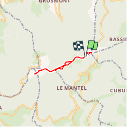
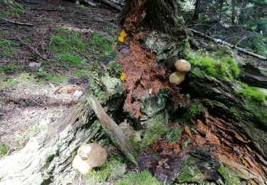
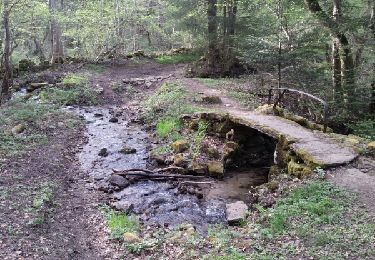
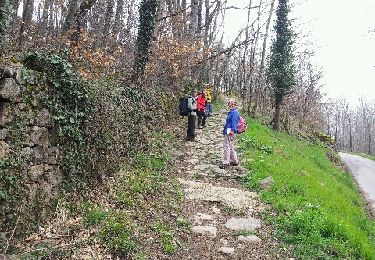
Ruta Senderismo de 7,8 km a descubrir en Auvergne-Rhône-Alpes, Loira, Doizieux. Esta ruta ha sido propuesta por ANDREJAC.
Descripción
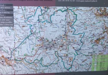
Départ et retour parking du collet 1319m,
Table d'orientation Crêt de l'Oeillon, Table d'orientation Crêt de la Perdrix par la route des crêtes, retour par le belvédère et le Crêt de l'Etançon.
Localización
País:
France
Región :
Auvergne-Rhône-Alpes
Departamento/provincia :
Loira
Municipio :
Doizieux
Localidad:
Unknown
Salida:(Dec)
Salida:(UTM)
625870 ; 5027677 (31T) N.
Comentarios
Excursiones cerca
![Excursión Senderismo Doizieux - chemin des crêtes de la jassiere - Photo](https://media.geolcdn.com/t/375/260/ext.jpg?maxdim=2&url=https%3A%2F%2Fservices.sitytrail.com%2FGeolivesWS%2FDownloadMedia.ashx%3FTrailID%3D215361%26Media%3Dfix__20130820162447.jpg)
![Senderismo Senderismo](https://static1.geolcdn.com/sitytour/trail-icons/101.png)
chemin des crêtes de la jassiere
Senderismo
Fácil
(2)
Doizieux,
Auvergne-Rhône-Alpes,
Loira,
France
![](/images/other/stat-length.png)
12,4 km | 18,3 km-effort
3h 36min
![](https://static1.geolcdn.com/siteimages/upload/files/16400158638029165_repeat_loop_refresh_sync_direction_icon.png)
Sí
![Excursión Senderismo Roisey - Le cret de l'oeillon - Photo](https://media.geolcdn.com/t/375/260/ext.jpg?maxdim=2&url=https%3A%2F%2Fstatic1.geolcdn.com%2Fsiteimages%2Fupload%2Ffiles%2F1553511878bg_sport_marche.png)
![Senderismo Senderismo](https://static1.geolcdn.com/sitytour/trail-icons/101.png)
Le cret de l'oeillon
Senderismo
Difícil
(1)
Roisey,
Auvergne-Rhône-Alpes,
Loira,
France
![](/images/other/stat-length.png)
13,3 km | 22 km-effort
4h 59min
![](https://static1.geolcdn.com/siteimages/upload/files/16400158638029165_repeat_loop_refresh_sync_direction_icon.png)
Sí
![Excursión Senderismo Doizieux - Doizieux - De l'émetteur du Pilat à la Jasserie - Photo](https://media.geolcdn.com/t/375/260/ext.jpg?maxdim=2&url=https%3A%2F%2Fmedia.geolcdn.com%2Ff%2Fb332cb02-c93e-4c8f-b155-20a2a7bc60d2.jpg)
![Senderismo Senderismo](https://static1.geolcdn.com/sitytour/trail-icons/101.png)
Doizieux - De l'émetteur du Pilat à la Jasserie
Senderismo
Difícil
Doizieux,
Auvergne-Rhône-Alpes,
Loira,
France
![](/images/other/stat-length.png)
9,4 km | 13,8 km-effort
3h 8min
![](https://static1.geolcdn.com/siteimages/upload/files/16400158638029165_repeat_loop_refresh_sync_direction_icon.png)
Sí
![Excursión Senderismo Colombier - 42-st-sabin-pilat-18km-610m-juil21 - Photo](https://media.geolcdn.com/t/375/260/ext.jpg?maxdim=2&url=https%3A%2F%2Fmedia.geolcdn.com%2Ff%2F6645f7a0-e301-4c2c-adfe-0d10cb403641.jpg)
![Senderismo Senderismo](https://static1.geolcdn.com/sitytour/trail-icons/101.png)
42-st-sabin-pilat-18km-610m-juil21
Senderismo
Medio
Colombier,
Auvergne-Rhône-Alpes,
Loira,
France
![](/images/other/stat-length.png)
18,9 km | 27 km-effort
5h 19min
![](https://static1.geolcdn.com/siteimages/upload/files/16400158638029165_repeat_loop_refresh_sync_direction_icon.png)
Sí
![Excursión Senderismo Colombier - 42-st-sabin-cret-de-perdrix-16km-620m - Photo](https://media.geolcdn.com/t/375/260/ext.jpg?maxdim=2&url=https%3A%2F%2Fmedia.geolcdn.com%2Ff%2Fa762516b-441d-4621-b446-f73b335578ba.jpg)
![Senderismo Senderismo](https://static1.geolcdn.com/sitytour/trail-icons/101.png)
42-st-sabin-cret-de-perdrix-16km-620m
Senderismo
Medio
Colombier,
Auvergne-Rhône-Alpes,
Loira,
France
![](/images/other/stat-length.png)
16 km | 24 km-effort
3h 57min
![](https://static1.geolcdn.com/siteimages/upload/files/16400158638029165_repeat_loop_refresh_sync_direction_icon.png)
Sí
![Excursión Senderismo Véranne - Col du crêt - Photo](https://media.geolcdn.com/t/375/260/ext.jpg?maxdim=2&url=https%3A%2F%2Fmedia.geolcdn.com%2Ff%2Fa1d98657-e242-4366-8194-3852981e1deb.jpg)
![Senderismo Senderismo](https://static1.geolcdn.com/sitytour/trail-icons/101.png)
Col du crêt
Senderismo
Fácil
Véranne,
Auvergne-Rhône-Alpes,
Loira,
France
![](/images/other/stat-length.png)
4,5 km | 7,1 km-effort
3h 0min
![](https://static1.geolcdn.com/siteimages/upload/files/16400158638029165_repeat_loop_refresh_sync_direction_icon.png)
Sí
![Excursión Senderismo Pélussin - La Boucharie Chez Forest - Photo](https://media.geolcdn.com/t/375/260/ext.jpg?maxdim=2&url=https%3A%2F%2Fservices.sitytrail.com%2FGeolivesWS%2FDownloadMedia.ashx%3FTrailID%3D949416%26Media%3Dfix__20180422183621.jpg)
![Senderismo Senderismo](https://static1.geolcdn.com/sitytour/trail-icons/101.png)
La Boucharie Chez Forest
Senderismo
Medio
Pélussin,
Auvergne-Rhône-Alpes,
Loira,
France
![](/images/other/stat-length.png)
10,6 km | 16 km-effort
2h 41min
![](https://static1.geolcdn.com/siteimages/upload/files/16400158638029165_repeat_loop_refresh_sync_direction_icon.png)
Sí
![Excursión Senderismo Véranne - pilat-TDF-saint sabin - Photo](https://media.geolcdn.com/t/375/260/ext.jpg?maxdim=2&url=https%3A%2F%2Fstatic1.geolcdn.com%2Fsiteimages%2Fupload%2Ffiles%2F1553511878bg_sport_marche.png)
![Senderismo Senderismo](https://static1.geolcdn.com/sitytour/trail-icons/101.png)
pilat-TDF-saint sabin
Senderismo
Medio
(1)
Véranne,
Auvergne-Rhône-Alpes,
Loira,
France
![](/images/other/stat-length.png)
17,9 km | 26 km-effort
5h 20min
![](https://static1.geolcdn.com/siteimages/upload/files/16400158638029165_repeat_loop_refresh_sync_direction_icon.png)
Sí
![Excursión Senderismo Pélussin - sentier du priel - Photo](https://media.geolcdn.com/t/375/260/ext.jpg?maxdim=2&url=https%3A%2F%2Fservices.sitytrail.com%2FGeolivesWS%2FDownloadMedia.ashx%3FTrailID%3D182478%26Media%3D20130401122237.jpeg)
![Senderismo Senderismo](https://static1.geolcdn.com/sitytour/trail-icons/101.png)
sentier du priel
Senderismo
Medio
Pélussin,
Auvergne-Rhône-Alpes,
Loira,
France
![](/images/other/stat-length.png)
8,6 km | 12,4 km-effort
2h 40min
![](https://static1.geolcdn.com/siteimages/upload/files/16400158638029165_repeat_loop_refresh_sync_direction_icon.png)
Sí