![](/images/other/stat-length.png)
![Excursión Senderismo Eygluy-Escoulin - Escoulin - Photo](https://media.geolcdn.com/t/1900/400/ext.pjpeg?maxdim=2&url=https%3A%2F%2Fstatic1.geolcdn.com%2Fsiteimages%2Fupload%2Ffiles%2F1553511878bg_sport_marche.png)
Escoulin
ajd26
Usuario
![Longitud](/images/other/stat-length.png)
Longitud
15,7 km
![Altitud máxima](https://static1.geolcdn.com/siteimages/upload/files/1508320355ic_sort_altitude_max_24dp.png)
Altitud máxima
921 m
![Desnivel positivo](https://static1.geolcdn.com/siteimages/upload/files/1508320355ic_sort_den_pos_24dp.png)
Desnivel positivo
654 m
![Km-Effort](/images/other/stat-length.png)
Km-Effort
24 km
![Altitud mínima](https://static1.geolcdn.com/siteimages/upload/files/1508320355ic_sort_altitude_min_24dp.png)
Altitud mínima
515 m
![Desnivel negativo](https://static1.geolcdn.com/siteimages/upload/files/1508320355ic_sort_den_neg_24dp.png)
Desnivel negativo
655 m
![Boucle](https://static1.geolcdn.com/siteimages/upload/files/16400158638029165_repeat_loop_refresh_sync_direction_icon.png)
Boucle
Sí
Fecha de creación :
2021-03-25 08:00:00.0
Última modificación :
2021-04-04 07:07:51.646
![Senderismo](https://static1.geolcdn.com/sitytour/trail-icons/101.png)
4h33
Dificultad : Medio
![Escanee este código QR para abrir la excursión en la aplicación SityTrail](https://capi.geolives.com/qq0zvz2zws4bq2lad0pu/sitytour/trails/2721446/qr.png?size=200)
Aplicación GPS de excursión GRATIS
A propósito
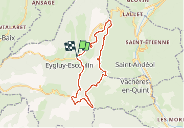
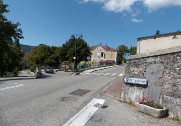
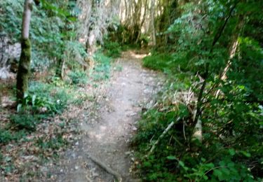
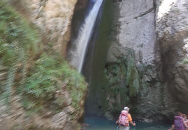
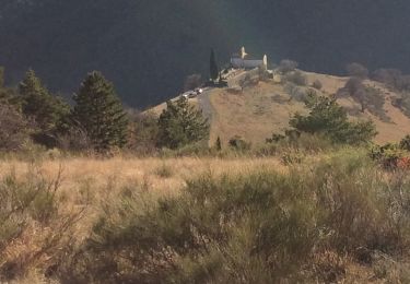
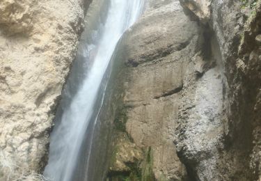
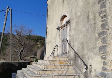
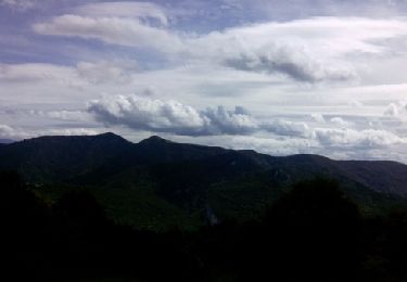
Ruta Senderismo de 15,7 km a descubrir en Auvergne-Rhône-Alpes, Drôme, Eygluy-Escoulin. Esta ruta ha sido propuesta por ajd26.
Descripción
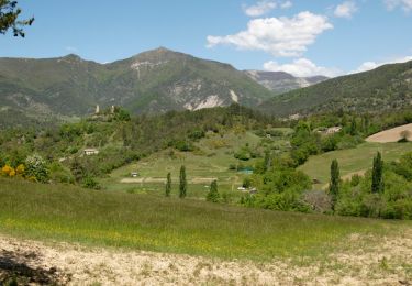
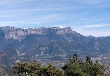
Escoulin, col de La Croix, ermite, Taillefer, col des Blaches. Beaux panoramas sur les crêtes
Localización
País:
France
Región :
Auvergne-Rhône-Alpes
Departamento/provincia :
Drôme
Municipio :
Eygluy-Escoulin
Localidad:
Unknown
Salida:(Dec)
Salida:(UTM)
675648 ; 4963499 (31T) N.
Comentarios
Excursiones cerca
![Excursión Senderismo Eygluy-Escoulin - Le Taillefer - Escoulin-18969835 - Photo](https://media.geolcdn.com/t/375/260/ext.jpg?maxdim=2&url=https%3A%2F%2Fmedia.geolcdn.com%2Ff%2Fa320a5a5-0487-4886-a0f3-90a4c7c70715.jpg)
![Senderismo Senderismo](https://static1.geolcdn.com/sitytour/trail-icons/101.png)
Le Taillefer - Escoulin-18969835
Senderismo
Medio
Eygluy-Escoulin,
Auvergne-Rhône-Alpes,
Drôme,
France
![](/images/other/stat-length.png)
8,4 km | 14,1 km-effort
4h 0min
![](https://static1.geolcdn.com/siteimages/upload/files/16400158638029165_repeat_loop_refresh_sync_direction_icon.png)
Sí
![Excursión Senderismo Sainte-Croix - 26 Sainte Croix Crêtes de Ramiat - Photo](https://media.geolcdn.com/t/375/260/ext.jpg?maxdim=2&url=https%3A%2F%2Fmedia.geolcdn.com%2Ff%2F203a62f6-fb85-4425-89b0-bab28fcb9e6a.jpg)
![Senderismo Senderismo](https://static1.geolcdn.com/sitytour/trail-icons/101.png)
26 Sainte Croix Crêtes de Ramiat
Senderismo
Muy difícil
Sainte-Croix,
Auvergne-Rhône-Alpes,
Drôme,
France
![](/images/other/stat-length.png)
17,5 km | 30 km-effort
6h 42min
![](https://static1.geolcdn.com/siteimages/upload/files/16400158638029165_repeat_loop_refresh_sync_direction_icon.png)
Sí
![Excursión Senderismo Plan-de-Baix - Canyon des Gueulards - Plateau du Vellan - Photo](https://media.geolcdn.com/t/375/260/ext.jpg?maxdim=2&url=https%3A%2F%2Fmedia.geolcdn.com%2Ff%2Fdf942d02-3843-4e15-b86a-2050f17fdf62.jpg)
![Senderismo Senderismo](https://static1.geolcdn.com/sitytour/trail-icons/101.png)
Canyon des Gueulards - Plateau du Vellan
Senderismo
Medio
Plan-de-Baix,
Auvergne-Rhône-Alpes,
Drôme,
France
![](/images/other/stat-length.png)
18,7 km | 28 km-effort
4h 55min
![](https://static1.geolcdn.com/siteimages/upload/files/16400158638029165_repeat_loop_refresh_sync_direction_icon.png)
Sí
![Excursión Senderismo Plan-de-Baix - Le Canyon des Gueulards - Photo](https://media.geolcdn.com/t/375/260/ext.jpg?maxdim=2&url=https%3A%2F%2Fmedia.geolcdn.com%2Ff%2F138e2d3e-d109-4451-9e9f-dc740c8ceb56.jpg)
![Senderismo Senderismo](https://static1.geolcdn.com/sitytour/trail-icons/101.png)
Le Canyon des Gueulards
Senderismo
Difícil
Plan-de-Baix,
Auvergne-Rhône-Alpes,
Drôme,
France
![](/images/other/stat-length.png)
14,2 km | 22 km-effort
4h 27min
![](https://static1.geolcdn.com/siteimages/upload/files/16400158638029165_repeat_loop_refresh_sync_direction_icon.png)
Sí
![Excursión Senderismo Omblèze - les 3 perles de la servante. - Photo](https://media.geolcdn.com/t/375/260/ext.jpg?maxdim=2&url=https%3A%2F%2Fmedia.geolcdn.com%2Ff%2Fbcc0043b-769e-4b07-b4bc-d90d7b748ee1.jpg)
![Senderismo Senderismo](https://static1.geolcdn.com/sitytour/trail-icons/101.png)
les 3 perles de la servante.
Senderismo
Medio
Omblèze,
Auvergne-Rhône-Alpes,
Drôme,
France
![](/images/other/stat-length.png)
23 km | 35 km-effort
8h 35min
![](https://static1.geolcdn.com/siteimages/upload/files/16400158638029165_repeat_loop_refresh_sync_direction_icon.png)
Sí
![Excursión Senderismo Eygluy-Escoulin - Bec pointu - Photo](https://media.geolcdn.com/t/375/260/ext.jpg?maxdim=2&url=https%3A%2F%2Fmedia.geolcdn.com%2Ff%2Fa6a2760a-d00d-427d-9568-fba16e0745a6.jpg)
![Senderismo Senderismo](https://static1.geolcdn.com/sitytour/trail-icons/101.png)
Bec pointu
Senderismo
Difícil
Eygluy-Escoulin,
Auvergne-Rhône-Alpes,
Drôme,
France
![](/images/other/stat-length.png)
11,2 km | 23 km-effort
3h 39min
![](https://static1.geolcdn.com/siteimages/upload/files/16400158638029165_repeat_loop_refresh_sync_direction_icon.png)
Sí
![Excursión Senderismo Omblèze - 03 mai 2019 gorge d'ombreze - Photo](https://media.geolcdn.com/t/375/260/ext.jpg?maxdim=2&url=https%3A%2F%2Fmedia.geolcdn.com%2Ff%2Fe4af078b-538d-466e-8a02-738bdf5d3d3d.jpg)
![Senderismo Senderismo](https://static1.geolcdn.com/sitytour/trail-icons/101.png)
03 mai 2019 gorge d'ombreze
Senderismo
Medio
Omblèze,
Auvergne-Rhône-Alpes,
Drôme,
France
![](/images/other/stat-length.png)
17,5 km | 28 km-effort
6h 35min
![](https://static1.geolcdn.com/siteimages/upload/files/16400158638029165_repeat_loop_refresh_sync_direction_icon.png)
No
![Excursión Senderismo Eygluy-Escoulin - 26 escoulin berches ayes - Photo](https://media.geolcdn.com/t/375/260/ext.jpg?maxdim=2&url=https%3A%2F%2Fmedia.geolcdn.com%2Ff%2F5381e54b-64ec-4f45-8508-60345424d51d.jpg)
![Senderismo Senderismo](https://static1.geolcdn.com/sitytour/trail-icons/101.png)
26 escoulin berches ayes
Senderismo
Medio
Eygluy-Escoulin,
Auvergne-Rhône-Alpes,
Drôme,
France
![](/images/other/stat-length.png)
11,6 km | 25 km-effort
7h 6min
![](https://static1.geolcdn.com/siteimages/upload/files/16400158638029165_repeat_loop_refresh_sync_direction_icon.png)
Sí
![Excursión Senderismo Omblèze - F26 Ombleze Chafffal - Photo](https://media.geolcdn.com/t/375/260/ext.jpg?maxdim=2&url=https%3A%2F%2Fservices.sitytrail.com%2FGeolivesWS%2FDownloadMedia.ashx%3FTrailID%3D354207%26Media%3Dfix__20141014132217.jpg)
![Senderismo Senderismo](https://static1.geolcdn.com/sitytour/trail-icons/101.png)
F26 Ombleze Chafffal
Senderismo
Fácil
Omblèze,
Auvergne-Rhône-Alpes,
Drôme,
France
![](/images/other/stat-length.png)
9,9 km | 16,9 km-effort
4h 14min
![](https://static1.geolcdn.com/siteimages/upload/files/16400158638029165_repeat_loop_refresh_sync_direction_icon.png)
No