


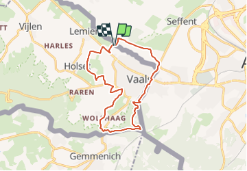

12,9 km | 16,3 km-effort

Usuario GUIDE


Aplicación GPS de excursión GRATIS
 SityTrail
IGN / Institutos geográficos
SityTrail World
El mundo es suyo
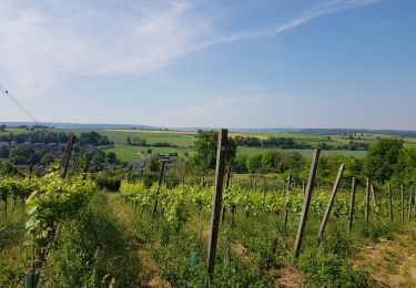
Ruta Senderismo de 13,1 km a descubrir en Limburgo, Desconocido, Vaals. Esta ruta ha sido propuesta por mumu.larandonneuse.
Belle randonnée transfrontalière passant par les 3 pays 🇧🇪🇳🇱🇩🇪.
Gpx pris de www.wandelgidszuidlimburg.com n° 1431.
📌 Camping Hoeve de Gastmolen,
Lemierserberg 23 à Vaals ou aux Ttois Bornes à Gemmenich.


Senderismo
Senderismo

Senderismo

Senderismo
Senderismo
Senderismo

Senderismo

Senderismo

Senderismo