![](/images/other/stat-length.png)
![Excursión Senderismo Froidchapelle - Balade au Lac de la Plate Taille - Photo](https://media.geolcdn.com/t/1900/400/ext.pjpeg?maxdim=2&url=https%3A%2F%2Fmedia.geolcdn.com%2Ff%2F427a13d1-6de9-495e-8227-ecb1c99818d2.jpeg)
Balade au Lac de la Plate Taille
Desrumaux
Usuario GUIDE
![Longitud](/images/other/stat-length.png)
Longitud
8,4 km
![Altitud máxima](https://static1.geolcdn.com/siteimages/upload/files/1508320355ic_sort_altitude_max_24dp.png)
Altitud máxima
277 m
![Desnivel positivo](https://static1.geolcdn.com/siteimages/upload/files/1508320355ic_sort_den_pos_24dp.png)
Desnivel positivo
101 m
![Km-Effort](/images/other/stat-length.png)
Km-Effort
9,8 km
![Altitud mínima](https://static1.geolcdn.com/siteimages/upload/files/1508320355ic_sort_altitude_min_24dp.png)
Altitud mínima
239 m
![Desnivel negativo](https://static1.geolcdn.com/siteimages/upload/files/1508320355ic_sort_den_neg_24dp.png)
Desnivel negativo
101 m
![Boucle](https://static1.geolcdn.com/siteimages/upload/files/16400158638029165_repeat_loop_refresh_sync_direction_icon.png)
Boucle
Sí
Fecha de creación :
2022-03-16 10:05:37.939
Última modificación :
2022-04-06 07:15:57.259
![Senderismo](https://static1.geolcdn.com/sitytour/trail-icons/101.png)
2h57
Dificultad : Medio
![Escanee este código QR para abrir la excursión en la aplicación SityTrail](https://capi.geolives.com/qq0zvz2zws4bq2lad0pu/sitytour/trails/3169003/qr.png?size=200)
Aplicación GPS de excursión GRATIS
A propósito
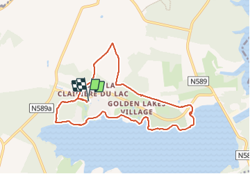
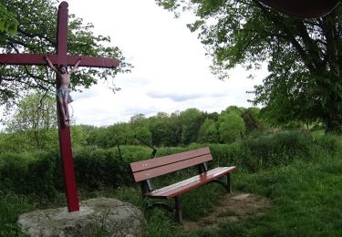
Ruta Senderismo de 8,4 km a descubrir en Valonia, Henao, Froidchapelle. Esta ruta ha sido propuesta por Desrumaux.
Descripción
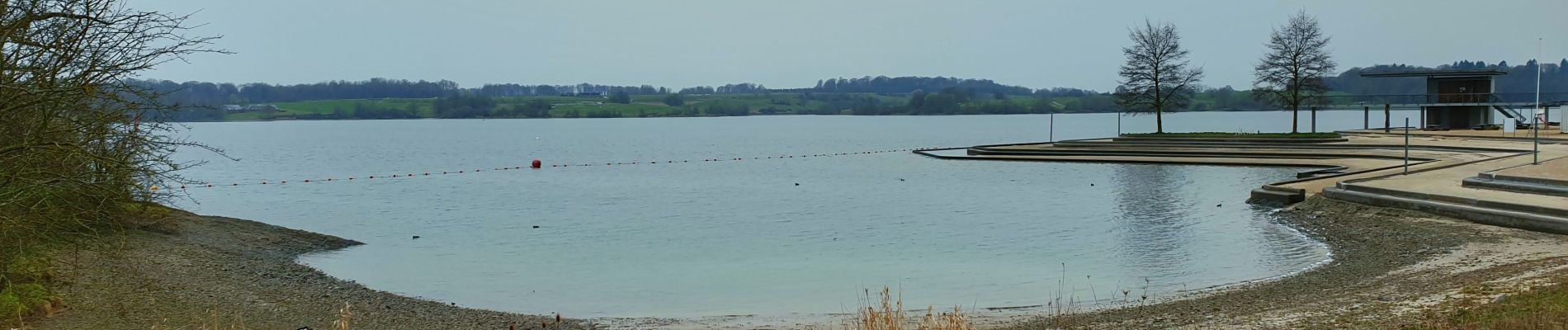
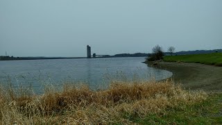
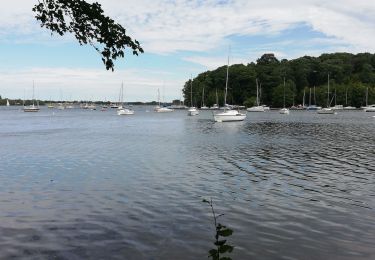
De la forêt aux rives de la Plate Taille
en passant par les campagnes.
Une promenade idéale pour quelques moments de
calme et de nature.
Départ: parking de l'Aquacentre, rue du Bois du Four, 6440 Froidchapelle
Localización
País:
Belgium
Región :
Valonia
Departamento/provincia :
Henao
Municipio :
Froidchapelle
Localidad:
Unknown
Salida:(Dec)
Salida:(UTM)
596428 ; 5560814 (31U) N.
Comentarios
Excursiones cerca
![Excursión Senderismo Cerfontaine - La balade du Ballonnet - Photo](https://media.geolcdn.com/t/375/260/ext.jpg?maxdim=2&url=https%3A%2F%2Fservices.sitytrail.com%2FGeolivesWS%2FDownloadMedia.ashx%3FTrailID%3D661211%26Media%3Df8ef018a-8a4e-43e9-8982-4175f97a626c.jpg)
![Senderismo Senderismo](https://static1.geolcdn.com/sitytour/trail-icons/101.png)
La balade du Ballonnet
Senderismo
Muy fácil
(6)
Cerfontaine,
Valonia,
Namur,
Belgium
![](/images/other/stat-length.png)
4,2 km | 5,2 km-effort
1h 12min
![](https://static1.geolcdn.com/siteimages/upload/files/16400158638029165_repeat_loop_refresh_sync_direction_icon.png)
Sí
![Excursión Senderismo Froidchapelle - Du Lac de l'Eau d'Heure au Lac du Ry Jaune - Photo](https://media.geolcdn.com/t/375/260/ext.jpg?maxdim=2&url=https%3A%2F%2Fservices.sitytrail.com%2FGeolivesWS%2FDownloadMedia.ashx%3FTrailID%3D379812%26Media%3Dd36c7a2e-70fd-44ad-a77a-7190af56fd8b.JPG)
![Senderismo Senderismo](https://static1.geolcdn.com/sitytour/trail-icons/101.png)
Du Lac de l'Eau d'Heure au Lac du Ry Jaune
Senderismo
Muy fácil
(3)
Froidchapelle,
Valonia,
Henao,
Belgium
![](/images/other/stat-length.png)
7,5 km | 9,4 km-effort
2h 6min
![](https://static1.geolcdn.com/siteimages/upload/files/16400158638029165_repeat_loop_refresh_sync_direction_icon.png)
Sí
![Excursión Senderismo Froidchapelle - Marche ADEPS à Boussu-lez-Walcourt - Photo](https://media.geolcdn.com/t/375/260/ext.jpg?maxdim=2&url=https%3A%2F%2Fservices.sitytrail.com%2FGeolivesWS%2FDownloadMedia.ashx%3FTrailID%3D251033%26Media%3D06de1a7a-a6bd-4c9d-b2ff-1e6fcd4fa4cd.JPG)
![Senderismo Senderismo](https://static1.geolcdn.com/sitytour/trail-icons/101.png)
Marche ADEPS à Boussu-lez-Walcourt
Senderismo
Fácil
(1)
Froidchapelle,
Valonia,
Henao,
Belgium
![](/images/other/stat-length.png)
10,4 km | 12,8 km-effort
2h 47min
![](https://static1.geolcdn.com/siteimages/upload/files/16400158638029165_repeat_loop_refresh_sync_direction_icon.png)
Sí
![Excursión Senderismo Cerfontaine - cerfontaine - Photo](https://media.geolcdn.com/t/375/260/ext.jpg?maxdim=2&url=https%3A%2F%2Fmedia.geolcdn.com%2Ff%2F0818d68f-0878-4b89-a84e-8d165ea60a59.jpg)
![Senderismo Senderismo](https://static1.geolcdn.com/sitytour/trail-icons/101.png)
cerfontaine
Senderismo
Muy fácil
(1)
Cerfontaine,
Valonia,
Namur,
Belgium
![](/images/other/stat-length.png)
6,5 km | 7,9 km-effort
1h 42min
![](https://static1.geolcdn.com/siteimages/upload/files/16400158638029165_repeat_loop_refresh_sync_direction_icon.png)
Sí
![Excursión Senderismo Beaumont - Balade à Barbençon - Photo](https://media.geolcdn.com/t/375/260/ext.jpg?maxdim=2&url=https%3A%2F%2Fservices.sitytrail.com%2FGeolivesWS%2FDownloadMedia.ashx%3FTrailID%3D574193%26Media%3Daac4060b-4d77-4046-9b2c-7fb6427c1e9c.jpg)
![Senderismo Senderismo](https://static1.geolcdn.com/sitytour/trail-icons/101.png)
Balade à Barbençon
Senderismo
Muy fácil
(3)
Beaumont,
Valonia,
Henao,
Belgium
![](/images/other/stat-length.png)
8 km | 9,6 km-effort
2h 4min
![](https://static1.geolcdn.com/siteimages/upload/files/16400158638029165_repeat_loop_refresh_sync_direction_icon.png)
Sí
![Excursión Senderismo Cerfontaine - Balade au village de la source de l'eau d'Heure Cerfontaine - Photo](https://media.geolcdn.com/t/375/260/ext.jpg?maxdim=2&url=https%3A%2F%2Fservices.sitytrail.com%2FGeolivesWS%2FDownloadMedia.ashx%3FTrailID%3D479710%26Media%3D2fce6745-f1ff-4853-9950-93fb7818c454.JPG)
![Senderismo Senderismo](https://static1.geolcdn.com/sitytour/trail-icons/101.png)
Balade au village de la source de l'eau d'Heure Cerfontaine
Senderismo
Fácil
(3)
Cerfontaine,
Valonia,
Namur,
Belgium
![](/images/other/stat-length.png)
11,6 km | 14,7 km-effort
3h 11min
![](https://static1.geolcdn.com/siteimages/upload/files/16400158638029165_repeat_loop_refresh_sync_direction_icon.png)
Sí
![Excursión Senderismo Froidchapelle - Le Tour du lac de la Plate Taille - Photo](https://media.geolcdn.com/t/375/260/ext.jpg?maxdim=2&url=https%3A%2F%2Fstatic1.geolcdn.com%2Fsiteimages%2Fupload%2Ffiles%2F1553511878bg_sport_marche.png)
![Senderismo Senderismo](https://static1.geolcdn.com/sitytour/trail-icons/101.png)
Le Tour du lac de la Plate Taille
Senderismo
Fácil
(3)
Froidchapelle,
Valonia,
Henao,
Belgium
![](/images/other/stat-length.png)
15,8 km | 18 km-effort
4h 0min
![](https://static1.geolcdn.com/siteimages/upload/files/16400158638029165_repeat_loop_refresh_sync_direction_icon.png)
Sí
![Excursión Senderismo Froidchapelle - Froidchapelle - Entre Champs et Forets - Photo](https://media.geolcdn.com/t/375/260/ext.jpg?maxdim=2&url=https%3A%2F%2Fstatic1.geolcdn.com%2Fsiteimages%2Fupload%2Ffiles%2F1553511878bg_sport_marche.png)
![Senderismo Senderismo](https://static1.geolcdn.com/sitytour/trail-icons/101.png)
Froidchapelle - Entre Champs et Forets
Senderismo
Fácil
(1)
Froidchapelle,
Valonia,
Henao,
Belgium
![](/images/other/stat-length.png)
14,3 km | 17,1 km-effort
3h 20min
![](https://static1.geolcdn.com/siteimages/upload/files/16400158638029165_repeat_loop_refresh_sync_direction_icon.png)
Sí
![Excursión Senderismo Froidchapelle - Du lac de l'Eau d'Heure vers la Plate Taille - Photo](https://media.geolcdn.com/t/375/260/ext.jpg?maxdim=2&url=https%3A%2F%2Fstatic1.geolcdn.com%2Fsiteimages%2Fupload%2Ffiles%2F1553511878bg_sport_marche.png)
![Senderismo Senderismo](https://static1.geolcdn.com/sitytour/trail-icons/101.png)
Du lac de l'Eau d'Heure vers la Plate Taille
Senderismo
Fácil
(4)
Froidchapelle,
Valonia,
Henao,
Belgium
![](/images/other/stat-length.png)
13,7 km | 16,2 km-effort
3h 20min
![](https://static1.geolcdn.com/siteimages/upload/files/16400158638029165_repeat_loop_refresh_sync_direction_icon.png)
Sí