![](/images/other/stat-length.png)
![Excursión Otra actividad Saint-Christophe-en-Oisans - Rateau - Photo](https://media.geolcdn.com/t/1900/400/ext.pjpeg?maxdim=2&url=https%3A%2F%2Fstatic1.geolcdn.com%2Fsiteimages%2Fupload%2Ffiles%2F1545311037marcheuse_200dpi.jpg)
Rateau
GAPIAN43
Usuario
![Longitud](/images/other/stat-length.png)
Longitud
16,9 km
![Altitud máxima](https://static1.geolcdn.com/siteimages/upload/files/1508320355ic_sort_altitude_max_24dp.png)
Altitud máxima
3804 m
![Desnivel positivo](https://static1.geolcdn.com/siteimages/upload/files/1508320355ic_sort_den_pos_24dp.png)
Desnivel positivo
1187 m
![Km-Effort](/images/other/stat-length.png)
Km-Effort
36 km
![Altitud mínima](https://static1.geolcdn.com/siteimages/upload/files/1508320355ic_sort_altitude_min_24dp.png)
Altitud mínima
1640 m
![Desnivel negativo](https://static1.geolcdn.com/siteimages/upload/files/1508320355ic_sort_den_neg_24dp.png)
Desnivel negativo
2205 m
![Boucle](https://static1.geolcdn.com/siteimages/upload/files/16400158638029165_repeat_loop_refresh_sync_direction_icon.png)
Boucle
No
Fecha de creación :
2015-07-10 00:00:00.0
Última modificación :
2015-07-10 00:00:00.0
![Otra actividad](https://static1.geolcdn.com/sitytour/trail-icons/900.png)
6h16
Dificultad : Difícil
![Escanee este código QR para abrir la excursión en la aplicación SityTrail](https://capi.geolives.com/qq0zvz2zws4bq2lad0pu/sitytour/trails/326315/qr.png?size=200)
Aplicación GPS de excursión GRATIS
A propósito
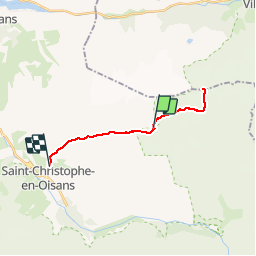
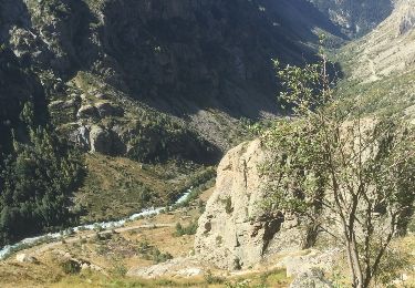
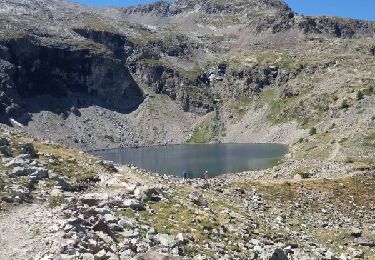
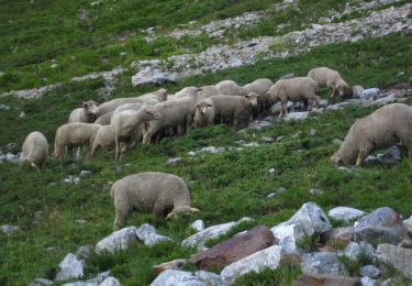
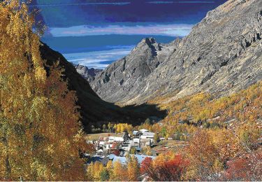
Ruta Otra actividad de 16,9 km a descubrir en Auvergne-Rhône-Alpes, Isère, Saint-Christophe-en-Oisans. Esta ruta ha sido propuesta por GAPIAN43.
Descripción
Rateau Sommet Est par l'arête sud de refuge de la Selle et retour St Christophe
Localización
País:
France
Región :
Auvergne-Rhône-Alpes
Departamento/provincia :
Isère
Municipio :
Saint-Christophe-en-Oisans
Localidad:
Unknown
Salida:(Dec)
Salida:(UTM)
283125 ; 4984659 (32T) N.
Comentarios
Excursiones cerca
![Excursión Senderismo La Grave - 2020-09-06 Marche La Grave Gare de Peyrou d'Amont au Col des Ruillans - Photo](https://media.geolcdn.com/t/375/260/ext.jpg?maxdim=2&url=https%3A%2F%2Fmedia.geolcdn.com%2Ff%2Fa3c985ae-cb99-452b-95ca-e622fb85b5fb.jpg)
![Senderismo Senderismo](https://static1.geolcdn.com/sitytour/trail-icons/101.png)
2020-09-06 Marche La Grave Gare de Peyrou d'Amont au Col des Ruillans
Senderismo
Medio
La Grave,
Provenza-Alpes-Costa Azul,
Altos Alpes,
France
![](/images/other/stat-length.png)
6,2 km | 15,7 km-effort
3h 30min
![](https://static1.geolcdn.com/siteimages/upload/files/16400158638029165_repeat_loop_refresh_sync_direction_icon.png)
No
![Excursión Senderismo La Grave - dome de la Lauze - Photo](https://media.geolcdn.com/t/375/260/ext.jpg?maxdim=2&url=https%3A%2F%2Fmedia.geolcdn.com%2Ff%2F1f0b24c0-9ce4-486e-ae01-9bc2cf1b59bc.jpg)
![Senderismo Senderismo](https://static1.geolcdn.com/sitytour/trail-icons/101.png)
dome de la Lauze
Senderismo
Fácil
La Grave,
Provenza-Alpes-Costa Azul,
Altos Alpes,
France
![](/images/other/stat-length.png)
4,8 km | 9,4 km-effort
4h 5min
![](https://static1.geolcdn.com/siteimages/upload/files/16400158638029165_repeat_loop_refresh_sync_direction_icon.png)
No
![Excursión Senderismo La Grave - Lac du Puy Vachier - Photo](https://media.geolcdn.com/t/375/260/ext.jpg?maxdim=2&url=https%3A%2F%2Fmedia.geolcdn.com%2Ff%2Faf3f4cf8-7b26-46c7-af5c-e7c98b8b602e.jpg)
![Senderismo Senderismo](https://static1.geolcdn.com/sitytour/trail-icons/101.png)
Lac du Puy Vachier
Senderismo
Difícil
La Grave,
Provenza-Alpes-Costa Azul,
Altos Alpes,
France
![](/images/other/stat-length.png)
8 km | 12,5 km-effort
2h 38min
![](https://static1.geolcdn.com/siteimages/upload/files/16400158638029165_repeat_loop_refresh_sync_direction_icon.png)
No
![Excursión Senderismo Saint-Christophe-en-Oisans - MONTÉE vers LE REFUGE DU SOREILLER-08-09-2016 - Photo](https://media.geolcdn.com/t/375/260/ext.jpg?maxdim=2&url=https%3A%2F%2Fservices.sitytrail.com%2FGeolivesWS%2FDownloadMedia.ashx%3FTrailID%3D630353%26Media%3D20160908120749.jpg)
![Senderismo Senderismo](https://static1.geolcdn.com/sitytour/trail-icons/101.png)
MONTÉE vers LE REFUGE DU SOREILLER-08-09-2016
Senderismo
Medio
Saint-Christophe-en-Oisans,
Auvergne-Rhône-Alpes,
Isère,
France
![](/images/other/stat-length.png)
5,6 km | 16,9 km-effort
4h 5min
![](https://static1.geolcdn.com/siteimages/upload/files/16400158638029165_repeat_loop_refresh_sync_direction_icon.png)
No
![Excursión Senderismo Saint-Christophe-en-Oisans - RETOUR du REFUGE DU SOREILLER-09-09-2016 - Photo](https://media.geolcdn.com/t/375/260/ext.jpg?maxdim=2&url=https%3A%2F%2Fservices.sitytrail.com%2FGeolivesWS%2FDownloadMedia.ashx%3FTrailID%3D630349%26Media%3D20160909111903.jpg)
![Senderismo Senderismo](https://static1.geolcdn.com/sitytour/trail-icons/101.png)
RETOUR du REFUGE DU SOREILLER-09-09-2016
Senderismo
Medio
Saint-Christophe-en-Oisans,
Auvergne-Rhône-Alpes,
Isère,
France
![](/images/other/stat-length.png)
5,6 km | 9,6 km-effort
3h 2min
![](https://static1.geolcdn.com/siteimages/upload/files/16400158638029165_repeat_loop_refresh_sync_direction_icon.png)
No
![Excursión Senderismo La Grave - Lac de Puy Vachier - Photo](https://media.geolcdn.com/t/375/260/ext.jpg?maxdim=2&url=https%3A%2F%2Fservices.sitytrail.com%2FGeolivesWS%2FDownloadMedia.ashx%3FTrailID%3D453673%26Media%3Dfix__20150803134309.jpg)
![Senderismo Senderismo](https://static1.geolcdn.com/sitytour/trail-icons/101.png)
Lac de Puy Vachier
Senderismo
Fácil
La Grave,
Provenza-Alpes-Costa Azul,
Altos Alpes,
France
![](/images/other/stat-length.png)
4,3 km | 7,8 km-effort
1h 9min
![](https://static1.geolcdn.com/siteimages/upload/files/16400158638029165_repeat_loop_refresh_sync_direction_icon.png)
Sí
![Excursión Senderismo Saint-Christophe-en-Oisans - Massif du Soreiller - Photo](https://media.geolcdn.com/t/375/260/ext.jpg?maxdim=2&url=https%3A%2F%2Fservices.sitytrail.com%2FGeolivesWS%2FDownloadMedia.ashx%3FTrailID%3D104783%26Media%3D8242_5.jpg)
![Senderismo Senderismo](https://static1.geolcdn.com/sitytour/trail-icons/101.png)
Massif du Soreiller
Senderismo
Difícil
Saint-Christophe-en-Oisans,
Auvergne-Rhône-Alpes,
Isère,
France
![](/images/other/stat-length.png)
4,9 km | 16,2 km-effort
4h 30min
![](https://static1.geolcdn.com/siteimages/upload/files/16400158638029165_repeat_loop_refresh_sync_direction_icon.png)
No
![Excursión Esquí de fondo La Grave - Vallons de la Meije - Photo](https://media.geolcdn.com/t/375/260/ext.jpg?maxdim=2&url=https%3A%2F%2Fstatic1.geolcdn.com%2Fsiteimages%2Fupload%2Ffiles%2F1524743154ski_fond.jpg)
![Esquí de fondo Esquí de fondo](https://static1.geolcdn.com/sitytour/trail-icons/503.png)
Vallons de la Meije
Esquí de fondo
Difícil
La Grave,
Provenza-Alpes-Costa Azul,
Altos Alpes,
France
![](/images/other/stat-length.png)
7,3 km | 13,1 km-effort
49min
![](https://static1.geolcdn.com/siteimages/upload/files/16400158638029165_repeat_loop_refresh_sync_direction_icon.png)
No
![Excursión Senderismo Saint-Christophe-en-Oisans - Tour Gourmand de Saint Christophe en Oisans - Jour 4 - Photo](https://media.geolcdn.com/t/375/260/ext.jpg?maxdim=2&url=https%3A%2F%2Fservices.sitytrail.com%2FGeolivesWS%2FDownloadMedia.ashx%3FTrailID%3D109941%26Media%3D4998_1.jpg)
![Senderismo Senderismo](https://static1.geolcdn.com/sitytour/trail-icons/101.png)
Tour Gourmand de Saint Christophe en Oisans - Jour 4
Senderismo
Difícil
Saint-Christophe-en-Oisans,
Auvergne-Rhône-Alpes,
Isère,
France
![](/images/other/stat-length.png)
8,7 km | 22 km-effort
5h 0min
![](https://static1.geolcdn.com/siteimages/upload/files/16400158638029165_repeat_loop_refresh_sync_direction_icon.png)
No