Excursión Senderismo La Bastide-Puylaurent - Masméjean Col du Thor - Photo
© OpenStreetMap contributors
Longitud
Longitud
14,1 km
Altitud máxima
Altitud máxima
1298 m
Desnivel positivo
Desnivel positivo
472 m
Km-Effort
Km-Effort  
20 km
Altitud mínima
Altitud mínima
1018 m
Desnivel negativo
Desnivel negativo
473 m
Boucle
Boucle
Fecha de creación :
2023-08-05 16:58:35.434
Última modificación :
2023-08-05 17:13:03.533

(0 Opinión)

Senderismo
Senderismo
4h38
Dificultad : Muy difícil

Escanee este código QR para abrir la excursión en la aplicación SityTrail

Aplicación GPS de excursión GRATIS

Logo SityTrail SityTrail

IGN / Institutos geográficos

Descargar SityTrail en App Store Descargar SityTrail en Google Play

Logo SityTrail SityTrail World

El mundo es suyo

Descargar SityTrail en App Store Descargar SityTrail en Google Play Descargar SityTrail en Huawei AppGallery

A propósito

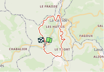
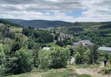
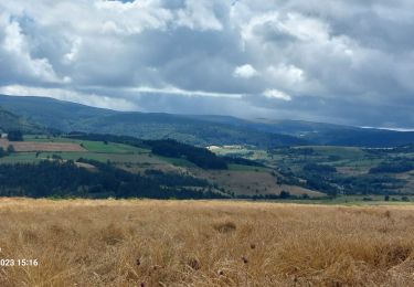
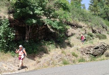
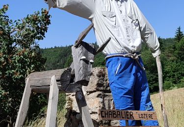
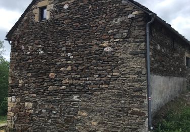
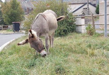
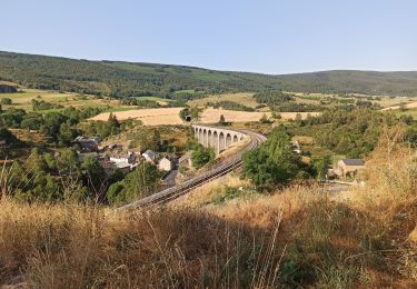
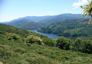
Ruta Senderismo de 14,1 km a descubrir en Occitania, Lozère, La Bastide-Puylaurent. Esta ruta ha sido propuesta por bernardchasson.

Perfil altimétrico

Localización

País:
France
Región :
Occitania
Departamento/provincia :
Lozère
Municipio :
La Bastide-Puylaurent
Localidad:
Unknown
Salida:(UTM)
570475 ; 4935301 (31T) N.

Excursiones cerca

Excursión Senderismo La Bastide-Puylaurent - la bastide saint Laurent _ Le Bleymard - Photo
Senderismo
MoulinPierrick

Senderismo

Difícil
(1)
La Bastide-Puylaurent, Occitania, Lozère, France
33 km | 46 km-effort
6h 59min
No
Excursión Senderismo Mont Lozère et Goulet - Stevenson étape 7 - Photo
Senderismo
GUIDE
nadinebondoux

Senderismo

Difícil
Mont Lozère et Goulet, Occitania, Lozère, France
20 km | 28 km-effort
4h 57min
No
Excursión Senderismo La Bastide-Puylaurent - Etape 5 Bastide Puy Laurent/ le Bleymard - Photo
Senderismo
Nathalie. Mercier

Senderismo

Difícil
La Bastide-Puylaurent, Occitania, Lozère, France
30 km | 42 km-effort
7h 18min
No
Excursión Senderismo Mont Lozère et Goulet - le Bleymard  - Photo
Senderismo
jeanjean35

Senderismo

Muy difícil
Mont Lozère et Goulet, Occitania, Lozère, France
17,3 km | 25 km-effort
5h 14min
No
Excursión Senderismo La Bastide-Puylaurent - Chasséradès  - Photo
Senderismo
jeanjean35

Senderismo

Difícil
(1)
La Bastide-Puylaurent, Occitania, Lozère, France
12 km | 16,8 km-effort
8h 54min
No
Excursión Senderismo Mont Lozère et Goulet - Chasserades Bleymard  - Photo
Senderismo
GUIDE
Roger Philippe Wallez

Senderismo

Difícil
Mont Lozère et Goulet, Occitania, Lozère, France
20 km | 28 km-effort
6h 57min
No
Excursión Senderismo Mont Lozère et Goulet - arsel chasserades au bleymard  - Photo
Senderismo
labarone

Senderismo

Muy fácil
Mont Lozère et Goulet, Occitania, Lozère, France
14,1 km | 21 km-effort
6h 14min
No
Excursión Bici de montaña Mont Lozère et Goulet - Chasserades Finiels 2020 - Photo
Bici de montaña
JeanPierreNancy

Bici de montaña

Difícil
Mont Lozère et Goulet, Occitania, Lozère, France
48 km | 67 km-effort
5h 36min
No
Excursión Senderismo La Bastide-Puylaurent - de la bastide puylaurent à villefort gr700 - Photo
Senderismo
BrassensJC

Senderismo

Muy difícil
La Bastide-Puylaurent, Occitania, Lozère, France
25 km | 33 km-effort
7h 20min
No


Cerrar
Mis suscripciones