


22 km | 29 km-effort
Trooz : découvrez les meilleures randonnées : 35 a pied, 246 marche, 11 marche nordique, 9 course à pied et 10 trail. Tous ces circuits, parcours, itinéraires et activités en plein air sont disponibles dans nos applications SityTrail pour smartphones et tablettes.
Marche


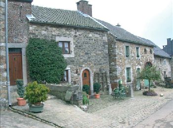
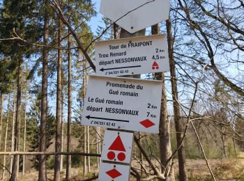
• (Nessonvaux, Fraipont, Banneux, Rondehaye, Raborive, Pepinster, Trasenster, Nessonvaux) « C’est la plus...
Marche
• CONTACT http://www.syndicat-initiative-trooz.com 📌 Rue Havegné , 4870 Fraipont DÉTAILS DE L'ITINÉRAIRE : Difficult...
Marche
• Belle randonnée assez difficile et panoramique dans la vallée de la Vesdre. ℹ Gpx pris sur www.wandelgidszuidlimbur...
Marche
Marche
• Rando bois de la casserole D 300

Marche
• Balade de /- 12 km au départ de la Ferme des Loups, descendant sur Saint-Hadelin par le Bois de Casserole . Directio...

Marche
• Niveau : facile à moyen Passant devant la pompe à eau, se dirigeant vers la Croix du Renard par Olno, pour descendre ...

Marche
• 5 km | +-1 heure 30 Niveau : facile Passant par le majestueux tilleul, descendant à travers bois vers le village de...
Marche
• (Nessonvaux, Fraipont, Banneux, Rondehaye, Raborive, Pepinster, Trasenster, Nessonvaux) « C’est la plus ravissante ...

Marche
Marche

Marche
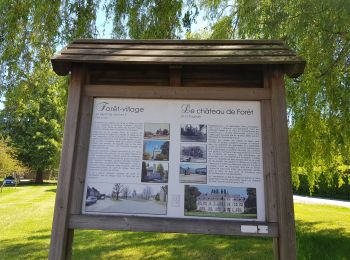
• Niveau : très facile Tours & detours dans le village de Forêt... Vous pourrez y découvrir la chapelle en rondins (égl...
Marche
• Dimanche 24 mars 2024 : Balade mensuelle des HUWAO. 14 indécrottables membres de HUWAO, 8♀ et 6♂, se sont lancés à l'...
Marche
• Le pery . au thier . sous l abbaye. beaucoup trop de routes et de constructions
Marche
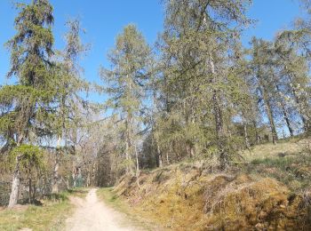
• Très joli parcours 99% nature, campagnard, champêtre et boisé. 📌 soit de la Ferme des Loups à Forêt, soit du 🅿️ du...

Marche
• Très variée
Marche
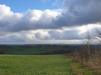
• Parcours de toute beauté au départ de Trooz vers Louveigné avec quelques belles côtes et donc ... de superbes vues. D...
Marche
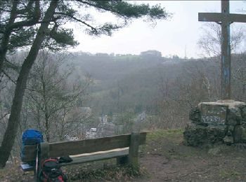
• D/A : parking de la gare à Nessonvaux Montée vers Banneux par le chemin de croix (chemin de pèlerinage) Pause : nomb...
Marche
• Olne Promenade n°5 Balisage Rectangle Jaune
Marche
• La Transcalestienne est un parcours de longue distance (290 km) qui parcourt la Calestienne sur toute sa longueur
20 randonnées affichées sur 302
Application GPS de randonnée GRATUITE
 SityTrail
IGN / Instituts géographiques
SityTrail World
Le monde est à vous