Saint-Côme-d'Olt, Aveyron : Les meilleures randonnées, itinéraires, parcours, balades et promenades

2 commentaires

Saint-Côme-d'Olt : découvrez les meilleures randonnées : 51 pédestres et 5 à vélo ou VTT. Tous ces circuits, parcours, itinéraires et activités en plein air sont disponibles dans nos applications SityTrail pour smartphones et tablettes.


Les meilleurs parcours (64)

Randonnée Marche Saint-Côme-d'Olt - étape st Jacques st come sur d olt-estaing - Photo
Marche 24.724
Km

Marche

Moyen
Saint-Côme-d'Olt, Occitanie, Aveyron, France
25 km | 32 km-effort
5h 54min
550 m
615 m
Non
fab0202

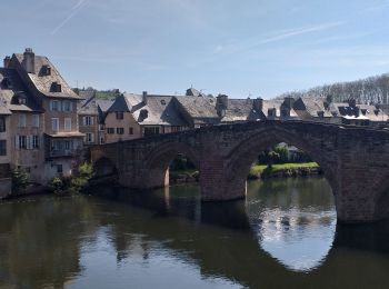
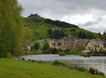
• belle rando entre st come et estaing avec de beaux panoramas, de belles églises et de beaux village espalion, verrièr...

Randonnée Marche Saint-Côme-d'Olt - saint Come d'Olt Estaing - Photo
Marche 14.46
Km

Marche

Moyen
Saint-Côme-d'Olt, Occitanie, Aveyron, France
14,5 km | 20 km-effort
5h 54min
422 m
447 m
Non
PhilDomDoxa

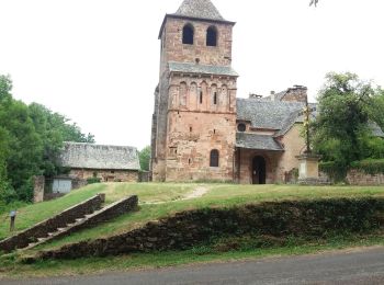
• St Jacques de Compostelle

Randonnée Marche Saint-Côme-d'Olt - saint Côme d'olt- Estaing - Photo
Marche 23.307
Km

Marche

Difficile
Saint-Côme-d'Olt, Occitanie, Aveyron, France
23 km | 31 km-effort
6h 17min
567 m
639 m
Non
guariso

• étape st Jacques gr65

Randonnée Marche Saint-Côme-d'Olt - Saint Côme d'Olt vers Estaing - Photo
Marche 20.432
Km

Marche

Moyen
Saint-Côme-d'Olt, Occitanie, Aveyron, France
20 km | 28 km-effort
7h 1min
537 m
591 m
Non
choubaka77

• Belle itinéraire avec deux montées bien raides mais pas trop longue !!! Plusieurs possibilités d'arrêt et ravitaillem...

Randonnée Marche Saint-Côme-d'Olt - Saint Côme - Espalion - Photo
Marche 7.108
Km

Marche

Moyen
Saint-Côme-d'Olt, Occitanie, Aveyron, France
7,1 km | 8,3 km-effort
2h 10min
77 m
112 m
Non
RR31

• Saint Jacques

Randonnée Autre activité Saint-Côme-d'Olt - ggggfff - Photo
Autre activité 38.956
Km

Autre activité

Très facile
Saint-Côme-d'Olt, Occitanie, Aveyron, France
39 km | 68 km-effort
6h 59min
2288 m
1966 m
Non
flopey94

Randonnée Vélo Saint-Côme-d'Olt - Sur les traces de la transhumance -  St Côme d'Olt  - Photo
Vélo 64.11
Km

Vélo

Difficile
Saint-Côme-d'Olt, Occitanie, Aveyron, France
64 km | 84 km-effort
4h 45min
1501 m
1499 m
Oui
tracegps

• Circuit proposé par le Comité Départemental de Tourisme de l'Aveyron. Départ de Saint-Côme-d’Olt, situé au bord du Lo...

Randonnée Marche Saint-Côme-d'Olt - live Saint Côme - Estaing - Photo
Marche 21.759
Km

Marche

Difficile
Saint-Côme-d'Olt, Occitanie, Aveyron, France
22 km | 29 km-effort
6h 37min
544 m
589 m
Non
djeepee74

Randonnée Marche Saint-Côme-d'Olt - Labastide canto messo - Photo
Marche 9.277
Km

Marche

Facile
Saint-Côme-d'Olt, Occitanie, Aveyron, France
9,3 km | 11,9 km-effort
2h 18min
199 m
198 m
Oui
limo12

Randonnée Marche Saint-Côme-d'Olt - St Côme d'Olt - Estaing - Chemin de St-Jacques de Compostelle - Photo
Marche 20.915
Km

Marche

Difficile
(2)
Saint-Côme-d'Olt, Occitanie, Aveyron, France
21 km | 29 km-effort
4h 0min
562 m
603 m
Non
tracegps

• Huitième étape sur notre Chemin de Compostelle qui nous mène de St Come d'Olt à Etaing. (Km 150,273 à Km 171.356) D’a...

Randonnée Marche Saint-Côme-d'Olt - trail d'aqui départ la Rozière  - Photo
Marche 13.659
Km

Marche

Difficile
Saint-Côme-d'Olt, Occitanie, Aveyron, France
13,7 km | 22 km-effort
4h 9min
640 m
645 m
Oui
chantal12

• boucle du trail de st côme d'olt au départ de la ROZIERE . Suivre balisage trail d'aqui. Prévoir bonnes chaussures d...

Randonnée Marche Saint-Côme-d'Olt - Saint-Come Les Vieilles Vignes - Photo
Marche 8.578
Km

Marche

Moyen
Saint-Côme-d'Olt, Occitanie, Aveyron, France
8,6 km | 11,4 km-effort
2h 31min
211 m
211 m
Oui
kayamb

Randonnée Marche Saint-Côme-d'Olt - Fin étape St Côme a Été spalion  - Photo
Marche 7.49
Km

Marche

Moyen
Saint-Côme-d'Olt, Occitanie, Aveyron, France
7,5 km | 8,7 km-effort
1h 38min
86 m
103 m
Non
Nono55

• Empalions magnifique

Randonnée Marche Saint-Côme-d'Olt - Le clamas de thubies - Photo
Marche 15.607
Km

Marche

Très difficile
Saint-Côme-d'Olt, Occitanie, Aveyron, France
15,6 km | 20 km-effort
4h 38min
363 m
365 m
Oui
laoj

• St come vers espalion retour vallee

Randonnée Marche Saint-Côme-d'Olt - Saint Come d'Olt / Estaing - Photo
Marche 22.607
Km

Marche

Moyen
Saint-Côme-d'Olt, Occitanie, Aveyron, France
23 km | 30 km-effort
7h 19min
520 m
575 m
Non
DENNEBECQ

Randonnée Marche Saint-Côme-d'Olt - Saint Côme Roquelaure - Photo
Marche 8.416
Km

Marche

Moyen
Saint-Côme-d'Olt, Occitanie, Aveyron, France
8,4 km | 13,6 km-effort
2h 26min
392 m
391 m
Oui
limo12

• Montée de Saint Côme vers Roqulaure par GR620

Randonnée Marche Saint-Côme-d'Olt - roquelaure - Photo
Marche 6.055
Km

Marche

Moyen
Saint-Côme-d'Olt, Occitanie, Aveyron, France
6,1 km | 9,7 km-effort
2h 6min
276 m
275 m
Oui
limo12

Randonnée Marche Saint-Côme-d'Olt - St Côme  - Photo
Marche 3.953
Km

Marche

Très facile
Saint-Côme-d'Olt, Occitanie, Aveyron, France
4 km | 4,5 km-effort
1h 39min
42 m
44 m
Oui
bauxtilou

• Moi

Randonnée V.T.C. Saint-Côme-d'Olt - combes - Photo
V.T.C. 13.101
Km

V.T.C.

Facile
Saint-Côme-d'Olt, Occitanie, Aveyron, France
13,1 km | 15,4 km-effort
1h 0min
173 m
173 m
Oui
limo12

Randonnée V.T.T. Saint-Côme-d'Olt - Compostelle Etape 3 Combe - conque - Photo
V.T.T. 49.176
Km

V.T.T.

Très difficile
Saint-Côme-d'Olt, Occitanie, Aveyron, France
49 km | 64 km-effort
4h 45min
1134 m
1187 m
Non
napoli

• Compostelle 2 en VTT etape2. Le Sauvage - Nasbinals 53.6km 995m D+

20 randonnées affichées sur 64

Application GPS de randonnée GRATUITE

Logo SityTrail SityTrail

IGN / Instituts géographiques

Télécharger SityTrail sur l'App Store Télécharger SityTrail sur Google Play

Logo SityTrail SityTrail World

Le monde est à vous

Télécharger SityTrail sur l'App Store Télécharger SityTrail sur Google Play Télécharger SityTrail sur Huawei AppGallery

Activités

Fermer
Mes abonnements