


24 km | 30 km-effort
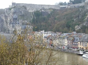
Dinant : découvrez les meilleures randonnées : 8 vélo, 1 vélo de route, 27 v.t.t., 2 v.t.c., 3 cyclotourisme et 3 vélo électrique. Tous ces circuits, parcours, itinéraires et activités en plein air sont disponibles dans nos applications SityTrail pour smartphones et tablettes.

V.T.T.


• Au fil de l'eau après un début de fort dénivelé. A éviter quand il fait boueux ou lors de la saison touristique si re...

Vélo
• Route faisant, à l'orée d'Anseremme, le doux murmure de la Lesse se répercute dans le bois. Alors que la Lesse n'est ...

Vélo
• Circuit vélo Dinant - Ile de Godinne En sortant de la ville des « Copères » (alias les Dinantais) par le RAVeL en riv...
V.T.T.
• Place Mercier->Ecluse-> Bethléem->Fond de Foqueux->Wespin->Bouvignes.
V.T.T.
•
V.T.T.
•
Vélo
• De Leffe, montée douce de +-10km puis séries de tiges et chavées typiques du Condroz jusqu'au Ravel à Ciney qui, par...
Cyclotourisme
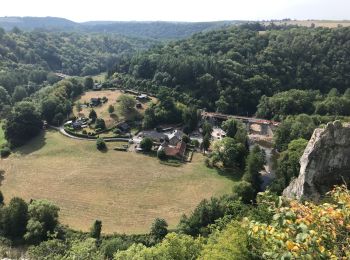
• Lisogne maredsous
Vélo électrique
V.T.T.
• Au départ de Dinant,vous effectuez une grande boucle sur le plateau de la rive droite de la Meuse en passant par la...
V.T.T.
• Le circuit démarre du pont ,longe le halage vers Anseremme puis s'engouffre sur la rive gauche de la Lesse. Vous mont...
V.T.T.
• départ devant l'église de Foy. Ce circuit est une grande boucle à travers les villages de Thynes ,Sorinnes ,Lisogne ...
V.T.T.
• Le circuit longe la Meuse. Au rocher Bayard,il y a une montée vers Dréhance par "Dinant évasion". Descente sur la Les...
V.T.T.
• Départ du rocher Bayard vers Dréhance par le sentier "Dinant Aventure"puis direction Foy, Taviet, Sorinnes. Retour pa...
V.T.C.
• Sur le Ravel de la Vallée de la Molignée. Wallonie à vélo : 20 balades incontournables Distribué par Wallonie Belgiqu...
V.T.C.
• Sur le Ravel de la Vallée de la Molignée. Wallonie à vélo : 20 balades incontournables Distribué par Wallonie Belgiqu...
V.T.T.
• 30 km si départ Dinant, 24 si départ Anseremme Dénivelé+ 550m
V.T.T.
• Dépard de Foy
V.T.T.
• départ place d'Anseremme
V.T.T.
• rando entre bois et campagnes
20 randonnées affichées sur 43
Application GPS de randonnée GRATUITE
 SityTrail
IGN / Instituts géographiques
SityTrail World
Le monde est à vous