Randonnée Marche Allogny - Forêt d'Allogny - Photo
 tracegps
tracegps

Utilisateur

© OpenStreetMap contributors
Longueur
Longueur
13,1 km
Altitude max
Altitude max
313 m
Dénivelé positif
Dénivelé positif
245 m
Km-Effort
Km-Effort  
16,4 km
Altitude min
Altitude min
191 m
Dénivelé négatif
Dénivelé négatif
247 m
Boucle
Boucle
Oui
Date de création :
2014-12-10 00:00:00.0
Dernière modification :
2014-12-10 00:00:00.0

(0 Avis)

Marche
Marche
2h30
Difficulté : Facile

Scannez ce code QR pour ouvrir la randonnée dans l'application SityTrail

Application GPS de randonnée GRATUITE

Logo SityTrail SityTrail

IGN / Instituts géographiques

Télécharger SityTrail sur l'App Store Télécharger SityTrail sur Google Play

Logo SityTrail SityTrail World

Le monde est à vous

Télécharger SityTrail sur l'App Store Télécharger SityTrail sur Google Play Télécharger SityTrail sur Huawei AppGallery

À propos

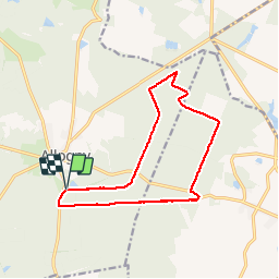
Randonnée Marche de 13,1 km à découvrir à Centre-Val de Loire, Cher, Allogny. Cette randonnée est proposée par tracegps.

Description

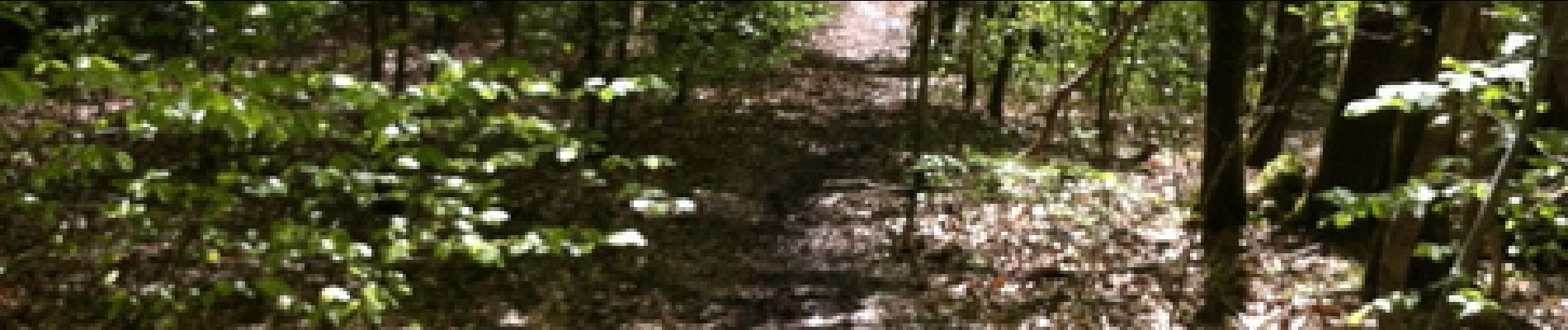
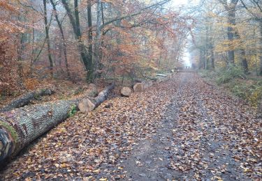
Départ de l'étang d'Allogny route de Bourges sur la D944. Randonnée dans la forêt, avec la possibilité de voir du gibier.

Profil altimétrique

Photos

Localisation

Pays :
France
Région :
Centre-Val de Loire
Département/Province :
Cher
Commune :
Allogny
Localité :
Unknown
Départ:(Dec)
Départ:(UTM)
448779 ; 5229630 (31T) N.

Randonnées à proximité

Randonnée Course à pied Allogny - allogny - Photo
Course à pied
levequejef

Course à pied

Facile
Allogny, Centre-Val de Loire, Cher, France
22 km | 27 km-effort
3h 11min
Oui
Randonnée A pied Saint-Éloy-de-Gy - Allogny sentes de Bléron - Photo
A pied
Jjlerat

A pied

Très facile
Saint-Éloy-de-Gy, Centre-Val de Loire, Cher, France
9,6 km | 11,7 km-effort
Inconnu
Oui
Randonnée V.T.T. Saint-Martin-d'Auxigny - ff - Photo
V.T.T.
jboutet

V.T.T.

Très facile
Saint-Martin-d'Auxigny, Centre-Val de Loire, Cher, France
18,6 km | 23 km-effort
43min
Non
Randonnée V.T.T. Saint-Éloy-de-Gy - badigeonner 32 - Photo
V.T.T.
jboutet

V.T.T.

Très facile
Saint-Éloy-de-Gy, Centre-Val de Loire, Cher, France
29 km | 36 km-effort
1h 21min
Non
Randonnée V.T.T. Saint-Éloy-de-Gy - barangeonne 32km - Photo
V.T.T.
jboutet

V.T.T.

Très facile
Saint-Éloy-de-Gy, Centre-Val de Loire, Cher, France
33 km | 40 km-effort
Inconnu
Oui
Randonnée Marche Saint-Éloy-de-Gy - orientation forêt Allogny 21 mai 23 - Photo
Marche
Orage

Marche

Très facile
Saint-Éloy-de-Gy, Centre-Val de Loire, Cher, France
4,1 km | 4,6 km-effort
2h 0min
Oui
Randonnée V.T.T. Allogny - ADEP  - Photo
V.T.T.
gp allogny

V.T.T.

Facile
Allogny, Centre-Val de Loire, Cher, France
10,2 km | 12,8 km-effort
48min
Oui
Randonnée V.T.T. Saint-Éloy-de-Gy - allogny  - Photo
V.T.T.
gregvtt95

V.T.T.

Difficile
Saint-Éloy-de-Gy, Centre-Val de Loire, Cher, France
31 km | 37 km-effort
2h 50min
Non
Randonnée V.T.T. Allogny - Test 2 - Photo
V.T.T.
gp allogny

V.T.T.

Allogny, Centre-Val de Loire, Cher, France
5,3 km | 6,1 km-effort
24min
Oui


Fermer
Mes abonnements