Randonnée Marche Lutter - LM - Photo
 dick68
dick68

Utilisateur

© OpenStreetMap contributors
Longueur
Longueur
10,7 km
Altitude max
Altitude max
678 m
Dénivelé positif
Dénivelé positif
278 m
Km-Effort
Km-Effort  
14,4 km
Altitude min
Altitude min
481 m
Dénivelé négatif
Dénivelé négatif
275 m
Boucle
Boucle
Oui
Date de création :
2014-12-10 00:00:00.0
Dernière modification :
2014-12-10 00:00:00.0

(0 Avis)

Marche
Marche
--
Difficulté : Facile

Scannez ce code QR pour ouvrir la randonnée dans l'application SityTrail

Application GPS de randonnée GRATUITE

Logo SityTrail SityTrail

IGN / Instituts géographiques

Télécharger SityTrail sur l'App Store Télécharger SityTrail sur Google Play

Logo SityTrail SityTrail World

Le monde est à vous

Télécharger SityTrail sur l'App Store Télécharger SityTrail sur Google Play Télécharger SityTrail sur Huawei AppGallery

À propos

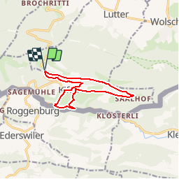
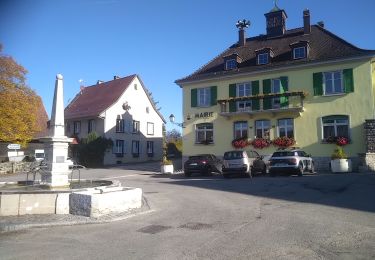
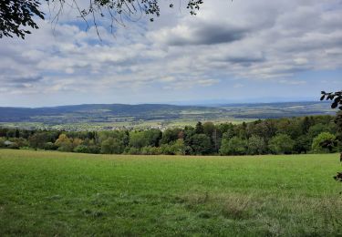
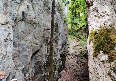
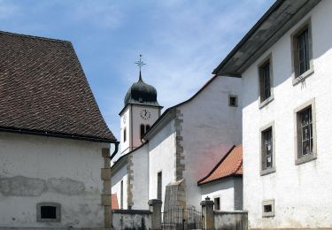
Randonnée Marche de 10,7 km à découvrir à Grand Est, Haut-Rhin, Lutter. Cette randonnée est proposée par dick68.

Description

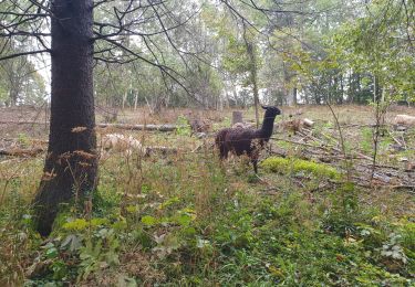
Schlosswald - Blauenberg - Saalhof - Krumgestell - Kiffis - Centre Equestre - Schlosswald

Profil altimétrique

Localisation

Pays :
France
Région :
Grand Est
Département/Province :
Haut-Rhin
Commune :
Lutter
Localité :
Unknown
Départ:(Dec)
Départ:(UTM)
375323 ; 5256199 (32T) N.

Randonnées à proximité

Randonnée Marche Wolschwiller - Rando 05/07/2024 - Photo
Marche
boubou68

Marche

Difficile
Wolschwiller, Grand Est, Haut-Rhin, France
11,7 km | 17,5 km-effort
3h 15min
Oui
Randonnée Marche Wolschwiller - Rando CLAS du 09/05/202..par PBo - Photo
Marche
boubou68

Marche

Très difficile
Wolschwiller, Grand Est, Haut-Rhin, France
20 km | 30 km-effort
4h 24min
Oui
Randonnée Marche Wolschwiller - Reco Rando CLAS du 09/05/2024 - Photo
Marche
boubou68

Marche

Très difficile
Wolschwiller, Grand Est, Haut-Rhin, France
18,9 km | 28 km-effort
3h 54min
Oui
Randonnée Marche Wolschwiller - Le sentier des douaniers - Wolschwiller - Photo
Marche
helmut68

Marche

Moyen
(1)
Wolschwiller, Grand Est, Haut-Rhin, France
12,2 km | 18,1 km-effort
3h 30min
Oui
Randonnée Marche Lutter - rdpr 20200929 lutter - Photo
Marche
GUIDE
stempfel52

Marche

Difficile
Lutter, Grand Est, Haut-Rhin, France
15,8 km | 23 km-effort
4h 52min
Oui
Randonnée Marche Wolschwiller - wolschwiller - Photo
Marche
jcguew

Marche

Facile
Wolschwiller, Grand Est, Haut-Rhin, France
7,3 km | 12,7 km-effort
4h 15min
Non
Randonnée Marche Oltingue - randonnée au départ d'Oltingue chapelle St Martin - Photo
Marche
sitykathy

Marche

Difficile
Oltingue, Grand Est, Haut-Rhin, France
13,4 km | 18,2 km-effort
3h 25min
Oui
Randonnée A pied Pleigne - Sentier panoramique - Photo
A pied
GUIDE+

A pied

Facile
Pleigne, Jura, District de Delémont, Suisse
5,7 km | 6,8 km-effort
1h 33min
Oui
Randonnée A pied Pleigne - Pleigne - Bourrignon - Photo
A pied
GUIDE+

A pied

Facile
Pleigne, Jura, District de Delémont, Suisse
4,9 km | 6,9 km-effort
1h 34min
Non


Fermer
Mes abonnements