


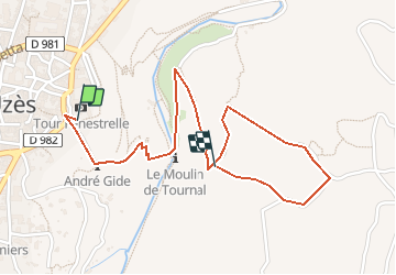


18 km | 23 km-effort


Utilisateur


Application GPS de randonnée GRATUITE
 SityTrail
IGN / Instituts géographiques
SityTrail World
Le monde est à vous
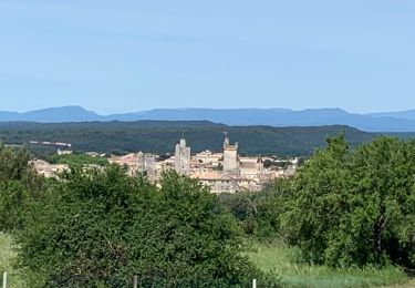
Randonnée Marche de 2,2 km à découvrir à Occitanie, Gard, Uzès. Cette randonnée est proposée par mpalatan.
Une balade depuis la cathédrale vers la montagne d'où vous aurez une vue exceptionnelle de la ville.

Course à pied
Marche

Marche

Vélo électrique
V.T.T.
Marche
Marche
V.T.T.