Randonnée Course à pied Nogent-le-Rotrou - foret Nogent le rotrou - Photo
 sash28
sash28

Utilisateur

© OpenStreetMap contributors
Longueur
Longueur
16,4 km
Altitude max
Altitude max
224 m
Dénivelé positif
Dénivelé positif
297 m
Km-Effort
Km-Effort  
20 km
Altitude min
Altitude min
105 m
Dénivelé négatif
Dénivelé négatif
300 m
Boucle
Boucle
Non
Date de création :
2014-12-10 00:00:00.0
Dernière modification :
2014-12-10 00:00:00.0

(0 Avis)

Course à pied
Course à pied
43m
Difficulté : Moyen

Scannez ce code QR pour ouvrir la randonnée dans l'application SityTrail

Application GPS de randonnée GRATUITE

Logo SityTrail SityTrail

IGN / Instituts géographiques

Télécharger SityTrail sur l'App Store Télécharger SityTrail sur Google Play

Logo SityTrail SityTrail World

Le monde est à vous

Télécharger SityTrail sur l'App Store Télécharger SityTrail sur Google Play Télécharger SityTrail sur Huawei AppGallery

À propos

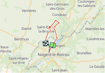
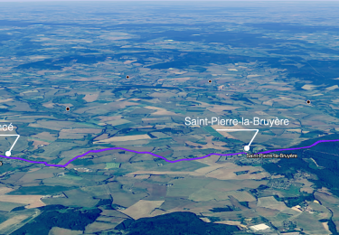
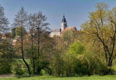
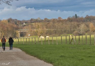
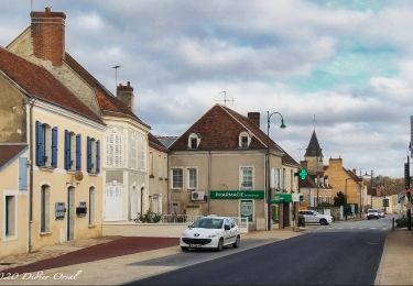
Randonnée Course à pied de 16,4 km à découvrir à Centre-Val de Loire, Eure-et-Loir, Nogent-le-Rotrou. Cette randonnée est proposée par sash28.

Description

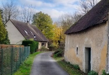
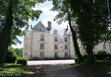
depart de la gare puis direction Condé. Entrée de la foret à gauche après la casse-auto(au niveau du PN. Amusez-vous bien!

Profil altimétrique

Photos

Points d'intérêt

Point d'intérêt Sablons sur Huisne - Point 1 - Photo
sash28
SABLONS SUR HUISNE 
Point d'intérêt Sablons sur Huisne - Point 3 - Photo
sash28
SABLONS SUR HUISNE 
Point d'intérêt Sablons sur Huisne - Point 4 - Photo
sash28
SABLONS SUR HUISNE 

Localisation

Pays :
France
Région :
Centre-Val de Loire
Département/Province :
Eure-et-Loir
Commune :
Nogent-le-Rotrou
Localité :
Unknown
Départ:(Dec)
Départ:(UTM)
337682 ; 5354829 (31U) N.

Randonnées à proximité

Randonnée Marche Trizay-Coutretot-Saint-Serge - 100 Kms Perche Boucle B - Photo
Marche
togolo28

Marche

Difficile
(2)
Trizay-Coutretot-Saint-Serge, Centre-Val de Loire, Eure-et-Loir, France
48 km | 56 km-effort
12h 1min
Oui
Randonnée Marche Nogent-le-Rotrou - NOGENT LE ROTROU - Photo
Marche
jeannine grandjean

Marche

Moyen
Nogent-le-Rotrou, Centre-Val de Loire, Eure-et-Loir, France
5,8 km | 6,9 km-effort
1h 33min
Oui
Randonnée Marche Nogent-le-Rotrou - Nogent-le-Rotrou - Saint-Victor-de-Buthon 19 km - Photo
Marche

Marche

Très difficile
Nogent-le-Rotrou, Centre-Val de Loire, Eure-et-Loir, France
19 km | 23 km-effort
5h 5min
Non
Randonnée Marche Berd'huis - Berd'huis - Condé-sur-Huisne 14 km - Photo
Marche
ODDAD78

Marche

Difficile
Berd'huis, Normandie, Orne, France
13,9 km | 16,7 km-effort
3h 37min
Non
Randonnée Marche Berd'huis - Berd'huis - Préaux-du-Perche 4,1 km - Photo
Marche

Marche

Très facile
Berd'huis, Normandie, Orne, France
4,1 km | 4,9 km-effort
1h 0min
Non
Randonnée Marche Nogent-le-Rotrou - Nogent-le-Rotrou - Thiron-Gardais via La Gaudaine 22 km - Photo
Marche

Marche

Très difficile
Nogent-le-Rotrou, Centre-Val de Loire, Eure-et-Loir, France
22 km | 26 km-effort
6h 0min
Non
Randonnée Marche Nogent-le-Rotrou - Nogent-le-Rotrou - Saint-Pierre-la-Bruyère 5,5 km - Photo
Marche

Marche

Facile
Nogent-le-Rotrou, Centre-Val de Loire, Eure-et-Loir, France
5,5 km | 6,9 km-effort
3h 42min
Non
Randonnée Marche Berd'huis - Bellême - Berd'huis 23 km - Photo
Marche

Marche

Difficile
Berd'huis, Normandie, Orne, France
23 km | 27 km-effort
5h 59min
Non
Randonnée Marche Saint-Pierre-la-Bruyère - Condé-sur-Huisne - Saint-Pierre-la-Bruyère  via Villeray 8,5 km - Photo
Marche

Marche

Facile
Saint-Pierre-la-Bruyère, Normandie, Orne, France
8,5 km | 10 km-effort
3h 23min
Non


Fermer
Mes abonnements