


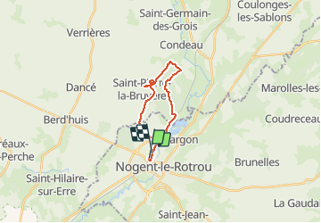


48 km | 56 km-effort

User


FREE GPS app for hiking
 SityTrail
IGN / Geographical institutes
SityTrail World
The world is yours!
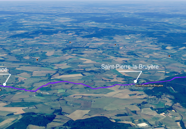
Trail Running of 16.4 km to be discovered at Centre-Loire Valley, Eure-et-Loir, Nogent-le-Rotrou. This trail is proposed by sash28.
depart de la gare puis direction Condé. Entrée de la foret à gauche après la casse-auto(au niveau du PN. Amusez-vous bien!


Walking
Walking
Walking
Walking
Walking
Walking
Walking

Walking
Walking