Randonnée A pied Eguisheim - Abbaye de Marbach vers Col de Marbach - Osenbuhr - Langenberg et retour - Photo

Abbaye de Marbach vers Col de Marbach - Osenbuhr - Langenberg et retour

 patrickbeyrath
patrickbeyrath

Utilisateur

© OpenStreetMap contributors
Longueur
Longueur
11,8 km
Altitude max
Altitude max
754 m
Dénivelé positif
Dénivelé positif
482 m
Km-Effort
Km-Effort  
18,3 km
Altitude min
Altitude min
352 m
Dénivelé négatif
Dénivelé négatif
481 m
Boucle
Boucle
Oui
Date de création :
2019-01-10 08:38:05.82
Dernière modification :
2019-01-23 11:30:07.685

(0 Avis)

A pied
A pied
--
Difficulté : Moyen

Scannez ce code QR pour ouvrir la randonnée dans l'application SityTrail

Application GPS de randonnée GRATUITE

Logo SityTrail SityTrail

IGN / Instituts géographiques

Télécharger SityTrail sur l'App Store Télécharger SityTrail sur Google Play

Logo SityTrail SityTrail World

Le monde est à vous

Télécharger SityTrail sur l'App Store Télécharger SityTrail sur Google Play Télécharger SityTrail sur Huawei AppGallery

À propos

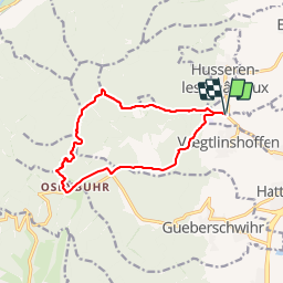
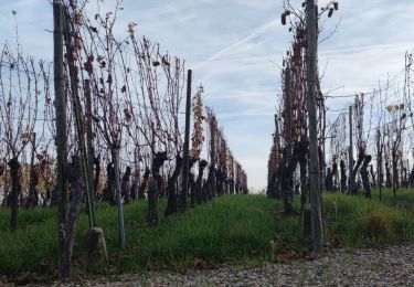
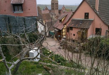
Randonnée A pied de 11,8 km à découvrir à Grand Est, Haut-Rhin, Eguisheim. Cette randonnée est proposée par patrickbeyrath.

Description

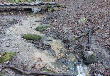
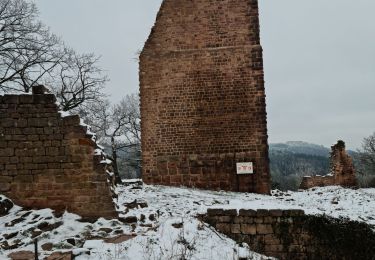
Parking au bord de la D1 au panneau Abbaye de Marbach -prendre triangle jaune direction Col de Marbach puis rond rouge jusqu'à Osenbuhr, Auberge des Chasseurs et repartir circulaire bleu du parcours sportif puis chevalet jaune puis losange rouge direction Langenberg et rester losange rouge jusqu'à l'Abbaye Marbach et retour parking

Profil altimétrique

Localisation

Pays :
France
Région :
Grand Est
Département/Province :
Haut-Rhin
Commune :
Eguisheim
Localité :
Unknown
Départ:(UTM)
371845 ; 5320645 (32U) N.

Randonnées à proximité

Randonnée Marche Wettolsheim - 4 châteaux Wettolsheim Husseren - Photo
Marche
apa

Marche

Moyen
(1)
Wettolsheim, Grand Est, Haut-Rhin, France
11,7 km | 17,7 km-effort
4h 28min
Non
Randonnée Marche Osenbach - Osenbach - Sentier des Sols - Photo
Marche
gscheven

Marche

Facile
(1)
Osenbach, Grand Est, Haut-Rhin, France
4,7 km | 6,6 km-effort
3h 0min
Oui
Randonnée Marche Eguisheim - 2023-12-29 Marche Hagueneck Pflixbourg Hohlandsbourg - Photo
Marche
GUIDE
holtzv

Marche

Moyen
Eguisheim, Grand Est, Haut-Rhin, France
22 km | 32 km-effort
7h 16min
Oui
Randonnée Marche Pfaffenheim - Schauenberg 1 - Photo
Marche
regisbodilis

Marche

Facile
(1)
Pfaffenheim, Grand Est, Haut-Rhin, France
10,3 km | 16,5 km-effort
3h 30min
Oui
Randonnée A pied Walbach - wihr au val - le petit hohnack - Photo
A pied
OxygenLT

A pied

Moyen
(1)
Walbach, Grand Est, Haut-Rhin, France
15,6 km | 25 km-effort
5h 46min
Oui
Randonnée Marche Husseren-les-Châteaux - Husseren les Châteaux - Photo
Marche
oscar1

Marche

Facile
Husseren-les-Châteaux, Grand Est, Haut-Rhin, France
12,7 km | 19,1 km-effort
3h 24min
Oui
Randonnée Marche Gueberschwihr - Les Marcheurs...et la fondue..26/01/2024 - Photo
Marche
boubou68

Marche

Moyen
Gueberschwihr, Grand Est, Haut-Rhin, France
20 km | 31 km-effort
4h 59min
Oui
Randonnée Marche Eguisheim - Rando des cinq châteaux  - Photo
Marche
Koralie Werny

Marche

Moyen
Eguisheim, Grand Est, Haut-Rhin, France
18,4 km | 28 km-effort
5h 19min
Oui
Randonnée Marche Gueberschwihr - Promenade circulaire Kuckuckstei - Photo
Marche
stef250

Marche

Moyen
Gueberschwihr, Grand Est, Haut-Rhin, France
7 km | 10,5 km-effort
2h 57min
Oui


Fermer
Mes abonnements