Randonnée A pied Dabo - Rocher du Dabo - Photo
 MIFE68
MIFE68

Utilisateur

© OpenStreetMap contributors
Longueur
Longueur
11,7 km
Altitude max
Altitude max
631 m
Dénivelé positif
Dénivelé positif
398 m
Km-Effort
Km-Effort  
17 km
Altitude min
Altitude min
297 m
Dénivelé négatif
Dénivelé négatif
396 m
Boucle
Boucle
Oui
Date de création :
2019-07-10 13:15:42.034
Dernière modification :
2019-07-11 08:04:34.724

(0 Avis)

A pied
A pied
--
Difficulté : Facile

Scannez ce code QR pour ouvrir la randonnée dans l'application SityTrail

Application GPS de randonnée GRATUITE

Logo SityTrail SityTrail

IGN / Instituts géographiques

Télécharger SityTrail sur l'App Store Télécharger SityTrail sur Google Play

Logo SityTrail SityTrail World

Le monde est à vous

Télécharger SityTrail sur l'App Store Télécharger SityTrail sur Google Play Télécharger SityTrail sur Huawei AppGallery

À propos

Randonnée A pied de 11,7 km à découvrir à Grand Est, Moselle, Dabo. Cette randonnée est proposée par MIFE68.

Description

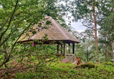
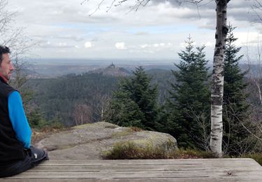
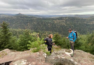
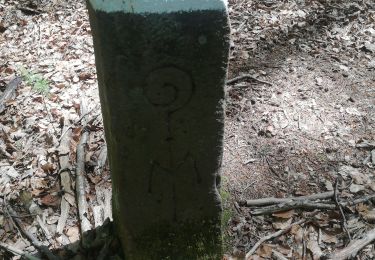
Départ cimetière de Dabo par GR534,
montée au rocher du Dabo, visite de la chapelle Saint-Léon. Descente vers le Sud,  prendre GR53 vers camping du Rocher. Traverser D45 et remonter au nord croix jaune vers SickertKopf. Descente vers la LochMuehl. Prendre Triangle jaune à gauche vers l'ouest, retraverser la D45  direction Dabo/ Petit Ballerstein, retour Dabo par Hopstein et cimetière.

Profil altimétrique

Localisation

Pays :
France
Région :
Grand Est
Département/Province :
Moselle
Commune :
Dabo
Localité :
Unknown
Départ:(UTM)
370023 ; 5390293 (32U) N.

Randonnées à proximité

Randonnée Marche Reinhardsmunster - 2020-06-13 Marche Ditschelkopf Schweizerberg - Photo
Marche
GUIDE
holtzv

Marche

Très facile
Reinhardsmunster, Grand Est, Bas-Rhin, France
14,5 km | 22 km-effort
4h 52min
Oui
Randonnée Marche Wangenbourg-Engenthal - 2020-03-14 Marche Engenthal le bas - Photo
Marche
GUIDE
holtzv

Marche

Très facile
Wangenbourg-Engenthal, Grand Est, Bas-Rhin, France
14,3 km | 22 km-effort
4h 27min
Oui
Randonnée Marche Wangenbourg-Engenthal - 2017-02-24 Marche Schneeberg - Photo
Marche
GUIDE
holtzv

Marche

Très facile
(1)
Wangenbourg-Engenthal, Grand Est, Bas-Rhin, France
12,8 km | 19,9 km-effort
Inconnu
Oui
Randonnée Marche Haselbourg - De Haselbourg au Rocher de Falkenfels - Photo
Marche
GUIDE
Desrumaux

Marche

Facile
(1)
Haselbourg, Grand Est, Moselle, France
6,4 km | 9,7 km-effort
2h 6min
Oui
Randonnée V.T.T. Dabo - Balcon de Dabo 2010 - Photo
V.T.T.
tracegps

V.T.T.

Très difficile
(1)
Dabo, Grand Est, Moselle, France
39 km | 54 km-effort
4h 30min
Oui
Randonnée Marche Dabo - 2022-11-01 Marche Dabo et ses Rochers - Photo
Marche
GUIDE
holtzv

Marche

Très difficile
Dabo, Grand Est, Moselle, France
26 km | 38 km-effort
7h 8min
Oui
Randonnée Marche Reinhardsmunster - Schuetzenfelsen - Photo
Marche
apa

Marche

Moyen
Reinhardsmunster, Grand Est, Bas-Rhin, France
12,4 km | 17 km-effort
3h 21min
Oui
Randonnée Marche Wangenbourg-Engenthal - Col de Valsberg - Photo
Marche
LUTZMarc

Marche

Facile
Wangenbourg-Engenthal, Grand Est, Bas-Rhin, France
46 km | 58 km-effort
6h 5min
Non
Randonnée V.T.T. Wangenbourg-Engenthal - rando engenthal 1j - Photo
V.T.T.
joelbouclainville

V.T.T.

Difficile
(1)
Wangenbourg-Engenthal, Grand Est, Bas-Rhin, France
49 km | 70 km-effort
21h 12min
Oui


Fermer
Mes abonnements