Randonnée V.T.T. Saint-Georges-sur-Cher - Château de CHENONCEAUX - Photo
 phil118
phil118

Utilisateur

© OpenStreetMap contributors
Longueur
Longueur
22 km
Altitude max
Altitude max
77 m
Dénivelé positif
Dénivelé positif
169 m
Km-Effort
Km-Effort  
24 km
Altitude min
Altitude min
53 m
Dénivelé négatif
Dénivelé négatif
169 m
Boucle
Boucle
Oui
Date de création :
2019-08-18 12:39:34.496
Dernière modification :
2019-08-18 16:52:56.622

(0 Avis)

V.T.T.
V.T.T.
2h17
Difficulté : Facile

Scannez ce code QR pour ouvrir la randonnée dans l'application SityTrail

Application GPS de randonnée GRATUITE

Logo SityTrail SityTrail

IGN / Instituts géographiques

Télécharger SityTrail sur l'App Store Télécharger SityTrail sur Google Play

Logo SityTrail SityTrail World

Le monde est à vous

Télécharger SityTrail sur l'App Store Télécharger SityTrail sur Google Play Télécharger SityTrail sur Huawei AppGallery

À propos

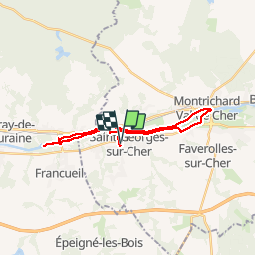
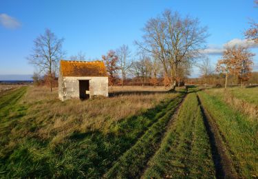
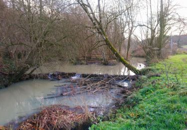
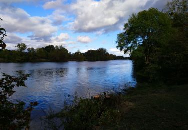
Randonnée V.T.T. de 22 km à découvrir à Centre-Val de Loire, Loir-et-Cher, Saint-Georges-sur-Cher. Cette randonnée est proposée par phil118.

Description

Saint Georges sur Cher château de Chenonceaux aler retour via Montrichard

Profil altimétrique

Photos

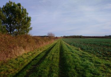
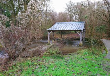
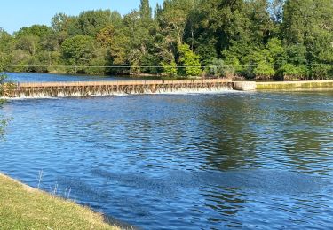
31 photos au total. Cliquez sur une photo pour les afficher toutes dans la galerie.

Localisation

Pays :
France
Région :
Centre-Val de Loire
Département/Province :
Loir-et-Cher
Commune :
Saint-Georges-sur-Cher
Localité :
Unknown
Départ:(UTM)
358346 ; 5243155 (31T) N.

Randonnées à proximité

Randonnée Marche Chenonceaux - Chenonceaux - Photo
Marche
LEMENIO

Marche

Facile
(1)
Chenonceaux, Centre-Val de Loire, Indre-et-Loire, France
10,9 km | 13,1 km-effort
2h 50min
Oui
Randonnée Marche Saint-Georges-sur-Cher - Saint-Georges-sur-Cher - GRP Forêt Montrichard - 17.6km 165m 3h40 - 2023 12 27 - Photo
Marche
Orcal37

Marche

Facile
Saint-Georges-sur-Cher, Centre-Val de Loire, Loir-et-Cher, France
17,7 km | 19,8 km-effort
3h 40min
Oui
Randonnée Marche Faverolles-sur-Cher - Montrichard - GR41 Forêt GRP - 13.9km 220m 3h30 - 2022 03 03 - Photo
Marche
Orcal37

Marche

Facile
Faverolles-sur-Cher, Centre-Val de Loire, Loir-et-Cher, France
13,9 km | 16,9 km-effort
3h 30min
Oui
Randonnée Marche Francueil - Chenonceaux - GR41 Francueil - 12.7km 160m 2h45 - 2022 01 01 - Photo
Marche
Orcal37

Marche

Facile
Francueil, Centre-Val de Loire, Indre-et-Loire, France
12,7 km | 14,8 km-effort
2h 45min
Oui
Randonnée Marche Saint-Georges-sur-Cher - Saint-Georges-sur-Cher - la Rabotière - 5.9km 50m 1h25 - 2021 12 26 - Photo
Marche
Orcal37

Marche

Très facile
Saint-Georges-sur-Cher, Centre-Val de Loire, Loir-et-Cher, France
5,9 km | 6,6 km-effort
1h 25min
Oui
Randonnée Vélo de route Faverolles-sur-Cher - Balade autour de Montrichard - Photo
Vélo de route
pauldurand

Vélo de route

Moyen
Faverolles-sur-Cher, Centre-Val de Loire, Loir-et-Cher, France
48 km | 54 km-effort
3h 38min
Non
Randonnée Marche Saint-Georges-sur-Cher - Saint-Georges-sur-Cher - Montfourgon - 10.1km 110m 2h25 - 2021 01 02 - Photo
Marche
Orcal37

Marche

Très facile
Saint-Georges-sur-Cher, Centre-Val de Loire, Loir-et-Cher, France
10,2 km | 11,6 km-effort
2h 25min
Oui
Randonnée Marche Saint-Georges-sur-Cher - Saint-Georges-sur-Cher - barrage de castors - 10km 130m 2h10 - 2020 12 26 - Photo
Marche
Orcal37

Marche

Très facile
Saint-Georges-sur-Cher, Centre-Val de Loire, Loir-et-Cher, France
10 km | 11,8 km-effort
2h 10min
Oui
Randonnée Marche Saint-Georges-sur-Cher - Saint-Georges-sur-Cher - boucle bord du Cher - 6.5km 50m 1h35 - 2020 10 04 - Photo
Marche
Orcal37

Marche

Très facile
Saint-Georges-sur-Cher, Centre-Val de Loire, Loir-et-Cher, France
6,5 km | 7,2 km-effort
1h 35min
Oui


Fermer
Mes abonnements