Randonnée Marche Chanac - le villard - Photo
 Bobzebob
Bobzebob

Utilisateur

© OpenStreetMap contributors
Longueur
Longueur
13,1 km
Altitude max
Altitude max
927 m
Dénivelé positif
Dénivelé positif
382 m
Km-Effort
Km-Effort  
18,2 km
Altitude min
Altitude min
623 m
Dénivelé négatif
Dénivelé négatif
377 m
Boucle
Boucle
Oui
Date de création :
2019-08-19 09:53:56.498
Dernière modification :
2019-08-20 17:51:09.846

(1 Avis)

Marche
Marche
3h44
Difficulté : Difficile

Scannez ce code QR pour ouvrir la randonnée dans l'application SityTrail

Application GPS de randonnée GRATUITE

Logo SityTrail SityTrail

IGN / Instituts géographiques

Télécharger SityTrail sur l'App Store Télécharger SityTrail sur Google Play

Logo SityTrail SityTrail World

Le monde est à vous

Télécharger SityTrail sur l'App Store Télécharger SityTrail sur Google Play Télécharger SityTrail sur Huawei AppGallery

À propos

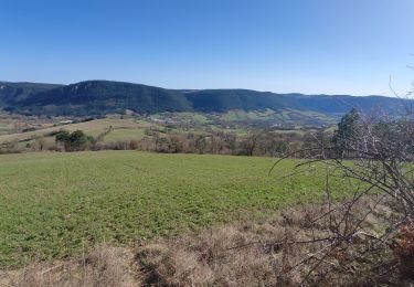
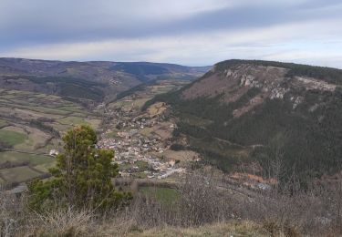
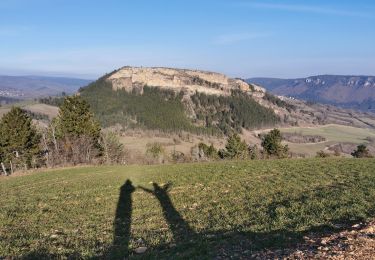
Randonnée Marche de 13,1 km à découvrir à Occitanie, Lozère, Chanac. Cette randonnée est proposée par Bobzebob.

Description

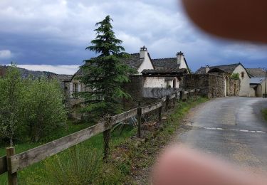
randonnée n•33 Ou 21 guide chamina balisée en vert et non en jaune comme indiqué dans le guide.
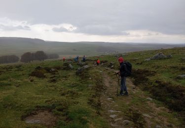
Très jolie randonnée avec une forte montée et un chemin très vertigineux sur la fin.
au départ prendre le chemin qui descend au bort du Lot pour rejoindre le Pont Vieux.

Profil altimétrique

Photos

Localisation

Pays :
France
Région :
Occitanie
Département/Province :
Lozère
Commune :
Chanac
Localité :
Chanac
Départ:(UTM)
527080 ; 4923786 (31T) N.

Commentaires

Veuillez vous connecter pour laisser un commentaire ou une note


Randonnées à proximité

Randonnée Marche Esclanèdes - Rocherousse Marijoulet - Photo
Marche
tyntyn

Marche

Difficile
Esclanèdes, Occitanie, Lozère, France
10,5 km | 16,4 km-effort
2h 58min
Oui
Randonnée Marche Barjac - Villaret - Photo
Marche
tyntyn

Marche

Difficile
Barjac, Occitanie, Lozère, France
12,9 km | 18,4 km-effort
3h 24min
Oui
Randonnée Marche Palhers - Urbain V 3 - Photo
Marche
bymarc26

Marche

Moyen
Palhers, Occitanie, Lozère, France
17,9 km | 27 km-effort
4h 45min
Non
Randonnée Marche Palhers - Urbain V 2 - Photo
Marche
bymarc26

Marche

Moyen
Palhers, Occitanie, Lozère, France
30 km | 41 km-effort
5h 15min
Non
Randonnée V.T.T. Esclanèdes - esclanedes sauveterre le sec esclanedes  - Photo
V.T.T.
tyntyn

V.T.T.

Facile
Esclanèdes, Occitanie, Lozère, France
42 km | 53 km-effort
3h 11min
Oui
Randonnée Marche Barjac - la roche /Veyrac/Vielbougue  - Photo
Marche
tyntyn

Marche

Moyen
Barjac, Occitanie, Lozère, France
11,5 km | 17 km-effort
3h 17min
Oui
Randonnée Quad Grèzes - Quad 2 - Photo
Quad
UHINA

Quad

Grèzes, Occitanie, Lozère, France
15,9 km | 23 km-effort
57min
Non
Randonnée Marche Chanac - Chemin de St Guilhem - Le Gazy - Sainte Enimie - Photo
Marche
GUIDE
Kargil

Marche

Très difficile
Chanac, Occitanie, Lozère, France
21 km | 28 km-effort
5h 45min
Non
Randonnée Marche Chanac - Chanac 48 Sentier des Arts - Photo
Marche
OLYMP42

Marche

Moyen
Chanac, Occitanie, Lozère, France
6,6 km | 9,8 km-effort
2h 3min
Non


Fermer
Mes abonnements