Randonnée Marche Saint-Jean-du-Gard - Arsel de St Jean du Gard au rocher d escorces - Photo

Arsel de St Jean du Gard au rocher d escorces

 labarone
labarone

Utilisateur

© OpenStreetMap contributors
Longueur
Longueur
17,4 km
Altitude max
Altitude max
496 m
Dénivelé positif
Dénivelé positif
667 m
Km-Effort
Km-Effort  
26 km
Altitude min
Altitude min
161 m
Dénivelé négatif
Dénivelé négatif
669 m
Boucle
Boucle
Oui
Date de création :
2020-02-04 08:34:48.2
Dernière modification :
2020-02-04 14:56:30.994

(0 Avis)

Marche
Marche
5h55
Difficulté : Moyen

Scannez ce code QR pour ouvrir la randonnée dans l'application SityTrail

Application GPS de randonnée GRATUITE

Logo SityTrail SityTrail

IGN / Instituts géographiques

Télécharger SityTrail sur l'App Store Télécharger SityTrail sur Google Play

Logo SityTrail SityTrail World

Le monde est à vous

Télécharger SityTrail sur l'App Store Télécharger SityTrail sur Google Play Télécharger SityTrail sur Huawei AppGallery

À propos

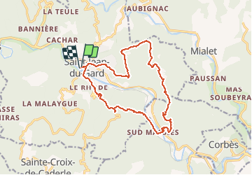
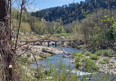
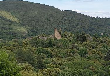
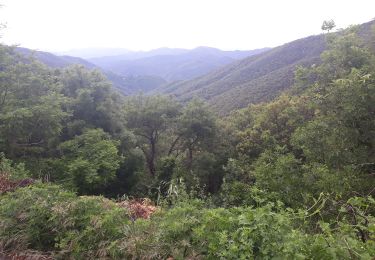
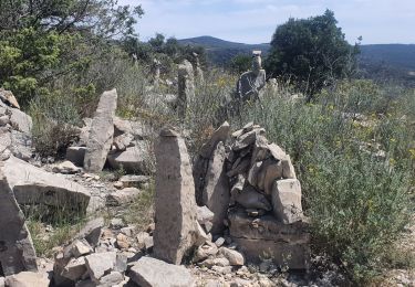
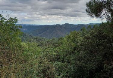
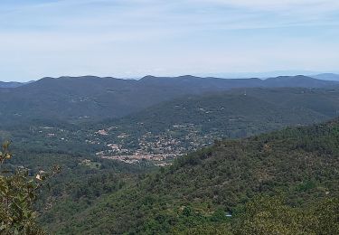
Randonnée Marche de 17,4 km à découvrir à Occitanie, Gard, Saint-Jean-du-Gard. Cette randonnée est proposée par labarone.

Description

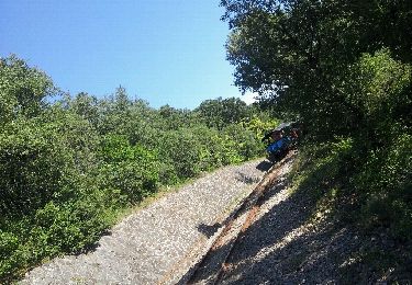
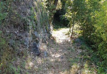
Belle rando un peu sportive surtout dans les descentes. Dernier 300 m à faire avec prudence mais il y a aussi une  dizaine d escalier d une dizaine de marche. Ruine d habitation antérieure. Rando à faire

Profil altimétrique

Photos

Localisation

Pays :
France
Région :
Occitanie
Département/Province :
Gard
Commune :
Saint-Jean-du-Gard
Localité :
Unknown
Départ:(UTM)
570606 ; 4883953 (31T) N.

Randonnées à proximité

Randonnée Marche Thoiras - chemin des ecoliers THOIRAS - Photo
Marche
rocheteau7

Marche

Facile
(2)
Thoiras, Occitanie, Gard, France
8,8 km | 12,2 km-effort
2h 20min
Oui
Randonnée Marche Saint-Jean-du-Gard - Signal Saint Pierre  - Photo
Marche
GUIDE
nadinebondoux

Marche

Moyen
Saint-Jean-du-Gard, Occitanie, Gard, France
17,7 km | 26 km-effort
4h 44min
Non
Randonnée Marche Soudorgues - Vallée Salindrenque - Photo
Marche
GUIDE
nadinebondoux

Marche

Difficile
Soudorgues, Occitanie, Gard, France
19,4 km | 30 km-effort
6h 20min
Oui
Randonnée Marche Peyrolles - la Diligence  - Photo
Marche
GUIDE
nadinebondoux

Marche

Moyen
Peyrolles, Occitanie, Gard, France
15,3 km | 0 m-effort
4h 47min
Oui
Randonnée Marche Saint-Jean-du-Gard - visite st jean du gard et de son train en attendant le bus pour Ales 1.50  - Photo
Marche
Nathalie. Mercier

Marche

Très facile
Saint-Jean-du-Gard, Occitanie, Gard, France
3,8 km | 4,2 km-effort
1h 5min
Non
Randonnée Marche Saint-Jean-du-Gard - 17-05-2023 E12 Saint Jean du Gard - Ales  - Photo
Marche
GUIDE
Kargil

Marche

Très difficile
Saint-Jean-du-Gard, Occitanie, Gard, France
30 km | 44 km-effort
10h 1min
Non
Randonnée Marche Saint-Jean-du-Gard - Col St Pierre,  sentier d 'Auriol - Photo
Marche
GUIDE
nadinebondoux

Marche

Difficile
Saint-Jean-du-Gard, Occitanie, Gard, France
22 km | 34 km-effort
7h 2min
Oui
Randonnée Marche Saint-Jean-du-Gard - St jean du Gard - grotte de Rouville - Photo
Marche
Bart2015

Marche

Difficile
Saint-Jean-du-Gard, Occitanie, Gard, France
17,8 km | 27 km-effort
5h 57min
Oui
Randonnée Marche Peyrolles - gorges du Soucy Mont Brion Vallée Obscure - Photo
Marche
GUIDE
nadinebondoux

Marche

Difficile
Peyrolles, Occitanie, Gard, France
19,3 km | 30 km-effort
6h 43min
Oui


Fermer
Mes abonnements