Randonnée Marche Sainte-Marie-aux-Mines - Col des Bagenelles et les deux Brézouard - Photo

Col des Bagenelles et les deux Brézouard

 VacheKiri67
VacheKiri67

Utilisateur

© OpenStreetMap contributors
Longueur
Longueur
12,5 km
Altitude max
Altitude max
1226 m
Dénivelé positif
Dénivelé positif
497 m
Km-Effort
Km-Effort  
19,1 km
Altitude min
Altitude min
898 m
Dénivelé négatif
Dénivelé négatif
494 m
Boucle
Boucle
Oui
Date de création :
2020-07-30 08:40:23.585
Dernière modification :
2020-07-30 16:44:13.756

(0 Avis)

Marche
Marche
3h33
Difficulté : Moyen

Scannez ce code QR pour ouvrir la randonnée dans l'application SityTrail

Application GPS de randonnée GRATUITE

Logo SityTrail SityTrail

IGN / Instituts géographiques

Télécharger SityTrail sur l'App Store Télécharger SityTrail sur Google Play

Logo SityTrail SityTrail World

Le monde est à vous

Télécharger SityTrail sur l'App Store Télécharger SityTrail sur Google Play Télécharger SityTrail sur Huawei AppGallery

À propos

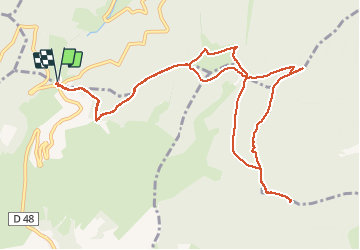
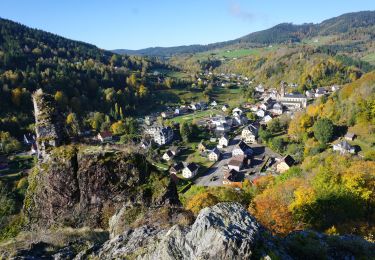
Randonnée Marche de 12,5 km à découvrir à Grand Est, Haut-Rhin, Sainte-Marie-aux-Mines. Cette randonnée est proposée par VacheKiri67.

Description

Faite le 30/07/2020. Départ : parking du Col des Bagenelles. Le crochet par la Grande Roche n'apporte pas grand chose car il n'offre qu'un panorama partiel.

Profil altimétrique

Photos

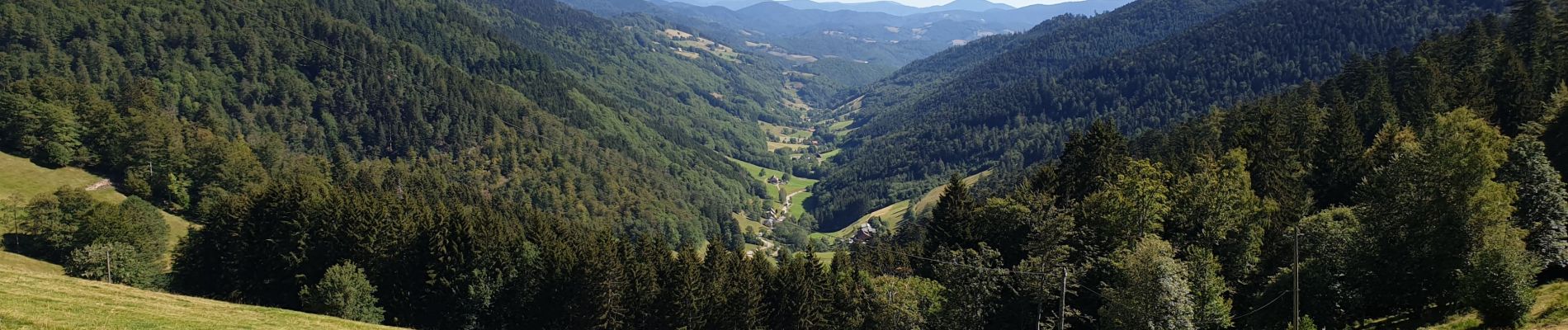
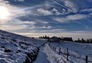
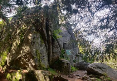
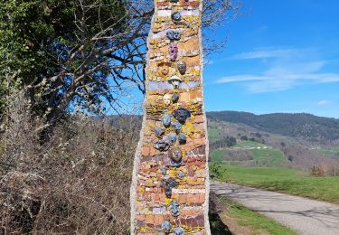
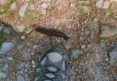
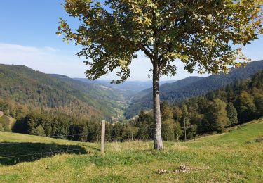
25 photos au total. Cliquez sur une photo pour les afficher toutes dans la galerie.

Localisation

Pays :
France
Région :
Grand Est
Département/Province :
Haut-Rhin
Commune :
Sainte-Marie-aux-Mines
Localité :
Unknown
Départ:(UTM)
359836 ; 5339480 (32U) N.

Randonnées à proximité

Randonnée Marche Le Bonhomme - Le Bonhomme - Circuit du village - Photo
Marche
GUIDE
Desrumaux

Marche

Facile
(1)
Le Bonhomme, Grand Est, Haut-Rhin, France
3 km | 5,3 km-effort
1h 30min
Oui
Randonnée Marche Sainte-Marie-aux-Mines - 2021-02-14 Marche Bagenelles Brezouard Fuste de Etoile - Photo
Marche
GUIDE
holtzv

Marche

Très difficile
Sainte-Marie-aux-Mines, Grand Est, Haut-Rhin, France
17,1 km | 27 km-effort
6h 6min
Oui
Randonnée Marche Lapoutroie - 2020-07-19 Marche Étang du Devin Col Calvaire Tête des Faux - Photo
Marche
GUIDE
holtzv

Marche

Très facile
Lapoutroie, Grand Est, Haut-Rhin, France
14,2 km | 22 km-effort
3h 27min
Oui
Randonnée Marche Ban-de-Laveline - 20130508 - Photo
Marche
pida

Marche

Très facile
(1)
Ban-de-Laveline, Grand Est, Vosges, France
7,6 km | 11,1 km-effort
2h 19min
Oui
Randonnée Marche Fréland - CVL - Rando 25/03/2024 - Col de Chamont - Photo
Marche
Hub6877

Marche

Moyen
Fréland, Grand Est, Haut-Rhin, France
6,6 km | 9,5 km-effort
2h 15min
Oui
Randonnée A pied Sainte-Marie-aux-Mines - Le Haïcot - Le Petit Brézouard - Le Haïcot - Photo
A pied
patrickbeyrath

A pied

Facile
(2)
Sainte-Marie-aux-Mines, Grand Est, Haut-Rhin, France
7,1 km | 10,5 km-effort
2h 23min
Oui
Randonnée Marche Lapoutroie - rdpr G3 le bonhomme 230905 - Photo
Marche
GUIDE
stempfel52

Marche

Difficile
Lapoutroie, Grand Est, Haut-Rhin, France
11,6 km | 16,5 km-effort
4h 12min
Oui
Randonnée Marche Le Bonhomme - Le  Bonhomme-le Brézouard - Photo
Marche
oscar1

Marche

Moyen
Le Bonhomme, Grand Est, Haut-Rhin, France
15 km | 26 km-effort
4h 34min
Oui
Randonnée Marche Sainte-Marie-aux-Mines - Crête granitique et forêts profondes - Photo
Marche
VacheKiri67

Marche

Moyen
Sainte-Marie-aux-Mines, Grand Est, Haut-Rhin, France
13,7 km | 22 km-effort
3h 56min
Oui


Fermer
Mes abonnements