Randonnée V.T.T. Rabastens - rabastens - Photo
 ra2000
ra2000

Utilisateur

© OpenStreetMap contributors
Longueur
Longueur
40 km
Altitude max
Altitude max
236 m
Dénivelé positif
Dénivelé positif
692 m
Km-Effort
Km-Effort  
50 km
Altitude min
Altitude min
102 m
Dénivelé négatif
Dénivelé négatif
704 m
Boucle
Boucle
Non
Date de création :
2020-08-23 07:24:30.397
Dernière modification :
2020-08-23 19:26:41.359

(0 Avis)

V.T.T.
V.T.T.
3h47
Difficulté : Moyen

Scannez ce code QR pour ouvrir la randonnée dans l'application SityTrail

Application GPS de randonnée GRATUITE

Logo SityTrail SityTrail

IGN / Instituts géographiques

Télécharger SityTrail sur l'App Store Télécharger SityTrail sur Google Play

Logo SityTrail SityTrail World

Le monde est à vous

Télécharger SityTrail sur l'App Store Télécharger SityTrail sur Google Play Télécharger SityTrail sur Huawei AppGallery

À propos

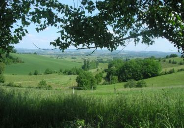
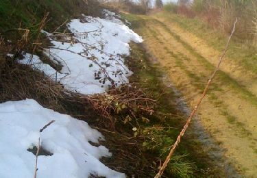
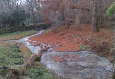
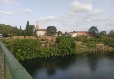
Randonnée V.T.T. de 40 km à découvrir à Occitanie, Tarn, Rabastens. Cette randonnée est proposée par ra2000.

Profil altimétrique

Localisation

Pays :
France
Région :
Occitanie
Département/Province :
Tarn
Commune :
Rabastens
Localité :
Unknown
Départ:(UTM)
399297 ; 4853617 (31T) N.

Randonnées à proximité

Randonnée Marche Lisle-sur-Tarn - L'Isle sur Tarn GRP 1 - Photo
Marche
tracegps

Marche

Difficile
(3)
Lisle-sur-Tarn, Occitanie, Tarn, France
12,8 km | 16,2 km-effort
3h 0min
Oui
Randonnée Marche Rabastens - Le sentier du Lac des Lauzerals - Rabastens - Photo
Marche
tracegps

Marche

Moyen
(1)
Rabastens, Occitanie, Tarn, France
14,1 km | 17,4 km-effort
3h 30min
Oui
Randonnée Course à pied Rabastens - Le sentier du Lac des Lauzerals - Rabastens - Photo
Course à pied
tracegps

Course à pied

Moyen
Rabastens, Occitanie, Tarn, France
14,1 km | 17,4 km-effort
1h 30min
Oui
Randonnée V.T.T. Rabastens - Le sentier du Lac des Lauzerals - Rabastens - Photo
V.T.T.
tracegps

V.T.T.

Moyen
Rabastens, Occitanie, Tarn, France
14,1 km | 17,4 km-effort
1h 10min
Oui
Randonnée Marche Coufouleux - Rabastens-Boucle du Tarn.R - Photo
Marche
Remio

Marche

Facile
(1)
Coufouleux, Occitanie, Tarn, France
13,7 km | 15,2 km-effort
5h 4min
Oui
Randonnée Vélo de route Coufouleux - coufouleux l'Isle sur tarn - Photo
Vélo de route
pedromartin

Vélo de route

Moyen
Coufouleux, Occitanie, Tarn, France
27 km | 29 km-effort
1h 44min
Oui
Randonnée Marche nordique Rabastens - Ta Ashe said - Photo
Marche nordique
chripaci

Marche nordique

Facile
Rabastens, Occitanie, Tarn, France
9,3 km | 10,1 km-effort
2h 2min
Oui
Randonnée A pied Rabastens - Rabastens lac - Photo
A pied
pidjam

A pied

Moyen
Rabastens, Occitanie, Tarn, France
14,1 km | 17,3 km-effort
3h 0min
Oui
Randonnée Marche Rabastens - 81_Rabastens_longue - Photo
Marche
jab31

Marche

Très difficile
Rabastens, Occitanie, Tarn, France
28 km | 37 km-effort
7h 43min
Oui


Fermer
Mes abonnements