


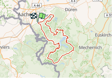


15,5 km | 19,8 km-effort


Utilisateur


Application GPS de randonnée GRATUITE
 SityTrail
IGN / Instituts géographiques
SityTrail World
Le monde est à vous
Randonnée Vélo de 137 km à découvrir à Rhénanie-du-Nord-Westphalie, Région urbaine d'Aix-la-Chapelle, Aix-la-Chapelle. Cette randonnée est proposée par gpstracks.
More information on GPStracks.nl : http://www.gpstracks.nl
Marche

A pied
A pied
A pied
A pied
Marche
A pied
A pied
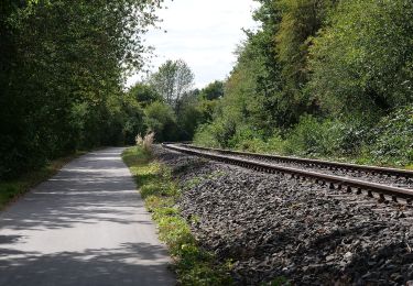
![Randonnée A pied Aix-la-Chapelle - [5] Itertalweg - Variante als Rundweg - Photo](https://media.geolcdn.com/t/375/260/ext.jpg?maxdim=2&url=https%3A%2F%2Fmedia.geolcdn.com%2Ff%2F484480c9-a885-4696-8e01-a48866a6fd77.jpeg)
A pied