Randonnée Marche Wildenstein - Wildenstein Pourri Faing Blockloch - Photo

Wildenstein Pourri Faing Blockloch

 bob68
bob68

Utilisateur

© OpenStreetMap contributors
Longueur
Longueur
11,7 km
Altitude max
Altitude max
1108 m
Dénivelé positif
Dénivelé positif
563 m
Km-Effort
Km-Effort  
19,2 km
Altitude min
Altitude min
567 m
Dénivelé négatif
Dénivelé négatif
564 m
Boucle
Boucle
Oui
Date de création :
2014-12-10 00:00:00.0
Dernière modification :
2014-12-10 00:00:00.0

(1 Avis)

Marche
Marche
3h21
Difficulté : Moyen

Scannez ce code QR pour ouvrir la randonnée dans l'application SityTrail

Application GPS de randonnée GRATUITE

Logo SityTrail SityTrail

IGN / Instituts géographiques

Télécharger SityTrail sur l'App Store Télécharger SityTrail sur Google Play

Logo SityTrail SityTrail World

Le monde est à vous

Télécharger SityTrail sur l'App Store Télécharger SityTrail sur Google Play Télécharger SityTrail sur Huawei AppGallery

À propos

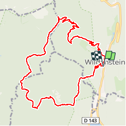
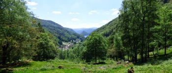
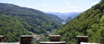
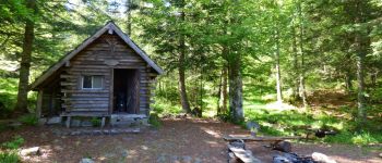
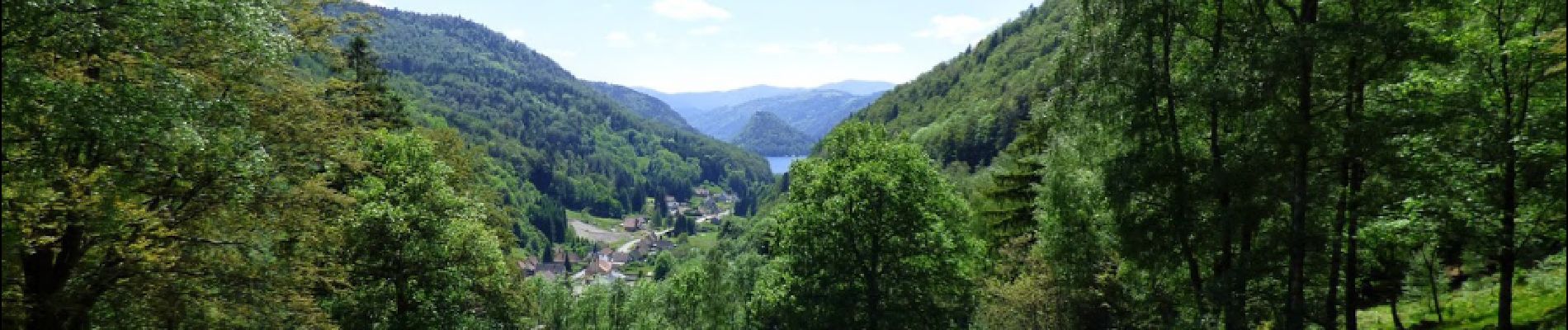
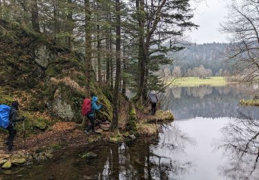
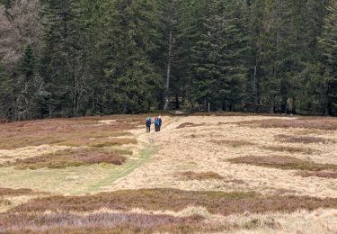
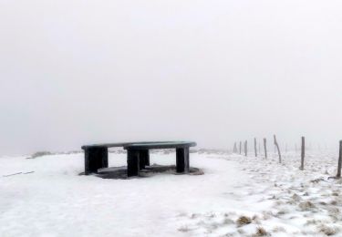
Randonnée Marche de 11,7 km à découvrir à Grand Est, Haut-Rhin, Wildenstein. Cette randonnée est proposée par bob68.

Profil altimétrique

Photos

Points d'intérêt

Point d'intérêt Wildenstein - Point de vue - Photo
bob68
WILDENSTEIN 
Point d'intérêt Wildenstein - Point de vue - Photo
bob68
WILDENSTEIN 
Point d'intérêt Cornimont - Col du Pourri Faing - Photo
bob68
Point d'intérêt Kruth - Abri - Photo
bob68
KRUTH 
Point d'intérêt Wildenstein - Point de vue - Photo
bob68
WILDENSTEIN 

Localisation

Pays :
France
Région :
Grand Est
Département/Province :
Haut-Rhin
Commune :
Wildenstein
Localité :
Unknown
Départ:(Dec)
Départ:(UTM)
347824 ; 5315745 (32T) N.

Commentaires

Veuillez vous connecter pour laisser un commentaire ou une note


Randonnées à proximité

Randonnée Marche La Bresse - 2023-04-16 Marche Abri Lac de Blanchemer vers Lac de Lispach - Photo
Marche
GUIDE
holtzv

Marche

Très difficile
(1)
La Bresse, Grand Est, Vosges, France
23 km | 36 km-effort
8h 4min
Non
Randonnée Marche La Bresse - 2023-04-15 Marche Abri Collet de Etang vers Abri Lac de Blanchemer - Photo
Marche
GUIDE
holtzv

Marche

Moyen
(1)
La Bresse, Grand Est, Vosges, France
22 km | 35 km-effort
7h 51min
Non
Randonnée Marche Wildenstein - 2022-02-20 Marche Kruth Grand Ventron - Photo
Marche
GUIDE
holtzv

Marche

Très difficile
(1)
Wildenstein, Grand Est, Haut-Rhin, France
16,8 km | 27 km-effort
4h 52min
Oui
Randonnée Marche La Bresse - Autour du Lac des Corbeaux - Photo
Marche
Alfredy

Marche

Moyen
(1)
La Bresse, Grand Est, Vosges, France
3,1 km | 6 km-effort
1h 30min
Oui
Randonnée Marche La Bresse - Kastelberg des pierres, des lacs, des panoramas magnifiques  - Photo
Marche
Alfredy

Marche

Difficile
(1)
La Bresse, Grand Est, Vosges, France
15,1 km | 26 km-effort
6h 11min
Oui
Randonnée Marche Wildenstein - Col du Bramont - Machey - Blanchemer - Photo
Marche
VacheKiri67

Marche

Moyen
(1)
Wildenstein, Grand Est, Haut-Rhin, France
15,3 km | 22 km-effort
4h 27min
Oui
Randonnée V.T.T. La Bresse - randonnée découverte à la Bresse.  - Photo
V.T.T.
Dutyrider

V.T.T.

Facile
(1)
La Bresse, Grand Est, Vosges, France
30 km | 41 km-effort
2h 58min
Oui
Randonnée Marche La Bresse - Rainkopf - Mittlach - Hohneck - Photo
Marche
tracegps

Marche

Difficile
(1)
La Bresse, Grand Est, Vosges, France
22 km | 41 km-effort
8h 0min
Oui
Randonnée Marche La Bresse - Le Lac des Corbeaux - La Bresse - Photo
Marche
tracegps

Marche

Moyen
(2)
La Bresse, Grand Est, Vosges, France
3 km | 6 km-effort
2h 0min
Oui


Fermer
Mes abonnements