![](/images/other/stat-length.png)
![Randonnée A pied Le Noirmont - La Goule - fixme - Photo](https://media.geolcdn.com/t/1900/400/ext.pjpeg?maxdim=2&url=https%3A%2F%2Fmedia.geolcdn.com%2Ff%2F26c9f498-14fd-470d-95fd-f93787b84ec0.jpeg)
La Goule - fixme
SityTrail - itinéraires balisés pédestres
Tous les sentiers balisés d’Europe PRO
![Longueur](/images/other/stat-length.png)
Longueur
3,9 km
![Altitude max](https://static1.geolcdn.com/siteimages/upload/files/1508320355ic_sort_altitude_max_24dp.png)
Altitude max
972 m
![Dénivelé positif](https://static1.geolcdn.com/siteimages/upload/files/1508320355ic_sort_den_pos_24dp.png)
Dénivelé positif
427 m
![Km-Effort](/images/other/stat-length.png)
Km-Effort
8,2 km
![Altitude min](https://static1.geolcdn.com/siteimages/upload/files/1508320355ic_sort_altitude_min_24dp.png)
Altitude min
551 m
![Dénivelé négatif](https://static1.geolcdn.com/siteimages/upload/files/1508320355ic_sort_den_neg_24dp.png)
Dénivelé négatif
18 m
![Boucle](https://static1.geolcdn.com/siteimages/upload/files/16400158638029165_repeat_loop_refresh_sync_direction_icon.png)
Boucle
Non
Balise
Date de création :
2022-02-14 08:46:12.916
Dernière modification :
2022-02-14 08:46:12.916
![A pied](https://static1.geolcdn.com/sitytour/trail-icons/100.png)
1h51
Difficulté : Facile
![Scannez ce code QR pour ouvrir la randonnée dans l'application SityTrail](https://capi.geolives.com/qq0zvz2zws4bq2lad0pu/sitytour/trails/3105962/qr.png?size=200)
Application GPS de randonnée GRATUITE
À propos
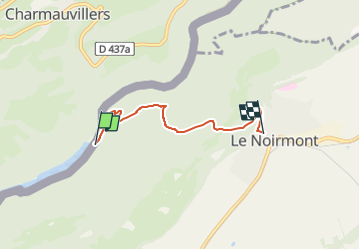
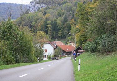
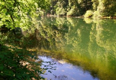
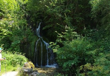
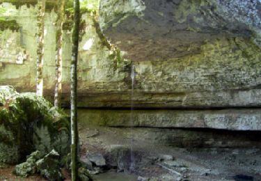
Randonnée A pied de 3,9 km à découvrir à Jura, District des Franches-Montagnes, Le Noirmont. Cette randonnée est proposée par SityTrail - itinéraires balisés pédestres.
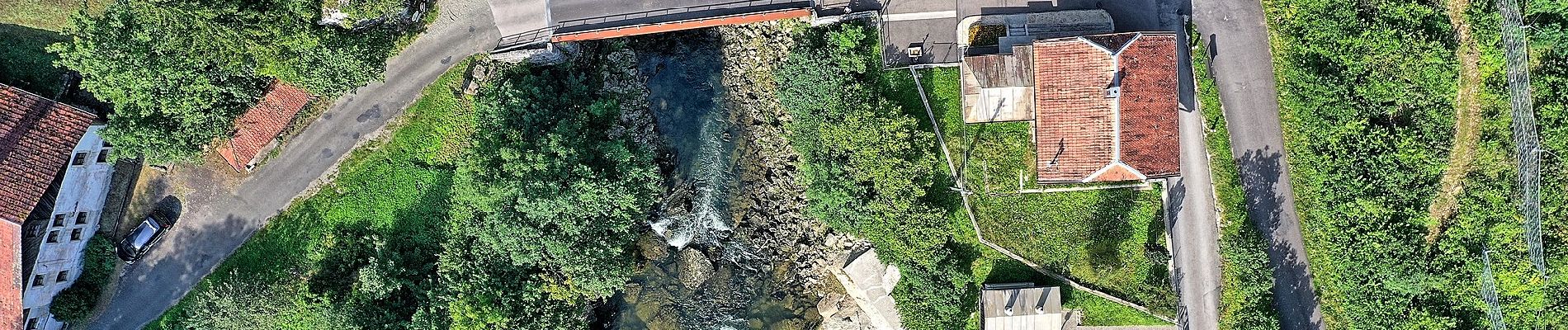
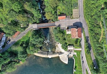
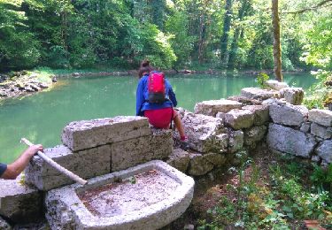
Description
La Goule - fixme
Symbole: gelber Diamant (waagrecht)
Localisation
Pays :
Suisse
Région :
Jura
Département/Province :
District des Franches-Montagnes
Commune :
Le Noirmont
Localité :
Unknown
Départ:(Dec)
Départ:(UTM)
342988 ; 5232141 (32T) N.
Commentaires
Randonnées à proximité
![Randonnée Marche Charquemont - Échelles de la mort - Photo](https://media.geolcdn.com/t/375/260/ext.jpg?maxdim=2&url=https%3A%2F%2Fmedia.geolcdn.com%2Ff%2F7b9848bb-a43e-4c47-8544-5e7b63b496f6.jpg)
![Marche Marche](https://static1.geolcdn.com/sitytour/trail-icons/101.png)
Échelles de la mort
Marche
Moyen
(1)
Charquemont,
Bourgogne-Franche-Comté,
Doubs,
France
![](/images/other/stat-length.png)
6,5 km | 9,5 km-effort
1h 33min
![](https://static1.geolcdn.com/siteimages/upload/files/16400158638029165_repeat_loop_refresh_sync_direction_icon.png)
Oui
![Randonnée A pied Le Noirmont - La Goule - fixme - Photo](https://media.geolcdn.com/t/375/260/ext.jpg?maxdim=2&url=https%3A%2F%2Fmedia.geolcdn.com%2Ff%2F26c9f498-14fd-470d-95fd-f93787b84ec0.jpeg)
![A pied A pied](https://static1.geolcdn.com/sitytour/trail-icons/100.png)
La Goule - fixme
A pied
Facile
Le Noirmont,
Jura,
District des Franches-Montagnes,
Suisse
![](/images/other/stat-length.png)
3,4 km | 4,5 km-effort
1h 0min
![](https://static1.geolcdn.com/siteimages/upload/files/16400158638029165_repeat_loop_refresh_sync_direction_icon.png)
Non
![Randonnée A pied Muriaux - Muriaux - Goumois - Photo](https://media.geolcdn.com/t/375/260/ext.jpg?maxdim=2&url=https%3A%2F%2Fmedia.geolcdn.com%2Ff%2F39340727-7fad-44c3-aed8-14f4632db308.jpeg)
![A pied A pied](https://static1.geolcdn.com/sitytour/trail-icons/100.png)
Muriaux - Goumois
A pied
Facile
Muriaux,
Jura,
District des Franches-Montagnes,
Suisse
![](/images/other/stat-length.png)
4 km | 6,7 km-effort
1h 31min
![](https://static1.geolcdn.com/siteimages/upload/files/16400158638029165_repeat_loop_refresh_sync_direction_icon.png)
Non
![Randonnée Marche Charquemont - gorges du Doubs - Photo](https://media.geolcdn.com/t/375/260/ext.jpg?maxdim=2&url=https%3A%2F%2Fservices.sitytrail.com%2FGeolivesWS%2FDownloadMedia.ashx%3FTrailID%3D759641%26Media%3Dfix__20170525134753.jpg)
![Marche Marche](https://static1.geolcdn.com/sitytour/trail-icons/101.png)
gorges du Doubs
Marche
Moyen
Charquemont,
Bourgogne-Franche-Comté,
Doubs,
France
![](/images/other/stat-length.png)
12,2 km | 19,6 km-effort
3h 36min
![](https://static1.geolcdn.com/siteimages/upload/files/16400158638029165_repeat_loop_refresh_sync_direction_icon.png)
Non
![Randonnée Marche Goumois - Les Sommêtres - Photo](https://media.geolcdn.com/t/375/260/ext.jpg?maxdim=2&url=https%3A%2F%2Fmedia.geolcdn.com%2Ff%2Fef3e2282-0802-4a6c-a13b-01c3f90c4f9a.JPG)
![Marche Marche](https://static1.geolcdn.com/sitytour/trail-icons/101.png)
Les Sommêtres
Marche
Moyen
Goumois,
Bourgogne-Franche-Comté,
Doubs,
France
![](/images/other/stat-length.png)
24 km | 37 km-effort
7h 54min
![](https://static1.geolcdn.com/siteimages/upload/files/16400158638029165_repeat_loop_refresh_sync_direction_icon.png)
Non
![Randonnée Marche Charquemont - Goumois-Le Boulois / Les échelles de la mort - Photo](https://media.geolcdn.com/t/375/260/ext.jpg?maxdim=2&url=https%3A%2F%2Fmedia.geolcdn.com%2Ff%2Fe486823a-bed9-43a4-abeb-bf237649de07.jpg)
![Marche Marche](https://static1.geolcdn.com/sitytour/trail-icons/101.png)
Goumois-Le Boulois / Les échelles de la mort
Marche
Moyen
Charquemont,
Bourgogne-Franche-Comté,
Doubs,
France
![](/images/other/stat-length.png)
15,9 km | 26 km-effort
3h 14min
![](https://static1.geolcdn.com/siteimages/upload/files/16400158638029165_repeat_loop_refresh_sync_direction_icon.png)
Oui
![Randonnée Marche Charmauvillers - Goumois randonnée La Goule - Photo](https://media.geolcdn.com/t/375/260/ext.jpg?maxdim=2&url=https%3A%2F%2Fmedia.geolcdn.com%2Ff%2F21b4c51b-c2b4-4e0c-a0c1-612025391c50.jpg)
![Marche Marche](https://static1.geolcdn.com/sitytour/trail-icons/101.png)
Goumois randonnée La Goule
Marche
Moyen
Charmauvillers,
Bourgogne-Franche-Comté,
Doubs,
France
![](/images/other/stat-length.png)
19,6 km | 35 km-effort
3h 5min
![](https://static1.geolcdn.com/siteimages/upload/files/16400158638029165_repeat_loop_refresh_sync_direction_icon.png)
Non
![Randonnée Marche Goumois - Goumois - Photo](https://media.geolcdn.com/t/375/260/ext.jpg?maxdim=2&url=https%3A%2F%2Fmedia.geolcdn.com%2Ff%2Fd0f49200-6ae5-4a6b-8236-c2c6eaab60f6.jpg)
![Marche Marche](https://static1.geolcdn.com/sitytour/trail-icons/101.png)
Goumois
Marche
Facile
Goumois,
Bourgogne-Franche-Comté,
Doubs,
France
![](/images/other/stat-length.png)
13,6 km | 19,4 km-effort
5h 42min
![](https://static1.geolcdn.com/siteimages/upload/files/16400158638029165_repeat_loop_refresh_sync_direction_icon.png)
Oui
![Randonnée Marche Goumois - La Chute du Bief de Vautenaivre et le Château Cugny. - Photo](https://media.geolcdn.com/t/375/260/ext.jpg?maxdim=2&url=https%3A%2F%2Fservices.sitytrail.com%2FGeolivesWS%2FDownloadMedia.ashx%3FTrailID%3D109661%26Media%3D4302_1.jpg)
![Marche Marche](https://static1.geolcdn.com/sitytour/trail-icons/101.png)
La Chute du Bief de Vautenaivre et le Château Cugny.
Marche
Moyen
Goumois,
Bourgogne-Franche-Comté,
Doubs,
France
![](/images/other/stat-length.png)
15,2 km | 23 km-effort
5h 30min
![](https://static1.geolcdn.com/siteimages/upload/files/16400158638029165_repeat_loop_refresh_sync_direction_icon.png)
Oui