Randonnée Marche Saint-Côme-d'Olt - étape st Jacques st come sur d olt-estaing - Photo

étape st Jacques st come sur d olt-estaing

 fab0202
fab0202

Utilisateur

© OpenStreetMap contributors
Longueur
Longueur
25 km
Altitude max
Altitude max
523 m
Dénivelé positif
Dénivelé positif
550 m
Km-Effort
Km-Effort  
32 km
Altitude min
Altitude min
312 m
Dénivelé négatif
Dénivelé négatif
615 m
Boucle
Boucle
Non
Date de création :
2022-07-20 05:58:43.231
Dernière modification :
2022-07-20 14:18:19.262

(0 Avis)

Marche
Marche
5h54
Difficulté : Moyen

Scannez ce code QR pour ouvrir la randonnée dans l'application SityTrail

Application GPS de randonnée GRATUITE

Logo SityTrail SityTrail

IGN / Instituts géographiques

Télécharger SityTrail sur l'App Store Télécharger SityTrail sur Google Play

Logo SityTrail SityTrail World

Le monde est à vous

Télécharger SityTrail sur l'App Store Télécharger SityTrail sur Google Play Télécharger SityTrail sur Huawei AppGallery

À propos

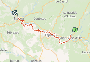
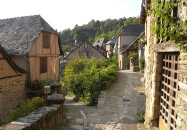
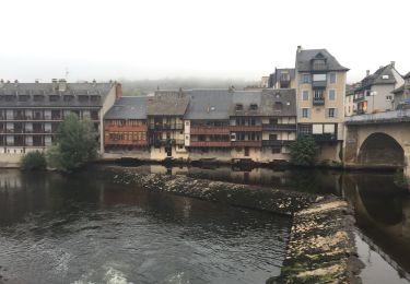
Randonnée Marche de 25 km à découvrir à Occitanie, Aveyron, Saint-Côme-d'Olt. Cette randonnée est proposée par fab0202.

Description

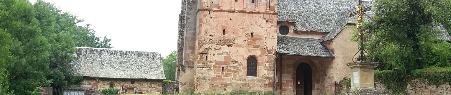
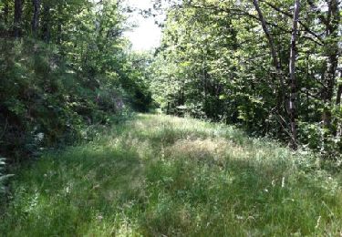
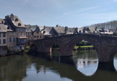
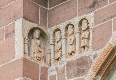
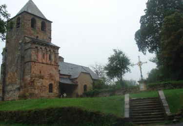
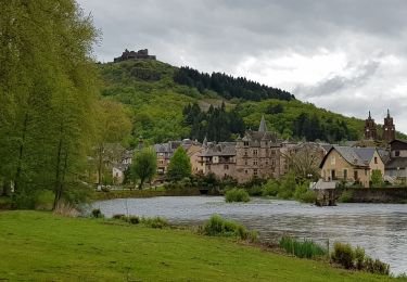
belle rando entre st come et estaing avec de beaux panoramas, de belles églises et de beaux village espalion, verrières et superbe arrivée sur estaing.

Profil altimétrique

Photos

Localisation

Pays :
France
Région :
Occitanie
Département/Province :
Aveyron
Commune :
Saint-Côme-d'Olt
Localité :
Unknown
Départ:(UTM)
485591 ; 4929658 (31T) N.

Randonnées à proximité

Randonnée Marche Espalion - Compostelle 08 - Espalion -> Estaing - Photo
Marche
uru2010

Marche

Facile
(1)
Espalion, Occitanie, Aveyron, France
13,8 km | 17,9 km-effort
3h 53min
Non
Randonnée Marche Espalion - Espalion Massip Avril 2018 - Photo
Marche
GUIDE
Kargil

Marche

Difficile
Espalion, Occitanie, Aveyron, France
25 km | 35 km-effort
7h 13min
Non
Randonnée Marche Saint-Côme-d'Olt - saint Come d'Olt Estaing - Photo
Marche
PhilDomDoxa

Marche

Moyen
Saint-Côme-d'Olt, Occitanie, Aveyron, France
14,5 km | 20 km-effort
5h 54min
Non
Randonnée A pied Espalion - La Voie du Rail - Photo
A pied
PRO

A pied

Facile
Espalion, Occitanie, Aveyron, France
10,2 km | 14,7 km-effort
3h 20min
Non
Randonnée Marche Espalion - CC_Velay_BD_08_Espalion_Golinhac_20070823 - Photo
Marche
patrickdanilo

Marche

Difficile
Espalion, Occitanie, Aveyron, France
28 km | 39 km-effort
7h 30min
Non
Randonnée Marche Saint-Côme-d'Olt - saint Côme d'olt- Estaing - Photo
Marche
guariso

Marche

Difficile
Saint-Côme-d'Olt, Occitanie, Aveyron, France
23 km | 31 km-effort
6h 17min
Non
Randonnée Marche Saint-Côme-d'Olt - Saint Côme d'Olt vers Estaing - Photo
Marche
choubaka77

Marche

Moyen
Saint-Côme-d'Olt, Occitanie, Aveyron, France
20 km | 28 km-effort
7h 1min
Non
Randonnée Marche Espalion - Mon Compostelle, quatrième étape - Photo
Marche
Ardeiserois

Marche

Très difficile
Espalion, Occitanie, Aveyron, France
47 km | 65 km-effort
10h 0min
Non
Randonnée Marche Espalion - espalion - golinhac - Photo
Marche
jib971

Marche

Difficile
Espalion, Occitanie, Aveyron, France
29 km | 39 km-effort
8h 42min
Non


Fermer
Mes abonnements