Randonnée Marche Maureillas-las-Illas - Maureillas  - Photo
 francineposkin
francineposkin

Utilisateur

© OpenStreetMap contributors
Longueur
Longueur
12,8 km
Altitude max
Altitude max
465 m
Dénivelé positif
Dénivelé positif
221 m
Km-Effort
Km-Effort  
16,9 km
Altitude min
Altitude min
114 m
Dénivelé négatif
Dénivelé négatif
546 m
Boucle
Boucle
Non
Date de création :
2023-06-19 08:07:17.0
Dernière modification :
2023-06-19 12:43:13.881

(0 Avis)

Marche
Marche
4h34
Difficulté : Difficile

Scannez ce code QR pour ouvrir la randonnée dans l'application SityTrail

Application GPS de randonnée GRATUITE

Logo SityTrail SityTrail

IGN / Instituts géographiques

Télécharger SityTrail sur l'App Store Télécharger SityTrail sur Google Play

Logo SityTrail SityTrail World

Le monde est à vous

Télécharger SityTrail sur l'App Store Télécharger SityTrail sur Google Play Télécharger SityTrail sur Huawei AppGallery

À propos

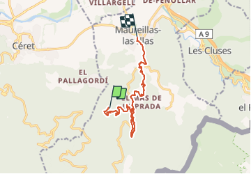
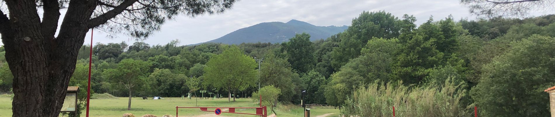
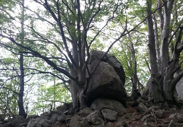
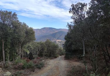
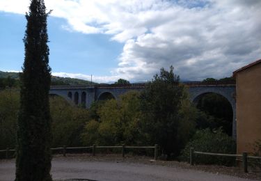
Randonnée Marche de 12,8 km à découvrir à Occitanie, Pyrénées-Orientales, Maureillas-las-Illas. Cette randonnée est proposée par francineposkin.

Description

Randonnée difficile car chemins difficiles avec dénivelé de  /-400 m

Profil altimétrique

Photos

Localisation

Pays :
France
Région :
Occitanie
Département/Province :
Pyrénées-Orientales
Commune :
Maureillas-las-Illas
Localité :
Unknown
Départ:(Dec)
Départ:(UTM)
482850 ; 4701229 (31T) N.

Randonnées à proximité

Randonnée Marche Les Cluses - LES CLUSES 66 - Photo
Marche
jeff66

Marche

Facile
(9)
Les Cluses, Occitanie, Pyrénées-Orientales, France
9,4 km | 12,8 km-effort
1h 50min
Oui
Randonnée Marche Céret - Cretes de Ceret_Fontfrede - Photo
Marche
force

Marche

Moyen
(2)
Céret, Occitanie, Pyrénées-Orientales, France
8,3 km | 14,1 km-effort
3h 14min
Oui
Randonnée Marche Saint-Jean-Pla-de-Corts - 66 ST-JEAN-PLA-DE-CORTS, promenade autour du Tech, jusqu'au BOULOU  - Photo
Marche
jeff66

Marche

Facile
(1)
Saint-Jean-Pla-de-Corts, Occitanie, Pyrénées-Orientales, France
7,9 km | 8,8 km-effort
1h 18min
Oui
Randonnée Marche Maureillas-las-Illas - CERET 66 - les hauts de CERET - ballade en bas Vallespir - dolmen de la Siureda torre Bel Ull  - Photo
Marche
jeff66

Marche

Moyen
(1)
Maureillas-las-Illas, Occitanie, Pyrénées-Orientales, France
6,5 km | 9,9 km-effort
1h 24min
Oui
Randonnée Marche Céret - Ermitage de saint ferreol - Photo
Marche
philippe66

Marche

Moyen
(1)
Céret, Occitanie, Pyrénées-Orientales, France
7,6 km | 10,4 km-effort
1h 59min
Oui
Randonnée Marche Céret - blacon de ceret via la cascade - Photo
Marche
philippe66

Marche

Moyen
(3)
Céret, Occitanie, Pyrénées-Orientales, France
10,1 km | 14,4 km-effort
3h 9min
Oui
Randonnée Marche Les Cluses - LES CLUSES 66 - LE PERTHUS -  - Photo
Marche
jeff66

Marche

Moyen
(2)
Les Cluses, Occitanie, Pyrénées-Orientales, France
14,4 km | 20 km-effort
2h 57min
Oui
Randonnée Marche Maureillas-las-Illas - RIUNOGUES PORTELL PANISSAR - Photo
Marche
MarcOBRECHT

Marche

Moyen
(1)
Maureillas-las-Illas, Occitanie, Pyrénées-Orientales, France
18 km | 26 km-effort
4h 35min
Oui
Randonnée Marche Céret - st Ferriol - Photo
Marche
gogo1965

Marche

Facile
Céret, Occitanie, Pyrénées-Orientales, France
8,2 km | 11,4 km-effort
2h 15min
Oui


Fermer
Mes abonnements