Randonnée Marche Guiche - Guiche - Photo
 DECHAMPD
DECHAMPD

Utilisateur

© OpenStreetMap contributors
Longueur
Longueur
11 km
Altitude max
Altitude max
118 m
Dénivelé positif
Dénivelé positif
194 m
Km-Effort
Km-Effort  
13,6 km
Altitude min
Altitude min
-2 m
Dénivelé négatif
Dénivelé négatif
189 m
Boucle
Boucle
Oui
Date de création :
2019-01-14 17:34:46.314
Dernière modification :
2019-01-14 17:34:46.329

(0 Avis)

Marche
Marche
2h57
Difficulté : Inconnu

Scannez ce code QR pour ouvrir la randonnée dans l'application SityTrail

Application GPS de randonnée GRATUITE

Logo SityTrail SityTrail

IGN / Instituts géographiques

Télécharger SityTrail sur l'App Store Télécharger SityTrail sur Google Play

Logo SityTrail SityTrail World

Le monde est à vous

Télécharger SityTrail sur l'App Store Télécharger SityTrail sur Google Play Télécharger SityTrail sur Huawei AppGallery

À propos

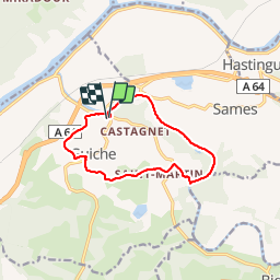
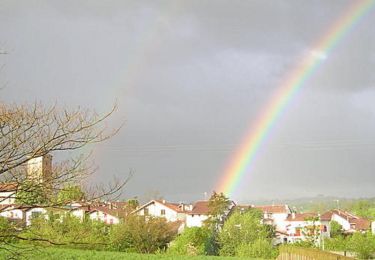
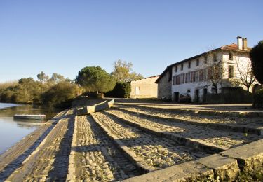
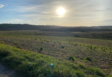
Randonnée Marche de 11 km à découvrir à Nouvelle-Aquitaine, Pyrénées-Atlantiques, Guiche. Cette randonnée est proposée par DECHAMPD.

Description

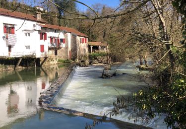
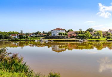
Ce circuit fera découvrir le patrimoine historique du village de Guiche, au travers de son port empierré, son château et de ces chemins de halage.

Profil altimétrique

Localisation

Pays :
France
Région :
Nouvelle-Aquitaine
Département/Province :
Pyrénées-Atlantiques
Commune :
Guiche
Localité :
Unknown
Départ:(Dec)
Départ:(UTM)
645681 ; 4820259 (30T) N.

Randonnées à proximité

Randonnée Marche Bidache - Bidache Came Boucle Bidouze - Photo
Marche
jaja64

Marche

Très facile
Bidache, Nouvelle-Aquitaine, Pyrénées-Atlantiques, France
11,2 km | 12,9 km-effort
2h 50min
Oui
Randonnée A pied Hastingues -  HASTINGUES PATRIMOINE G4 - Photo
A pied
GUIDE
marmotte65

A pied

Facile
Hastingues, Nouvelle-Aquitaine, Landes, France
8,8 km | 11 km-effort
2h 29min
Oui
Randonnée Marche Port-de-Lanne - Chateau du Bec de Gave et bords de l'Adour - Photo
Marche
Ladyclairdelune74

Marche

Moyen
(1)
Port-de-Lanne, Nouvelle-Aquitaine, Landes, France
9,6 km | 10,7 km-effort
2h 26min
Oui
Randonnée Marche Hastingues - hastingues G4fait  - Photo
Marche
LouisROGER

Marche

Très facile
Hastingues, Nouvelle-Aquitaine, Landes, France
9,1 km | 11,3 km-effort
5h 6min
Oui
Randonnée Cheval Sames - Sames - La Bastide Clairence - Photo
Cheval
tracegps

Cheval

Difficile
Sames, Nouvelle-Aquitaine, Pyrénées-Atlantiques, France
30 km | 36 km-effort
5h 0min
Non
Randonnée V.T.T. Bidache - Château et Bidouze - Bidache - Photo
V.T.T.
tracegps

V.T.T.

Moyen
Bidache, Nouvelle-Aquitaine, Pyrénées-Atlantiques, France
11 km | 12,7 km-effort
1h 19min
Oui
Randonnée Marche Bidache - Château et Bidouze - Bidache - Photo
Marche
tracegps

Marche

Difficile
(1)
Bidache, Nouvelle-Aquitaine, Pyrénées-Atlantiques, France
11 km | 12,7 km-effort
3h 10min
Oui
Randonnée V.T.C. Bidache - bidache guiche - Photo
V.T.C.
Dan30

V.T.C.

Facile
Bidache, Nouvelle-Aquitaine, Pyrénées-Atlantiques, France
20 km | 23 km-effort
1h 38min
Oui
Randonnée Marche Hastingues - Long de la Bidouze - Photo
Marche
bunji

Marche

Facile
Hastingues, Nouvelle-Aquitaine, Landes, France
4 km | 4,4 km-effort
1h 4min
Oui


Fermer
Mes abonnements