Randonnée Marche Saint-Michel-de-Chaillol - Chaillol - Photo
 rarnaud
rarnaud

Utilisateur

© OpenStreetMap contributors
Longueur
Longueur
13,1 km
Altitude max
Altitude max
1778 m
Dénivelé positif
Dénivelé positif
452 m
Km-Effort
Km-Effort  
19,2 km
Altitude min
Altitude min
1497 m
Dénivelé négatif
Dénivelé négatif
466 m
Boucle
Boucle
Oui
Date de création :
2018-06-26 12:31:20.617
Dernière modification :
2018-06-26 12:31:20.617

(0 Avis)

Marche
Marche
4h19
Difficulté : Facile

Scannez ce code QR pour ouvrir la randonnée dans l'application SityTrail

Application GPS de randonnée GRATUITE

Logo SityTrail SityTrail

IGN / Instituts géographiques

Télécharger SityTrail sur l'App Store Télécharger SityTrail sur Google Play

Logo SityTrail SityTrail World

Le monde est à vous

Télécharger SityTrail sur l'App Store Télécharger SityTrail sur Google Play Télécharger SityTrail sur Huawei AppGallery

À propos

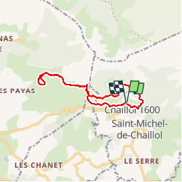
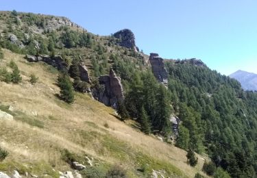
Randonnée Marche de 13,1 km à découvrir à Provence-Alpes-Côte d'Azur, Hautes-Alpes, Saint-Michel-de-Chaillol. Cette randonnée est proposée par rarnaud.

Description

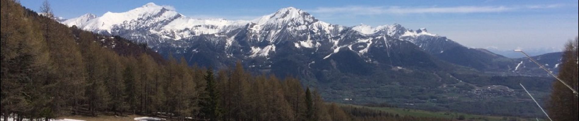
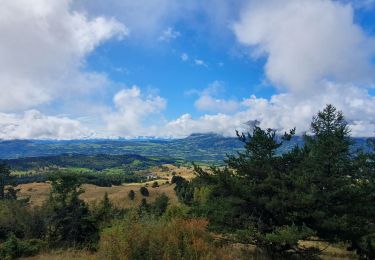
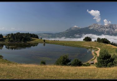
Sentier du canal de Mal Cros, Lac de Barbeyroux, retour par la station de ski de Chaillol.

Profil altimétrique

Photos

Localisation

Pays :
France
Région :
Provence-Alpes-Côte d'Azur
Département/Province :
Hautes-Alpes
Commune :
Saint-Michel-de-Chaillol
Localité :
Unknown
Départ:(Dec)
Départ:(UTM)
275008 ; 4952491 (32T) N.

Randonnées à proximité

Randonnée Marche Saint-Bonnet-en-Champsaur - Infournas haut - Lac des Barbeyroux - Les infournas - Photo
Marche
GUIDE
R@ph

Marche

Difficile
Saint-Bonnet-en-Champsaur, Provence-Alpes-Côte d'Azur, Hautes-Alpes, France
10,1 km | 16 km-effort
3h 38min
Oui
Randonnée Marche Saint-Michel-de-Chaillol - Tête ouest de Mal Cros - Photo
Marche
GUIDE
R@ph

Marche

Très difficile
Saint-Michel-de-Chaillol, Provence-Alpes-Côte d'Azur, Hautes-Alpes, France
21 km | 40 km-effort
8h 2min
Oui
Randonnée Marche Saint-Michel-de-Chaillol - Col de l'Escalier - Photo
Marche
Marco05

Marche

Difficile
Saint-Michel-de-Chaillol, Provence-Alpes-Côte d'Azur, Hautes-Alpes, France
16 km | 27 km-effort
6h 13min
Oui
Randonnée Marche Saint-Michel-de-Chaillol - Pic Queyrel - Photo
Marche
Marco05

Marche

Difficile
Saint-Michel-de-Chaillol, Provence-Alpes-Côte d'Azur, Hautes-Alpes, France
10,4 km | 19,8 km-effort
4h 29min
Oui
Randonnée Marche Saint-Michel-de-Chaillol - Pic du Tourond - Photo
Marche
Marco05

Marche

Très difficile
Saint-Michel-de-Chaillol, Provence-Alpes-Côte d'Azur, Hautes-Alpes, France
13,7 km | 27 km-effort
6h 14min
Oui
Randonnée Marche Saint-Michel-de-Chaillol - Lac de Malcros - Photo
Marche
Marco05

Marche

Très difficile
Saint-Michel-de-Chaillol, Provence-Alpes-Côte d'Azur, Hautes-Alpes, France
18,7 km | 34 km-effort
7h 43min
Oui
Randonnée Marche Saint-Bonnet-en-Champsaur - Col de l'Escalier - Photo
Marche
flip38

Marche

Moyen
Saint-Bonnet-en-Champsaur, Provence-Alpes-Côte d'Azur, Hautes-Alpes, France
19,6 km | 33 km-effort
6h 3min
Oui
Randonnée Marche Saint-Michel-de-Chaillol - pic de queyrel - Photo
Marche
nadd73

Marche

Très difficile
Saint-Michel-de-Chaillol, Provence-Alpes-Côte d'Azur, Hautes-Alpes, France
10,8 km | 21 km-effort
5h 40min
Oui
Randonnée Marche Saint-Michel-de-Chaillol - Aiguilles de Famourou - Photo
Marche
frizou83

Marche

Difficile
(1)
Saint-Michel-de-Chaillol, Provence-Alpes-Côte d'Azur, Hautes-Alpes, France
11,2 km | 18 km-effort
4h 5min
Oui


Fermer
Mes abonnements