Randonnée Marche Saint-Jean-de-la-Blaquière - Rochers des 2 Vierges - Photo
 gerardhenr
gerardhenr

Utilisateur

© OpenStreetMap contributors
Longueur
Longueur
11,1 km
Altitude max
Altitude max
522 m
Dénivelé positif
Dénivelé positif
429 m
Km-Effort
Km-Effort  
16,8 km
Altitude min
Altitude min
172 m
Dénivelé négatif
Dénivelé négatif
441 m
Boucle
Boucle
Oui
Date de création :
2015-08-20 00:00:00.0
Dernière modification :
2015-08-20 00:00:00.0

(0 Avis)

Marche
Marche
3h29
Difficulté : Moyen

Scannez ce code QR pour ouvrir la randonnée dans l'application SityTrail

Application GPS de randonnée GRATUITE

Logo SityTrail SityTrail

IGN / Instituts géographiques

Télécharger SityTrail sur l'App Store Télécharger SityTrail sur Google Play

Logo SityTrail SityTrail World

Le monde est à vous

Télécharger SityTrail sur l'App Store Télécharger SityTrail sur Google Play Télécharger SityTrail sur Huawei AppGallery

À propos

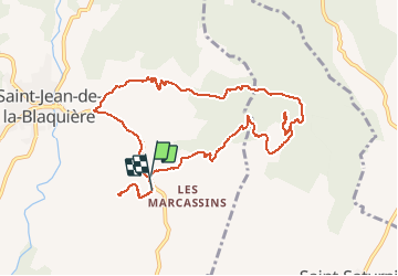
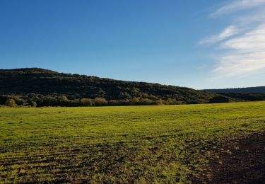
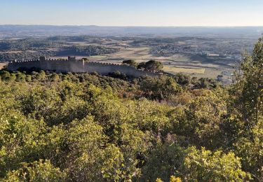
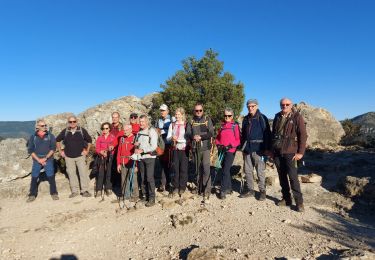
Randonnée Marche de 11,1 km à découvrir à Occitanie, Hérault, Saint-Jean-de-la-Blaquière. Cette randonnée est proposée par gerardhenr.

Description

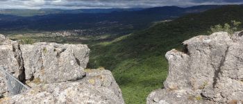
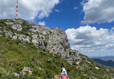
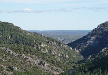
Parking au point d'Arrivée. Montée dure sur chemin caillouteux.Point de vue sublime au sommet.
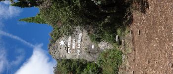
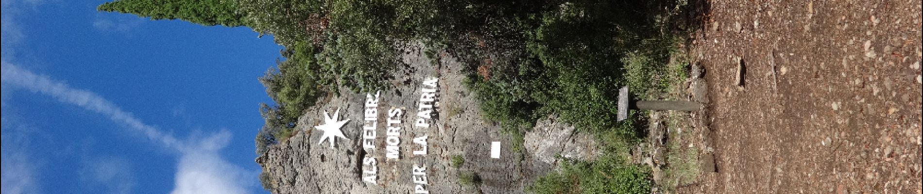
Passage au FélibrigesFélibriges.
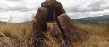
Supplément: Dolmen en cours d'étude.

Profil altimétrique

Photos

Points d'intérêt

Point d'intérêt Saint-Jean-de-la-Blaquière - Dolmen - Photo
gerardhenr
SAINT-JEAN-DE-LA-BLAQUIÈRE 
Point d'intérêt Saint-Saturnin-de-Lucian - Le Rocher des 2 Vierges - Photo
gerardhenr
SAINT-SATURNIN-DE-LUCIAN 
Point d'intérêt Saint-Saturnin-de-Lucian - Félibriges - Photo
gerardhenr
SAINT-SATURNIN-DE-LUCIAN 
Point d'intérêt Saint-Jean-de-la-Blaquière - Point Pique-nquec - Photo
gerardhenr
SAINT-JEAN-DE-LA-BLAQUIÈRE 

Localisation

Pays :
France
Région :
Occitanie
Département/Province :
Hérault
Commune :
Saint-Jean-de-la-Blaquière
Localité :
Unknown
Départ:(Dec)
Départ:(UTM)
535444 ; 4839394 (31T) N.

Randonnées à proximité

Randonnée Marche Le Bosc - Saint-Alban - Célis - La Roque  - Photo
Marche
mdauzat

Marche

Moyen
(1)
Le Bosc, Occitanie, Hérault, France
5,7 km | 7,9 km-effort
1h 47min
Oui
Randonnée Marche Saint-Saturnin-de-Lucian - Le Rocher des vierges - Photo
Marche
daniel34

Marche

Moyen
(2)
Saint-Saturnin-de-Lucian, Occitanie, Hérault, France
12,1 km | 17,4 km-effort
5h 1min
Oui
Randonnée Marche Le Bosc - Le Bosc - prieuré de Grandmont - Le Brédou - Soumont - Photo
Marche
vertygo

Marche

Moyen
(2)
Le Bosc, Occitanie, Hérault, France
19,1 km | 28 km-effort
5h 46min
Oui
Randonnée Marche Montpeyroux - Saint baudille - Photo
Marche
yt34

Marche

Facile
(3)
Montpeyroux, Occitanie, Hérault, France
10,2 km | 16,2 km-effort
3h 22min
Oui
Randonnée Marche Saint-Jean-de-la-Blaquière - Les Bois de Homs et de Latude - Photo
Marche
gerardhenr

Marche

Facile
(1)
Saint-Jean-de-la-Blaquière, Occitanie, Hérault, France
9,3 km | 13,1 km-effort
2h 27min
Oui
Randonnée Marche Montpeyroux - Font du Griffe le Baudille - Photo
Marche
daniel34

Marche

Difficile
Montpeyroux, Occitanie, Hérault, France
10,8 km | 16,8 km-effort
3h 32min
Oui
Randonnée Marche Montpeyroux - tour : font du griffe et mont St Baudille - Photo
Marche
jeanfcd

Marche

Difficile
Montpeyroux, Occitanie, Hérault, France
11,5 km | 17,5 km-effort
3h 58min
Oui
Randonnée Marche Montpeyroux - Le Castellas de Montpeyroux - Photo
Marche
Indi34

Marche

Moyen
Montpeyroux, Occitanie, Hérault, France
6,6 km | 9,5 km-effort
2h 2min
Oui
Randonnée Marche Saint-Saturnin-de-Lucian - Le rocher de la vierge - Photo
Marche
labarone

Marche

Difficile
Saint-Saturnin-de-Lucian, Occitanie, Hérault, France
14,4 km | 23 km-effort
5h 30min
Non


Fermer
Mes abonnements