Randonnée Marche Err - d'Err à Bolquère - Photo
 gberger
gberger

Utilisateur

© OpenStreetMap contributors
Longueur
Longueur
12,9 km
Altitude max
Altitude max
1629 m
Dénivelé positif
Dénivelé positif
487 m
Km-Effort
Km-Effort  
18,5 km
Altitude min
Altitude min
1351 m
Dénivelé négatif
Dénivelé négatif
224 m
Boucle
Boucle
Non
Date de création :
2015-09-20 00:00:00.0
Dernière modification :
2015-09-20 00:00:00.0

(0 Avis)

Marche
Marche
4h10
Difficulté : Facile

Scannez ce code QR pour ouvrir la randonnée dans l'application SityTrail

Application GPS de randonnée GRATUITE

Logo SityTrail SityTrail

IGN / Instituts géographiques

Télécharger SityTrail sur l'App Store Télécharger SityTrail sur Google Play

Logo SityTrail SityTrail World

Le monde est à vous

Télécharger SityTrail sur l'App Store Télécharger SityTrail sur Google Play Télécharger SityTrail sur Huawei AppGallery

À propos

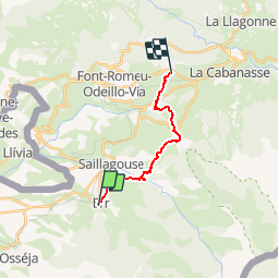
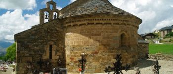
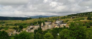
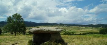
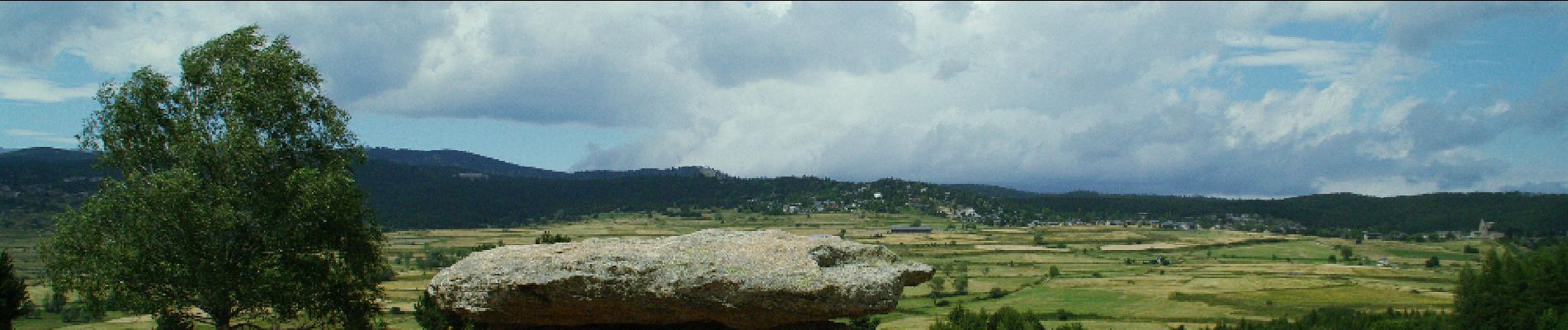
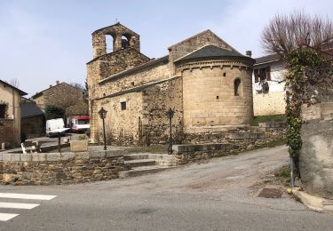
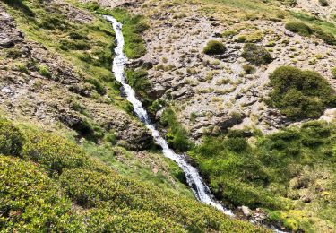
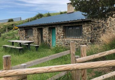
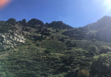
Randonnée Marche de 12,9 km à découvrir à Occitanie, Pyrénées-Orientales, Err. Cette randonnée est proposée par gberger.

Description

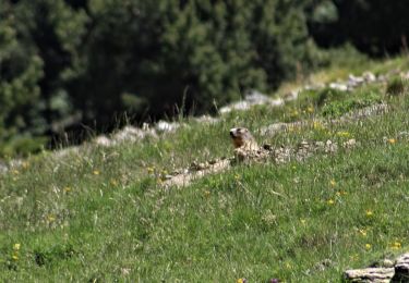
Une randonnée sur le plateau de Cerdagne à combiner avec un aller ou un retour par le train jaune, de Bolquère à Err.

Profil altimétrique

Photos

Points d'intérêt

Point d'intérêt Saillagouse - Vedrinyans - Photo
gberger
SAILLAGOUSE 
Point d'intérêt Saillagouse - Chapelle de Vedrinyans - Photo
gberger
Point d'intérêt Saillagouse - Sallagouse - Photo
gberger
SAILLAGOUSE 
Point d'intérêt Llo - Llo - Photo
gberger
LLO 
Point d'intérêt Eyne - Eyne - Photo
gberger
EYNE 
Point d'intérêt Eyne - Dolmen - Photo
gberger
EYNE 

Localisation

Pays :
France
Région :
Occitanie
Département/Province :
Pyrénées-Orientales
Commune :
Err
Localité :
Unknown
Départ:(Dec)
Départ:(UTM)
420398 ; 4699032 (31T) N.

Randonnées à proximité

Randonnée Marche Nahuja - boucle de Nahuja - Photo
Marche
crijack

Marche

Moyen
(1)
Nahuja, Occitanie, Pyrénées-Orientales, France
11,8 km | 18,2 km-effort
2h 44min
Oui
Randonnée Marche Eyne - Eyne,col de Nuria,pic d'Eyne,Torre d'Eyne,Eyne. - Photo
Marche
Machaon6

Marche

Très difficile
(1)
Eyne, Occitanie, Pyrénées-Orientales, France
24 km | 43 km-effort
8h 44min
Oui
Randonnée Marche Eyne - Vallée d'Eyne - Photo
Marche
GUIDE
nadinebondoux

Marche

Moyen
Eyne, Occitanie, Pyrénées-Orientales, France
10,7 km | 17,6 km-effort
4h 40min
Oui
Randonnée Marche Eyne - eyne - Photo
Marche
gardelg

Marche

Moyen
(2)
Eyne, Occitanie, Pyrénées-Orientales, France
6,2 km | 8,2 km-effort
2h 1min
Oui
Randonnée Marche Eyne - La vallée d'Eyne - Photo
Marche
suresnois

Marche

Difficile
Eyne, Occitanie, Pyrénées-Orientales, France
11,2 km | 18 km-effort
7h 8min
Oui
Randonnée Marche Estavar - 20220328 Estavar-Tartassonne(?) - Photo
Marche
ThonyM

Marche

Moyen
Estavar, Occitanie, Pyrénées-Orientales, France
14,8 km | 22 km-effort
3h 16min
Oui
Randonnée Marche Eyne - 20210722 vallée d’Eyne-Pic de Nuria et Finestrelle - Photo
Marche
ThonyM

Marche

Difficile
Eyne, Occitanie, Pyrénées-Orientales, France
21 km | 37 km-effort
5h 56min
Oui
Randonnée Marche Saillagouse - 20210627 à partir de Saillagouse  - Photo
Marche
ThonyM

Marche

Moyen
(1)
Saillagouse, Occitanie, Pyrénées-Orientales, France
16,2 km | 26 km-effort
3h 47min
Oui
Randonnée Marche Eyne - vallee d'Eyne - Photo
Marche
altaya

Marche

Facile
(1)
Eyne, Occitanie, Pyrénées-Orientales, France
13,7 km | 23 km-effort
4h 17min
Oui


Fermer
Mes abonnements