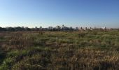
Randonnée Marche Perpignan - 66 PERPIGNAN, entre moulin à vent mas Balande et Cabestany - Photo

66 PERPIGNAN, entre moulin à vent mas Balande et Cabestany

 jeff66
jeff66

Utilisateur

© OpenStreetMap contributors
Longueur
Longueur
7,5 km
Altitude max
Altitude max
73 m
Dénivelé positif
Dénivelé positif
61 m
Km-Effort
Km-Effort  
8,3 km
Altitude min
Altitude min
28 m
Dénivelé négatif
Dénivelé négatif
61 m
Boucle
Boucle
Oui
Date de création :
2015-12-14 00:00:00.0
Dernière modification :
2015-12-14 00:00:00.0

(0 Avis)

Marche
Marche
1h22
Difficulté : Facile

Scannez ce code QR pour ouvrir la randonnée dans l'application SityTrail

Application GPS de randonnée GRATUITE

Logo SityTrail SityTrail

IGN / Instituts géographiques

Télécharger SityTrail sur l'App Store Télécharger SityTrail sur Google Play

Logo SityTrail SityTrail World

Le monde est à vous

Télécharger SityTrail sur l'App Store Télécharger SityTrail sur Google Play Télécharger SityTrail sur Huawei AppGallery

À propos

Randonnée Marche de 7,5 km à découvrir à Occitanie, Pyrénées-Orientales, Perpignan. Cette randonnée est proposée par jeff66.

Description

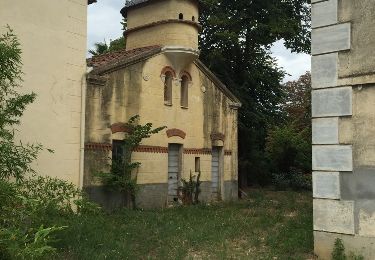
66 PERPIGNAN, av.P.Alduy, Mas Gaffard, le hameau DANTJOU, mas Balande, el pou de les Coulobres, station de pompage, chemin VC203, passage sous la RD22C, av. j.Giraudoux, moulin à vent, rond point des palmes académiques, rue de port-Vendred, av. du RÉART, rembla d'occitanie, av. F. De sardane, espace vert de la butte, résidence P.Alduy, Château d'Eau av. Said Boualam, collège St expert, parc des sports A.Mimoun, piscine, lycée Léon Blum, parcours de santé

Profil altimétrique

Photos

Localisation

Pays :
France
Région :
Occitanie
Département/Province :
Pyrénées-Orientales
Commune :
Perpignan
Localité :
Unknown
Départ:(Dec)
Départ:(UTM)
492213 ; 4724196 (31T) N.

Randonnées à proximité

Randonnée Marche Théza - 66 THEZA - CORNEILLA-DEL-VERCOL - Photo
Marche
jeff66

Marche

Facile
(2)
Théza, Occitanie, Pyrénées-Orientales, France
7 km | 7,5 km-effort
1h 8min
Oui
Randonnée Marche Cabestany - Chemins autour de Cabestany - Photo
Marche
tracegps

Marche

Moyen
(2)
Cabestany, Occitanie, Pyrénées-Orientales, France
11,8 km | 12,7 km-effort
3h 0min
Oui
Randonnée Marche Perpignan - Perpignan 01.10.2017  - Photo
Marche
jeff66

Marche

Facile
(1)
Perpignan, Occitanie, Pyrénées-Orientales, France
6,7 km | 7,5 km-effort
1h 39min
Non
Randonnée Marche Villeneuve-de-la-Raho - 66 VILLENEUVE-DE-LA-RAHO - grand tour périphérique du lac par les lignes de crêtes  - Photo
Marche
jeff66

Marche

Facile
(2)
Villeneuve-de-la-Raho, Occitanie, Pyrénées-Orientales, France
10 km | 11,5 km-effort
1h 44min
Oui
Randonnée Marche Saleilles - 66 SALEILLES - St-NAZAIRE, entre FOSSEILLE et REART - Photo
Marche
jeff66

Marche

Facile
(1)
Saleilles, Occitanie, Pyrénées-Orientales, France
7,3 km | 7,7 km-effort
1h 8min
Oui
Randonnée Marche Perpignan - Perpignan  - Photo
Marche
ombrabella

Marche

Très facile
Perpignan, Occitanie, Pyrénées-Orientales, France
18 km | 19,9 km-effort
2h 23min
Non
Randonnée Marche Perpignan - canal Perpignan  - Photo
Marche
Fildesir

Marche

Très facile
Perpignan, Occitanie, Pyrénées-Orientales, France
25 km | 27 km-effort
7h 29min
Non
Randonnée Marche Perpignan - 66 PERPIGNAN, quartier MAV au Bas Vernet  - Photo
Marche
jeff66

Marche

Facile
Perpignan, Occitanie, Pyrénées-Orientales, France
10,7 km | 11,8 km-effort
1h 45min
Oui
Randonnée Marche Perpignan - 66 Perpignan Panchot centre bas Vernet centre del mon - Photo
Marche
jeff66

Marche

Facile
Perpignan, Occitanie, Pyrénées-Orientales, France
8,6 km | 9,3 km-effort
1h 29min
Oui


Fermer
Mes abonnements