Randonnée Marche Came - Came - Photo
 isidori
isidori

Utilisateur

© OpenStreetMap contributors
Longueur
Longueur
6,7 km
Altitude max
Altitude max
132 m
Dénivelé positif
Dénivelé positif
185 m
Km-Effort
Km-Effort  
9,2 km
Altitude min
Altitude min
5 m
Dénivelé négatif
Dénivelé négatif
186 m
Boucle
Boucle
Oui
Date de création :
2018-08-21 08:50:11.655
Dernière modification :
2018-08-21 08:50:11.655

(0 Avis)

Marche
Marche
2h00
Difficulté : Facile

Scannez ce code QR pour ouvrir la randonnée dans l'application SityTrail

Application GPS de randonnée GRATUITE

Logo SityTrail SityTrail

IGN / Instituts géographiques

Télécharger SityTrail sur l'App Store Télécharger SityTrail sur Google Play

Logo SityTrail SityTrail World

Le monde est à vous

Télécharger SityTrail sur l'App Store Télécharger SityTrail sur Google Play Télécharger SityTrail sur Huawei AppGallery

À propos

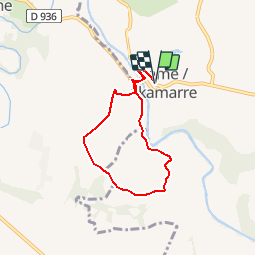
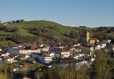
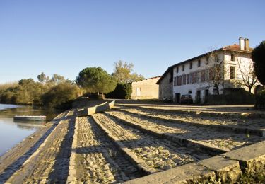
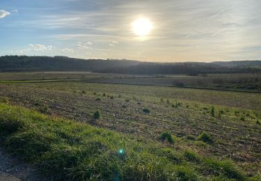
Randonnée Marche de 6,7 km à découvrir à Nouvelle-Aquitaine, Pyrénées-Atlantiques, Came. Cette randonnée est proposée par isidori.

Description

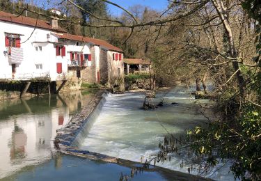
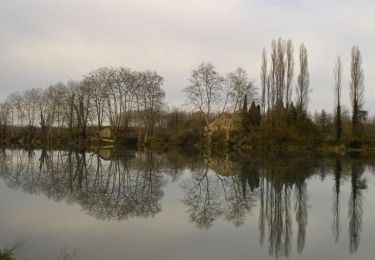
Les collines de Came, au fil de la Bidouze / Guide Audoubert / 09-08-11 / ***

Profil altimétrique

Localisation

Pays :
France
Région :
Nouvelle-Aquitaine
Département/Province :
Pyrénées-Atlantiques
Commune :
Came
Localité :
Unknown
Départ:(Dec)
Départ:(UTM)
652818 ; 4815072 (30T) N.

Randonnées à proximité

Randonnée Marche Bidache - Bidache Came Boucle Bidouze - Photo
Marche
jaja64

Marche

Très facile
Bidache, Nouvelle-Aquitaine, Pyrénées-Atlantiques, France
11,2 km | 12,9 km-effort
2h 50min
Oui
Randonnée Cheval Came - Came - Pessarou - Photo
Cheval
tracegps

Cheval

Moyen
Came, Nouvelle-Aquitaine, Pyrénées-Atlantiques, France
21 km | 28 km-effort
4h 0min
Non
Randonnée Cheval Came - Came - Sames - Photo
Cheval
tracegps

Cheval

Moyen
Came, Nouvelle-Aquitaine, Pyrénées-Atlantiques, France
41 km | 49 km-effort
8h 0min
Non
Randonnée V.T.T. Bidache - Château et Bidouze - Bidache - Photo
V.T.T.
tracegps

V.T.T.

Moyen
Bidache, Nouvelle-Aquitaine, Pyrénées-Atlantiques, France
11 km | 12,7 km-effort
1h 19min
Oui
Randonnée Marche Bidache - Château et Bidouze - Bidache - Photo
Marche
tracegps

Marche

Difficile
(1)
Bidache, Nouvelle-Aquitaine, Pyrénées-Atlantiques, France
11 km | 12,7 km-effort
3h 10min
Oui
Randonnée V.T.C. Bidache - bidache guiche - Photo
V.T.C.
Dan30

V.T.C.

Facile
Bidache, Nouvelle-Aquitaine, Pyrénées-Atlantiques, France
20 km | 23 km-effort
1h 38min
Oui
Randonnée Marche Hastingues - Long de la Bidouze - Photo
Marche
bunji

Marche

Facile
Hastingues, Nouvelle-Aquitaine, Landes, France
4 km | 4,4 km-effort
1h 4min
Oui
Randonnée Marche Arancou - Arancou - Photo
Marche
isidori

Marche

Facile
Arancou, Nouvelle-Aquitaine, Pyrénées-Atlantiques, France
9,5 km | 13,1 km-effort
2h 30min
Oui
Randonnée Marche Sorde-l'Abbaye - 1/2 kiwis guillaume janvier 23 - Photo
Marche
hourmilougue

Marche

Facile
Sorde-l'Abbaye, Nouvelle-Aquitaine, Landes, France
4,9 km | 5,4 km-effort
1h 1min
Non


Fermer
Mes abonnements